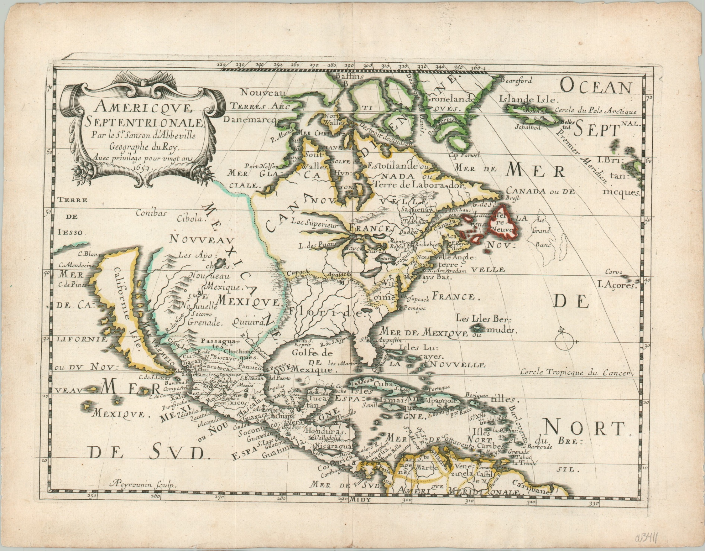
Americque Septentrionale
Sanson’s reduced map of North America showing California as an island.
Out of stock
Description
This tremendous map of North America captures many contemporary geographic misconceptions, yet would be tremendously influential on subsequent cartography of the continent.
The Northwest Passage is all but fact, accessible through a large Glacial Sea west of Hudson Bay, while a little to the south the Great Lakes are shown in an embryonic form. Spanish Florida is separated from New France by the Appalachian Mountains, running mysteriously east and west. Further west can be seen the legendary Quivira and Cibola, California as an island, and even ‘the Land of Iesso’ – technically Hokkaido, Japan.
Despite the numerous cartographic myths displayed on the map, Mexico, the Caribbean, and Central America are all shown with some degree of accuracy – reflecting the long-standing presence of the Spanish.
The map was published in Paris in 1657 as part of Nicholas Sanson’s L’Amerique en Plusieurs Cartes Nouvelles.
Map Details
Publication Date: 1657
Author: Nicholas Sanson
Sheet Width (in): 12.50
Sheet Height (in): 9.70
Condition: A-
Condition Description: Light discoloration visible in the margins and along the vertical centerfold. Minor wear along the outer edges of the sheet, but remains in very good to near fine condition overall. Original outline color.
Out of stock

