
American Red Cross Service Bureau City of Manila
Postwar map of Manila issued for local American servicemen.
Out of stock
Description
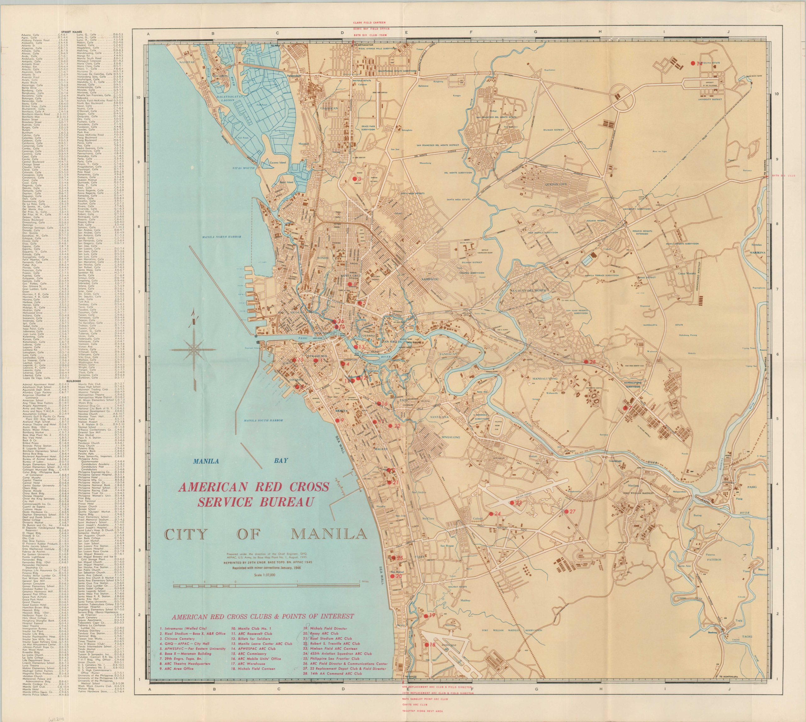
This detailed map of Manila was originally prepared in August 1945 by the Chief Engineer of the Army Forces in the Pacific (AFPAC) and printed by the 29th Base Engineer Topographic Battalion. This particular example was reissued early the following year, with corrections to January 1946.
Red overprinting identifies use by the American Red Cross Service Bureau – over twenty-five different related locations of interest are numbered and identified throughout the image. About a year prior to issue, the city hosted some of the worst urban fighting of the Pacific Theater, with ultimately over 100,000 civilians killed and the vast majority of buildings utterly demolished. Most of the destruction is overlooked or omitted by the map, which labels neighborhoods, transportation routes, geographic features, and important buildings. A comprehensive index of streets and structures is provided on the left side of the sheet.
Map Details
Publication Date: 1946
Author: 29th Engineer Base Topographic Battalion
Sheet Width (in): 22
Sheet Height (in): 19.75
Condition: A
Condition Description: Sharply creased along old fold lines and faint toning/wear from age. Very good to near fine condition overall.
Out of stock