American Indians and Alaska Natives in the United States
Native American tribes across the U.S. at the start of a new millennia.
Out of stock
Description
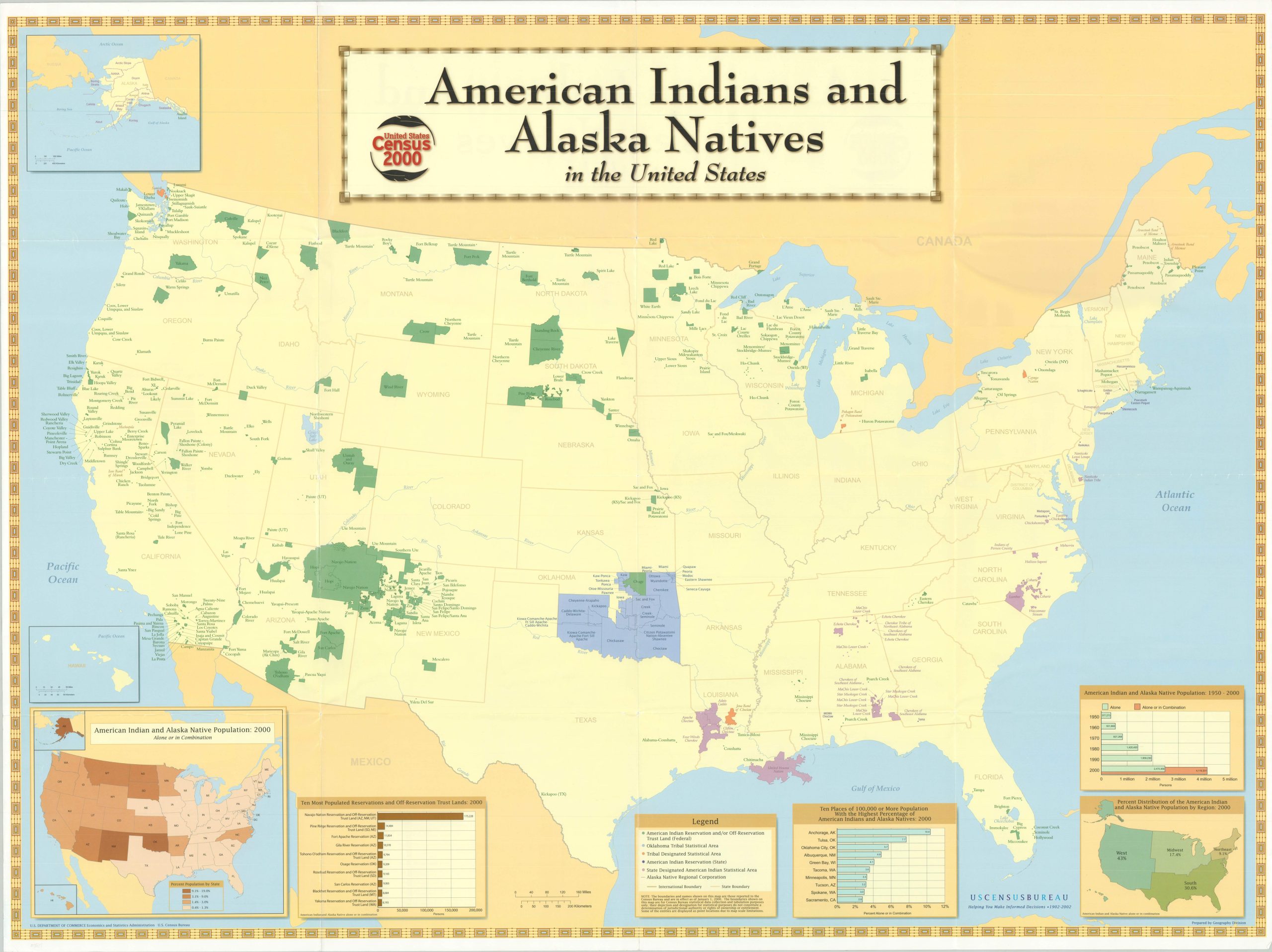
This straightforward image of the United States was created by the Census Bureau’s Geography Department in 2002, using the data collected two years prior. A central map of the continental U.S. shows the outlines of many, though not all, Indian reservations (there are over 300 in total) from coast to coast.
An inset in the upper left presents the divisions of the Native Alaska populations. Several more insets along the bottom provide additional information, such as the percentage of population by state, distribution by region, and a breakdown of the population growth of indigenous people in the second half of the 20th century.
Map Details
Publication Date: 2002
Author: U.S. Census Bureau (Geography Department)
Sheet Width (in): 47.75
Sheet Height (in): 35.75
Condition: A
Condition Description: Creasing and some light wear along old fold lines and around the outer edges of the sheet. Very good to near fine overall.
Out of stock