
American Airlines System Map [1961]
$95.00
A mid-century route map of “America’s Leading Airline.”
1 in stock
Description
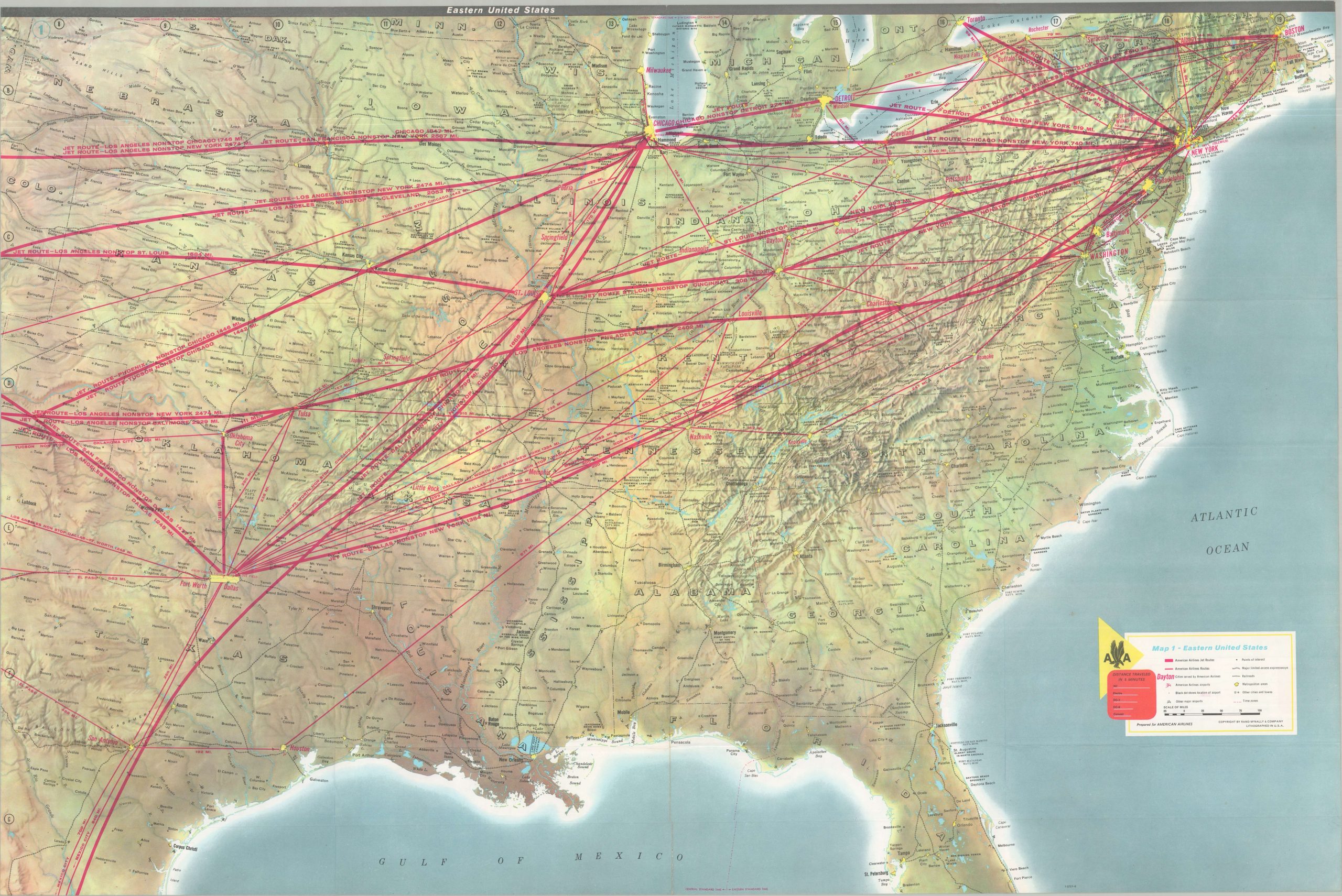
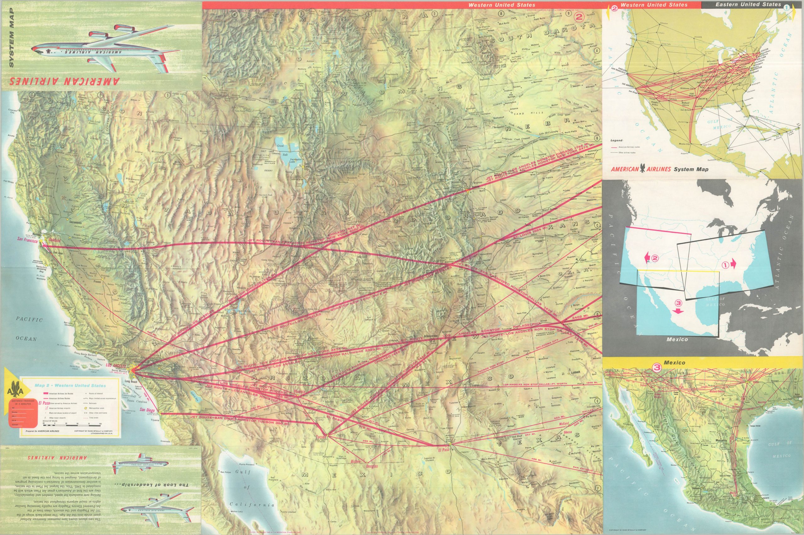
This striking topographic map of the United States was published in 1961 by Rand McNally & Company of Chicago on behalf of American Airlines. Three maps across both sides of the sheet present the operational air routes in bright red, noting distances between points. Points of interest, towns, and geographic features dot the landscape – perhaps giving the audience something to look for as they soar through the air.
The legend includes custom scales so distances can be measured for five different planes — Convair, DC-6, DC-7, Electra, and the 707. The introduction of the last just two years prior to publication revolutionized American Airlines’ services. Several of the airways are boldly labeled “Jet Route,” and text on the verso discusses the completion of the largest jet fleet in the nation by 1962.
Map Details
Publication Date: 1961
Author: Rand McNally
Sheet Width (in): 35.75
Sheet Height (in): 23.75
Condition: A
Condition Description: Double-sided map brochure, creased and lightly worn along original folds. Near fine condition overall.
$95.00
1 in stock