America e Oceania
$300.00
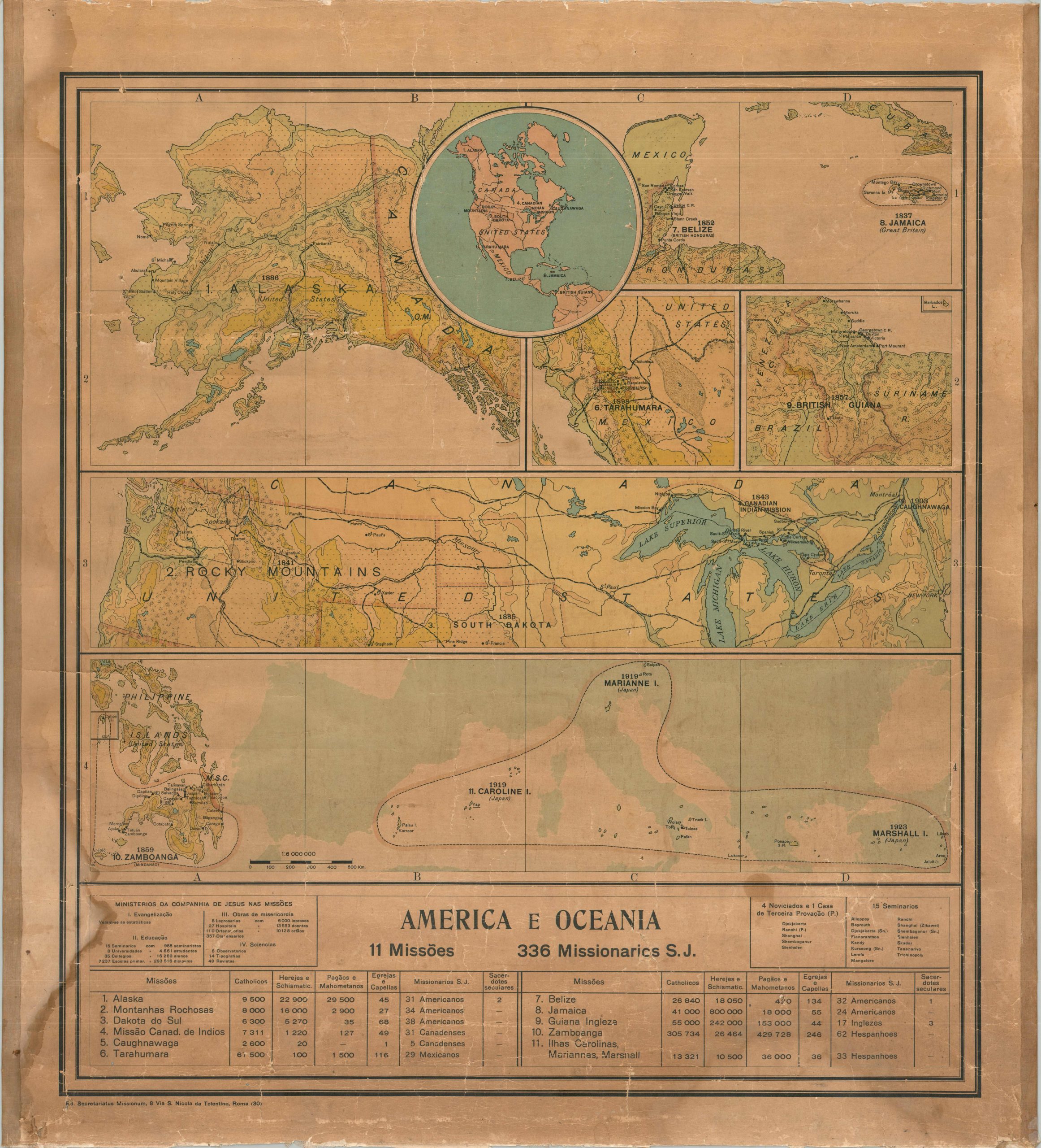
The presence of Jesuit missionaries across the Americas during the early 20th century.
1 in stock
Description
This interesting collage of topographic maps reflects the continent-spanning missionary efforts of the Society of Jesus (Jesuits). From Alaska to British Guiana and across remote islands in the Pacific, the Catholic order stationed dozens of priests to convert and educate the inhabitants. Seven different maps, plus a central ‘key’, reflect the geographic diversity of the historic operations and cover broad areas in Alaska, the Caribbean, Mexico, British Guiana, the Rocky Mountains, Great Lakes, Micronesia, and the Philippines. The eleven primary missions are listed in a table along the bottom of the sheet, which also outlines (in Portuguese) the Jesuits’ infrastructure and the religious practices of local populations. The missionaries (336 in total) are comprised of Americans, Spaniards, English, Canadians, and Mexicans.
Published in Rome by the Secretariatus Missionum (Secretariat for Missions), the Jesuit body that oversaw global missionary activities and correspondence. The last date within the image is 1923 (the Marshall Islands), though it was likely printed a bit later.
Map Details
Publication Date: c. 1928
Author: Ed. Secretariatus Missionum
Sheet Width (in): 33.00
Sheet Height (in): 37.00
Condition: B-
Condition Description: Color lithographed map mounted on linen, likely at the time of publication. Rough upper and lower edges, though the left and right have been hemmed and are quite sturdy. Damp stain, lower left, and heavy surface soiling along the lower edge. Scattered creasing and paper tears within the image, though with very minimal loss. A quarter sized spot in the lower right. Fair to good condition overall.
$300.00
1 in stock