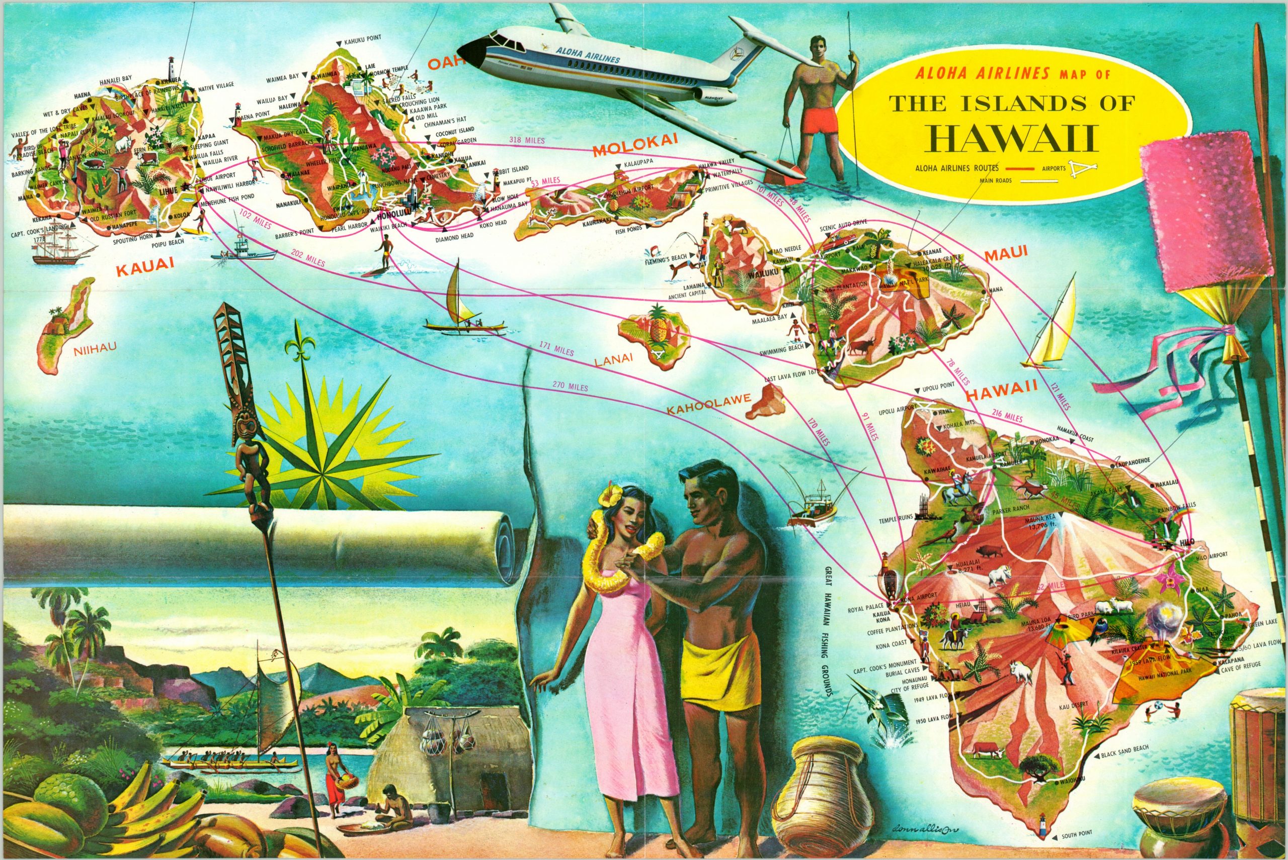
Aloha Airlines Map of the Islands of Hawaii
$75.00
Idyllic pictorial overview of the Hawaiian Islands.
1 in stock
Description
This vibrant map of the Hawaiian Islands was issued to promote tourism among the archipelago, with routes in operation by Aloha Airlines (a division of Pan-American) boldly highlighted in red. Stylized vignettes on each island emphasize points of interest, recreational activities, and local flora and fauna. Surrounding the map are additional illustrations that provide the audience a sense of the tropical paradise that awaits, though it’s unlikely there were topless natives in thatched huts in the second half of the 1960’s.
The verso features photographs and text describing each of the islands, as well as an overview of the luxurious amenities that are provided on the BAC One-Eleven planes that operate within the fleet. An image of the flagship jet can be seen in the upper center of the map.
Map Details
Publication Date: c. 1966
Author: Pan-American Airlines
Sheet Width (in): 17.80
Sheet Height (in): 11.90
Condition: A
Condition Description: Light creasing and faint wear along former fold lines, but in near fine condition overall.
$75.00
1 in stock