
Algerie
Commercial opportunities in Algeria just a few years after independence from France.
Out of stock
Description
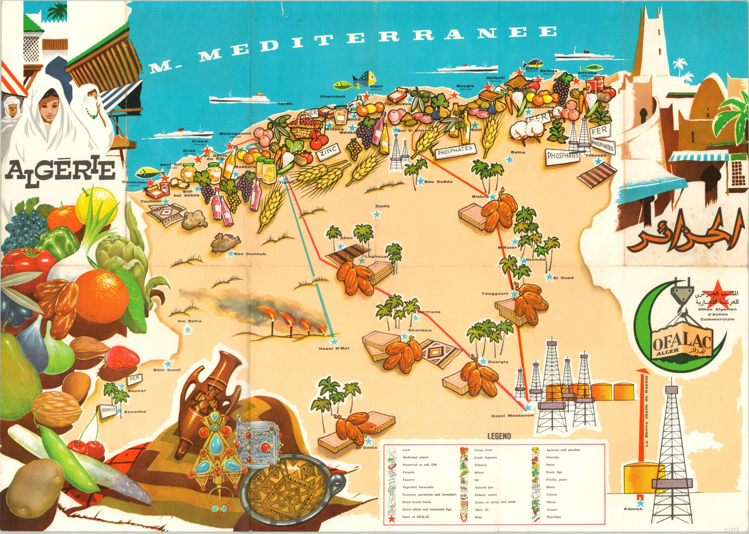
Combining an interesting mix of French, Arabic, and English, this vibrant pictorial map of Algeria was issued to catch the eye of anyone possibly interested in local economic investment. It was published in 1964, just two years after the country’s official independence from France.
Illustrated vignettes show many of the most profitable commercial exports, including figs, wheat, cork, and oil. The verso features additional information on local crops and other important industries across the country.
The map was published by O.F.A.L.A.C. – the Office Algerien d’Action Commerciale (Algerian Commercial Action Office).
Map Details
Publication Date: 1964
Author: Office Algerien d'Action Commerciale
Sheet Width (in): 26.40
Sheet Height (in): 18.90
Condition: B+
Condition Description: Creasing and wear along originally issued fold lines, including separation at fold intersections and small edge tears that have been repaired on the verso with archival tape. Scattered discoloration in the center right. Good to very good overall.
Out of stock