Album of Agricultural Statistics
$275.00
Visualizing the agricultural backbone of America in the late 19th century.
1 in stock
Description
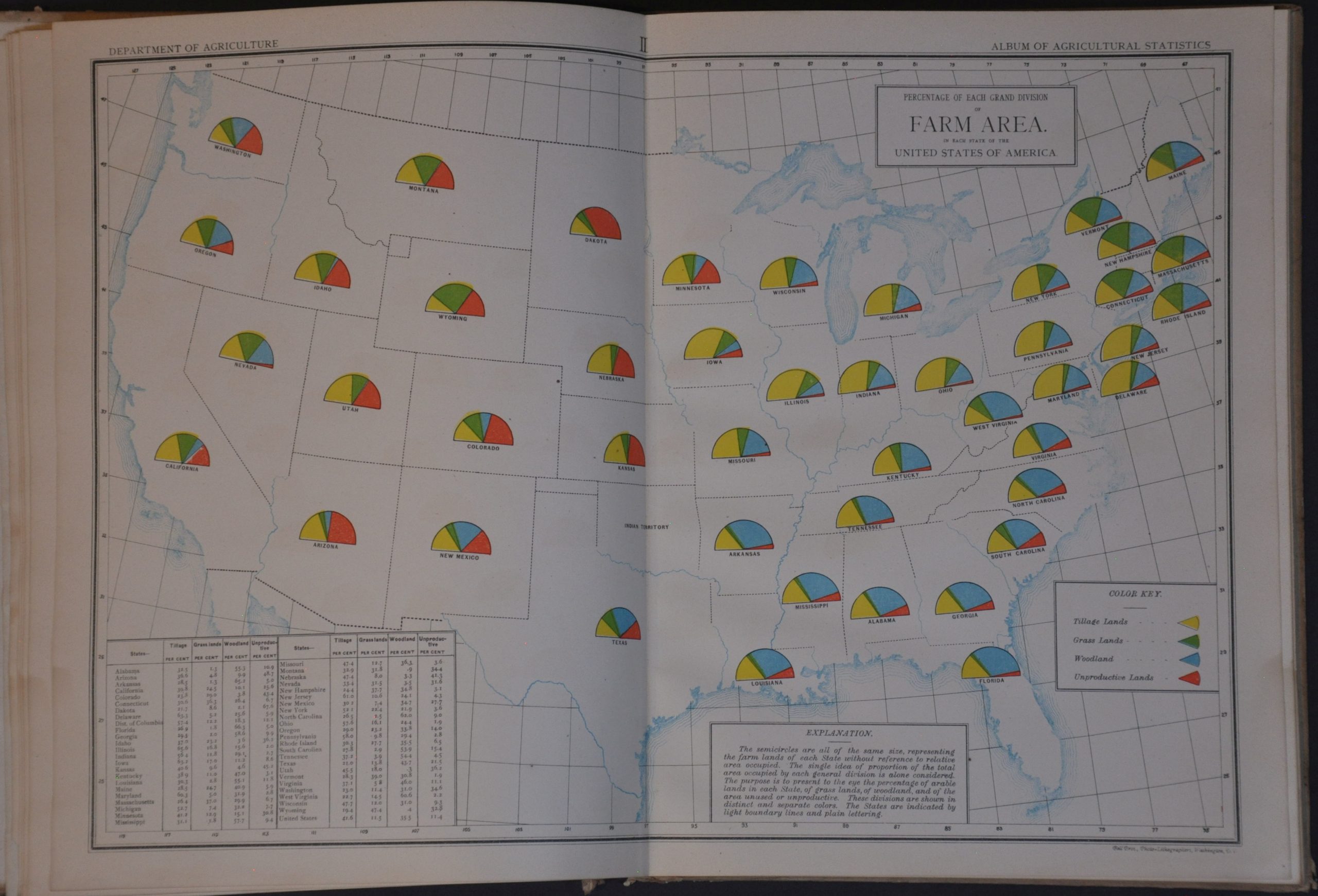
“The Album of Agricultural Statistics is presented to the people of the United States as an aid to their clear and instant appreciation of some of the leading facts of American agriculture.” – pg. 8.
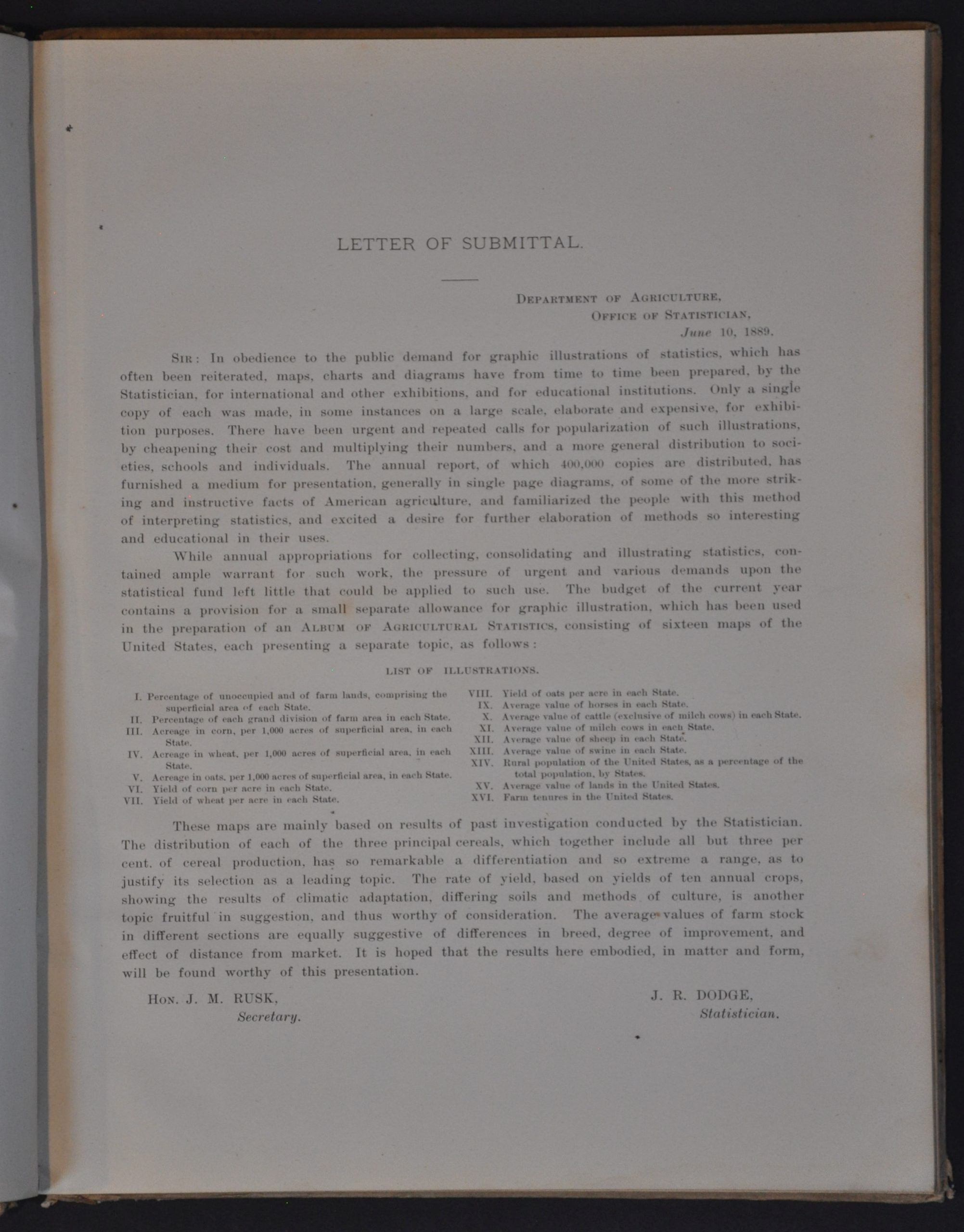
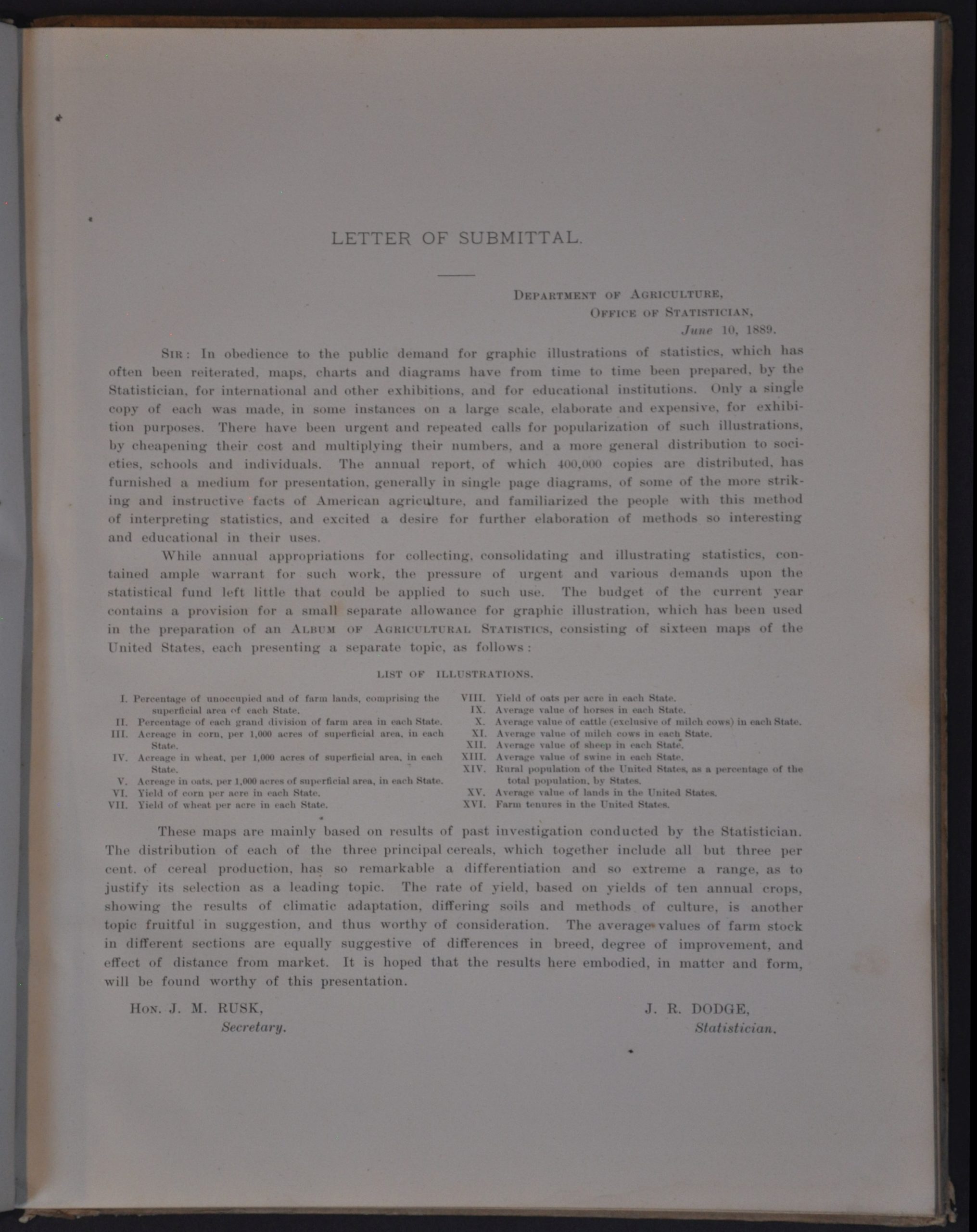
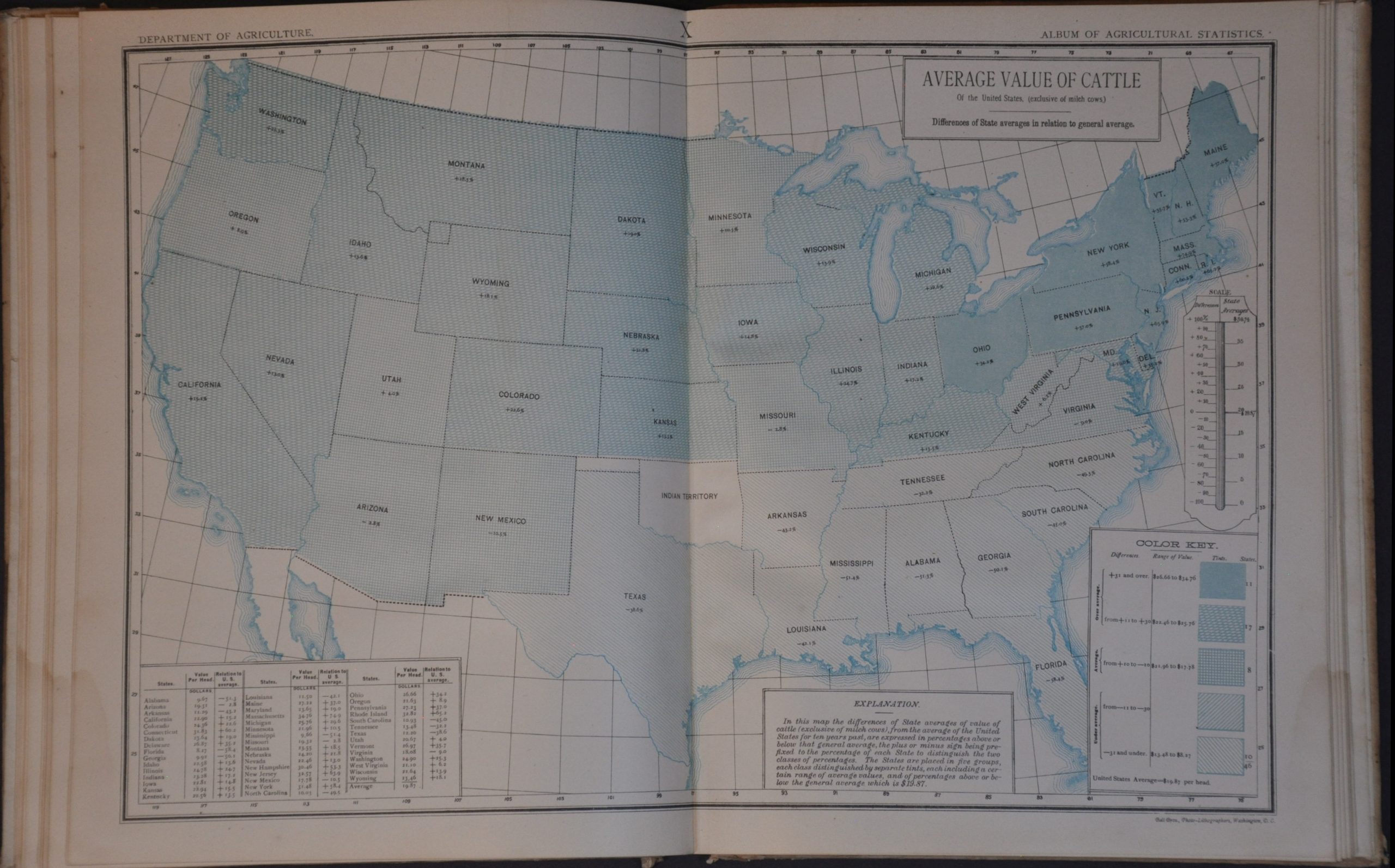
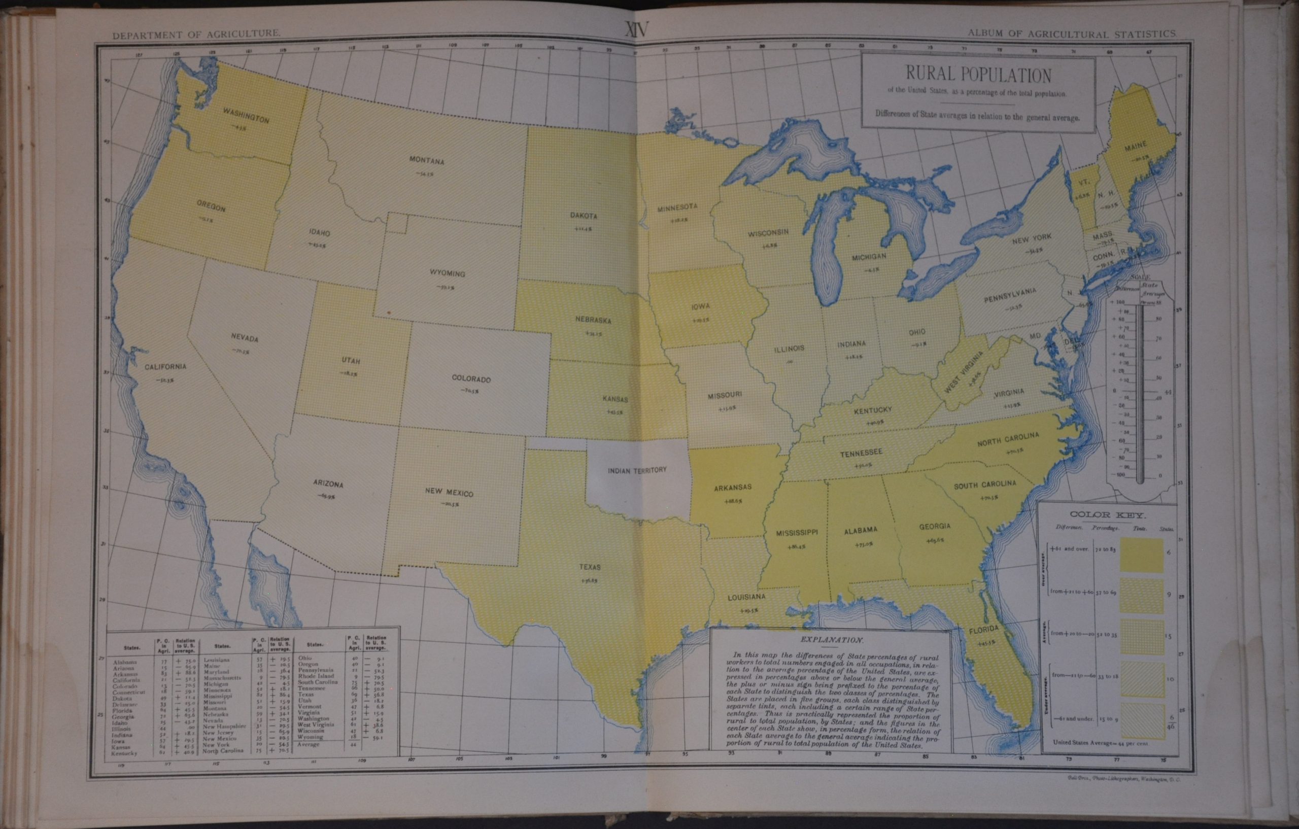
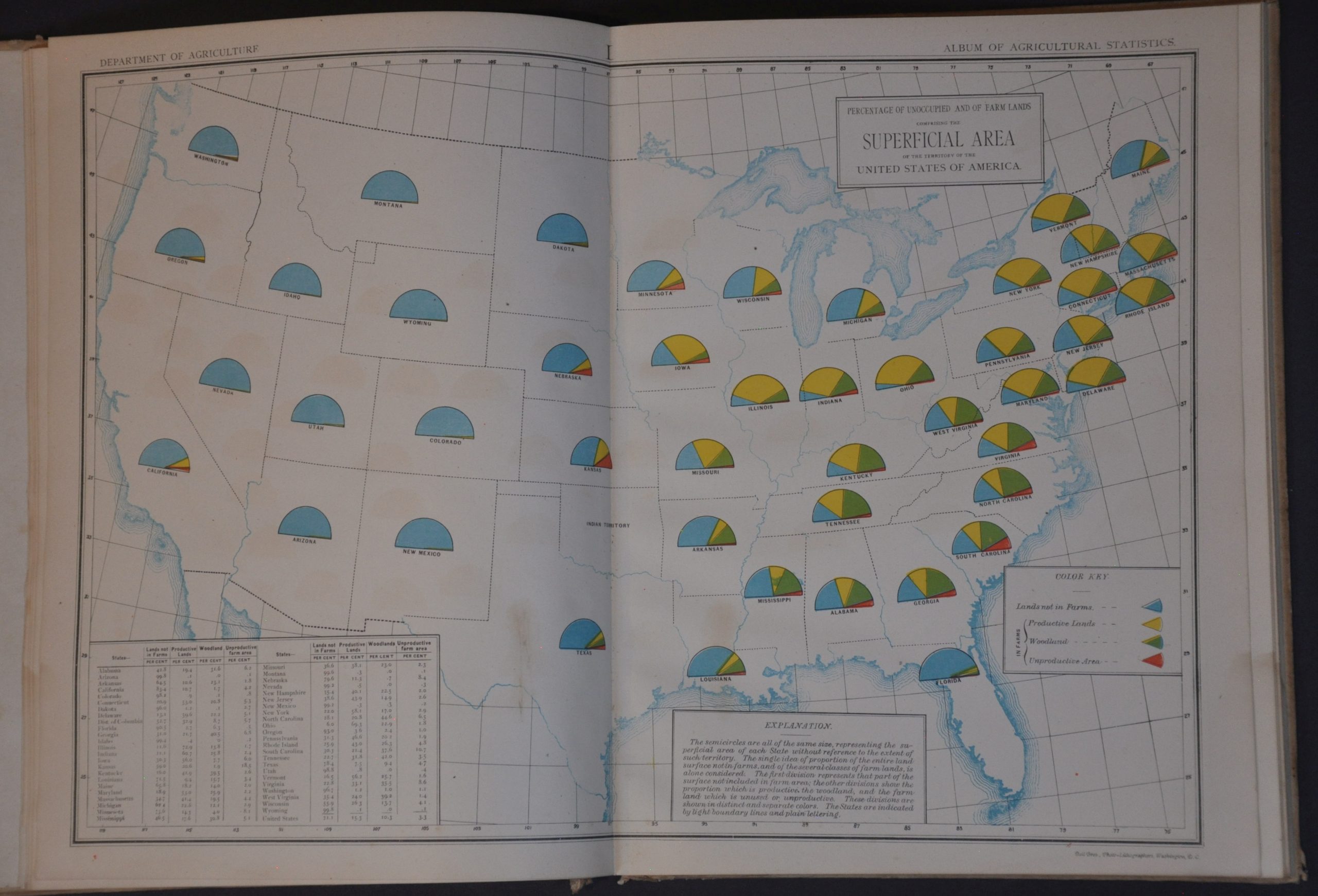
This fascinating atlas represents an incredible attempt by the U.S. Department of Agriculture to synthesize a vast amount of commercial data into a format that is easily understood by a broad audience. A brief introduction outlines the purpose of the volume and summarizes its contents, which consist primarily of sixteen double-page maps of the United States.
Each sheet, printed by the Bell Brothers of Washington, D.C., uses pie charts or color shading to highlight a variety of agricultural trends across America. These themes include the percentage of occupied farmland, the acreage and yield of primary crops (wheat, corn), distribution of livestock, and the composition of the rural population.
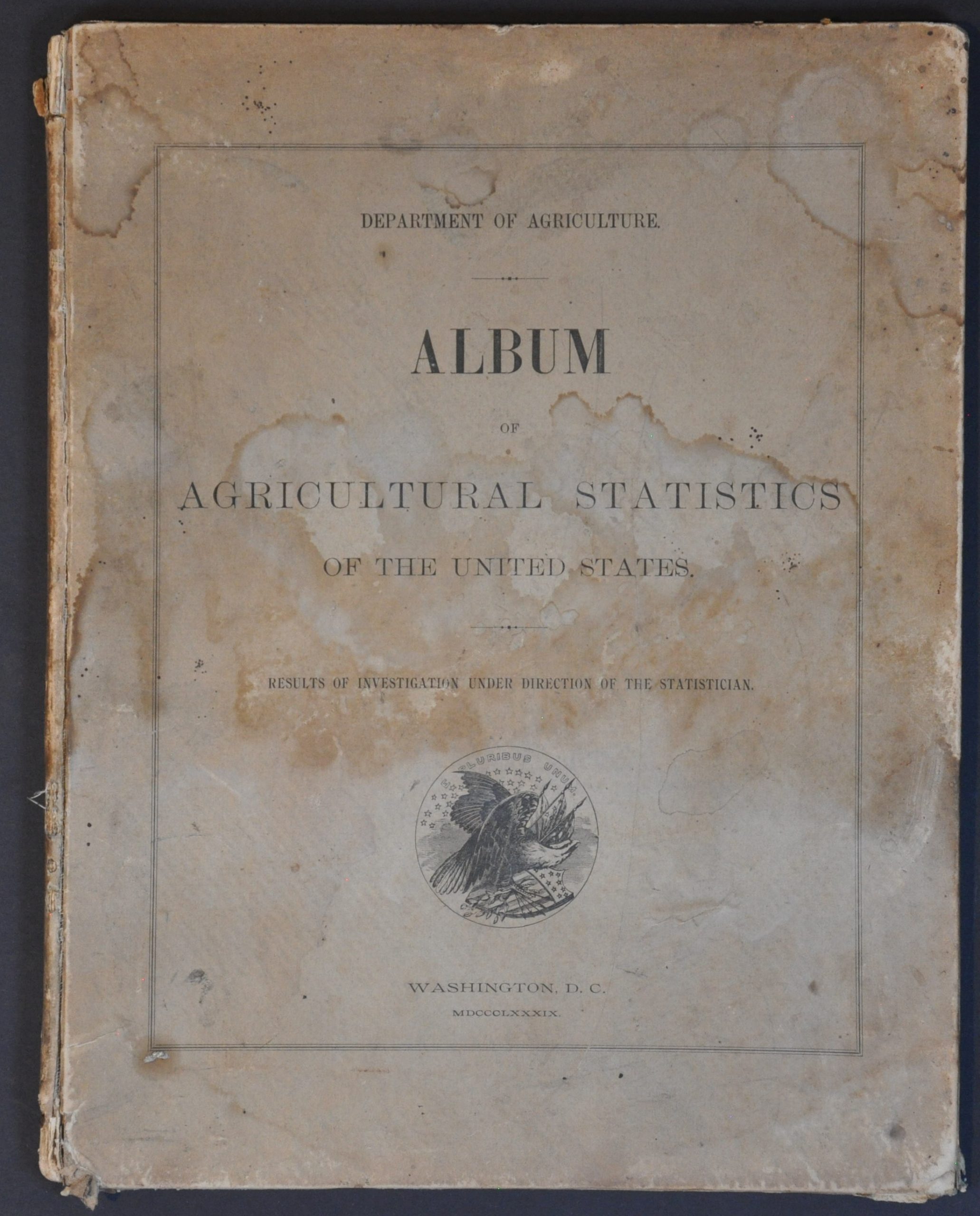
The atlas was compiled by J.R. Dodge, Chief Statistician of the U.S. Department of Agriculture. Published in 1889. This example includes a tag indicating it was distributed compliments of J.M. Rusk, the Secretary of Agriculture. In addition to educating America’s farmers, the volume was part of America’s industrial promotion at the Paris Universal Exposition.
Map Details
Publication Date: 1889
Author: U.S. Department of Agriculture
Sheet Width (in): 9.50
Sheet Height (in): 12.25
Condition: B+
Condition Description: Complete collection of sixteen double-page color printed maps, plus eight pages of introductory text and a letter of transmittal. Original paper covered boards are heavily soiled and damp stained. Contents show faint marginal damp staining in the lower left, some minor offsetting from the printed ink, and the scattered spot of foxing an marginal wear. Good condition overall.
$275.00
1 in stock