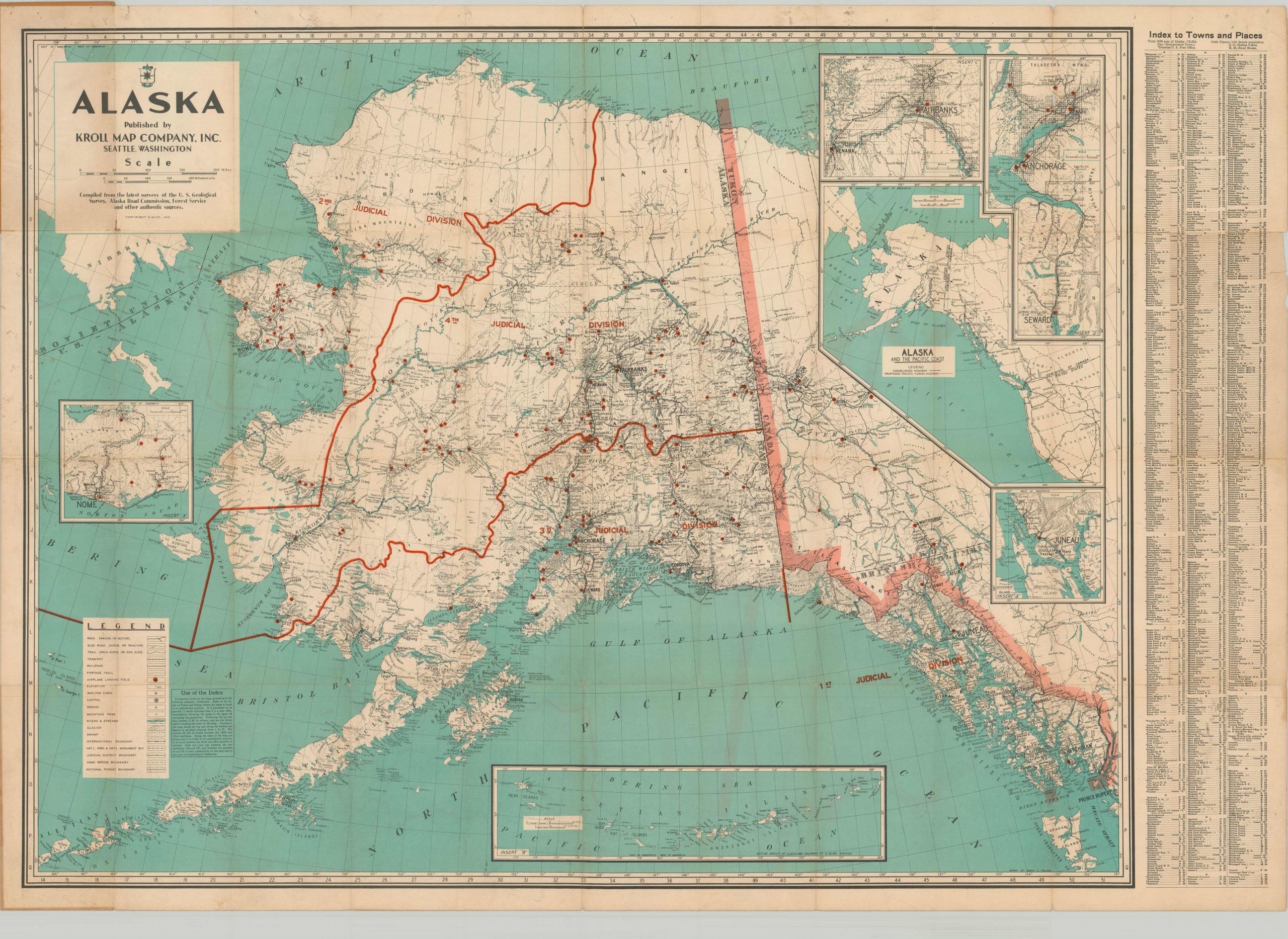
Alaska Published by the Kroll Map Company, Inc.
Large folding map highlighting the route of the recently completed Alaska-Canada (ALCAN) Highway.
Out of stock
Description
This detailed map of Alaska was published either during, or shortly after, World War II. It shows the four judicial divisions of the territory and border with adjacent Canada in bright lines. However, the emphasis of the map is on the various transportation options available in the remote area, which range from paved roads and railroads to portage trails and isolated airplane landing fields.
Of particular note is the Alaska Canada Highway, completed between 1942 and 1943 as a wartime supply route. Described on the front cover as ‘present a military road,’ the route opened up for public use in 1947.
An inset map also shows the connections between Alaska and the Pacific Coast Highway. Several other inset maps are included; the Aleutian Islands, Nome region, and the urban areas of Fairbanks, Juneau, and Anchorage.
Map Details
Publication Date: c. 1946
Author: Edwin C. Poland
Sheet Width (in): 45.75
Sheet Height (in): 32.5
Condition: B
Condition Description: Moderate wear and creasing along originally issued fold lines, including several small holes at fold intersections and minor discoloration in several areas. Soiling around the outer edges and faint spots of foxing visible in the lower quadrants. Further discoloration visible in the upper left from the adhesive used to affix the map to the front cover.
Out of stock

