Alaska Highway
$55.00
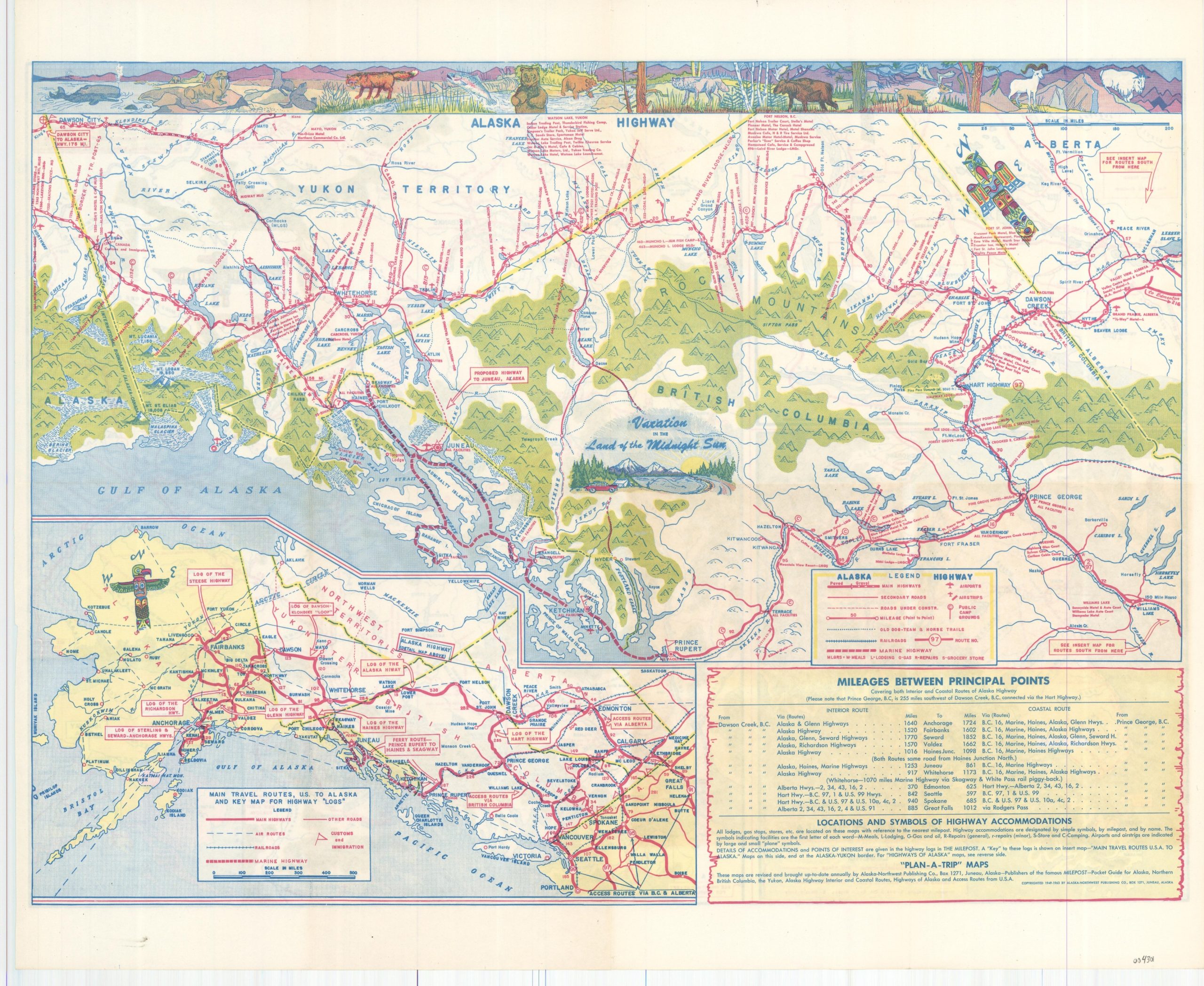
“Plan-A-Trip” map of the Alaska Highway from the 1960s.
1 in stock
Description
“Vacation in the Land of the Midnight Sun” with this fun tourist map of Eastern Canada and southern Alaska that highlights the route of the Alaska Highway. The route, completed in 1942, is shown running approximately 1,700 miles between Dawson Creek, BC and Fairbanks, AK, though the last ~200 or so miles were technically part of a different named route.
The primary image shows the Alaska Highway running through British Columbia and the Yukon Territory before crossing into Alaska at Border City. A variety of other transportation methods are depicted, including railroads, alternative automobile routes, and dog-sled/horse trails. Traveler amenities like garages, hotels, restaurants, and gas stations are also noted according to the legend in the lower right.
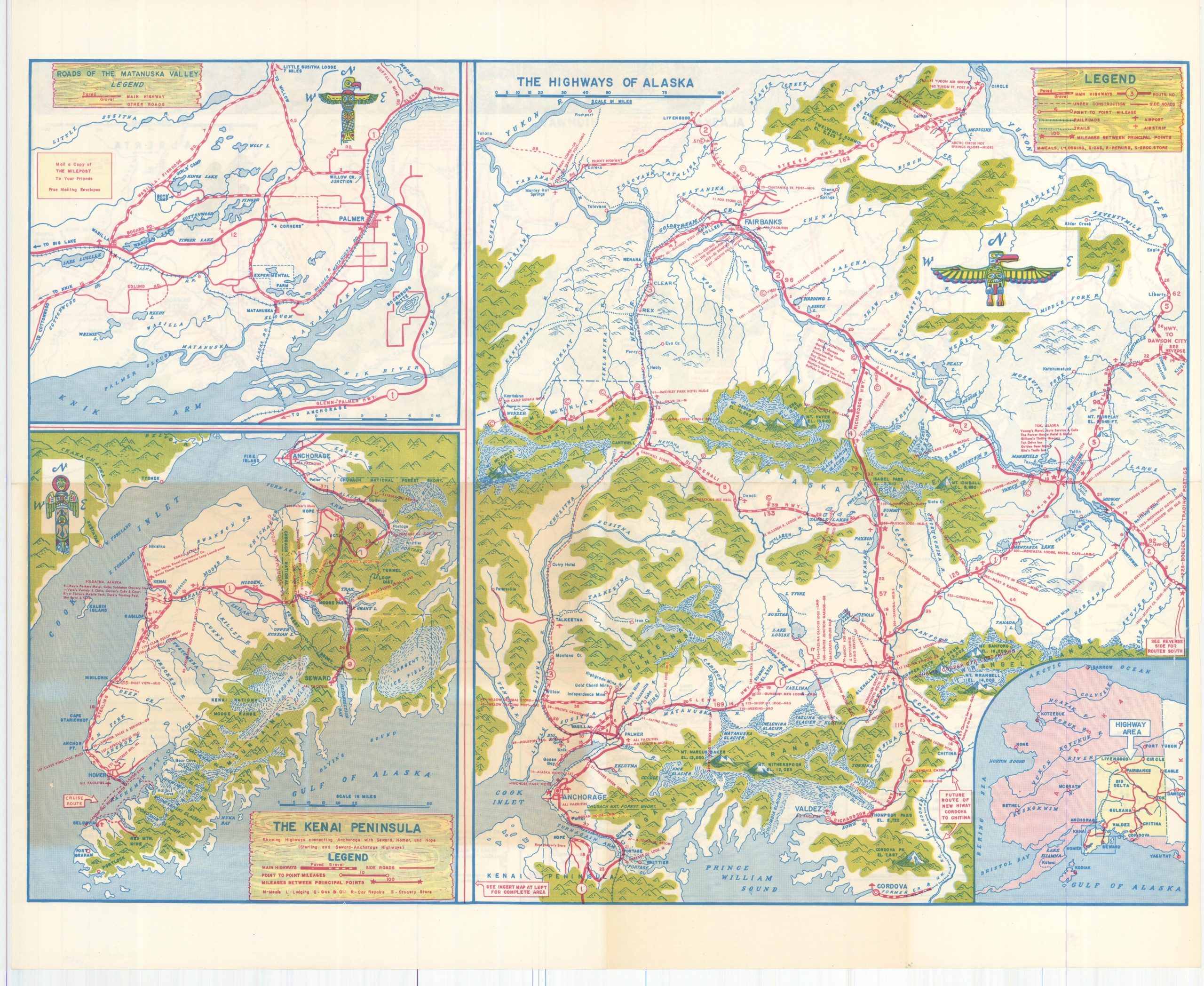
An inset in the lower left shows the primary highways connecting Alaska to the Pacific Northwest. Additional maps on the verso show the main automobile routes of Alaska, the roads of the Matanuska Valley, and the Kenai Peninsula.
Copywritten and published in 1963 by the Alaska-Northwest Publishing Company in Juneau.
Map Details
Publication Date: 1963
Author: Alaska-Northwest Publishing Company
Sheet Width (in): 19.1
Sheet Height (in): 15.5
Condition: A-
Condition Description: One small circular tear, about 1" in circumference, in the center left, repaired with archival tape on the verso. Lightly creased along old fold lines. Very good overall.
$55.00
1 in stock