Alaska and the Yukon Princess Cruises
$65.00
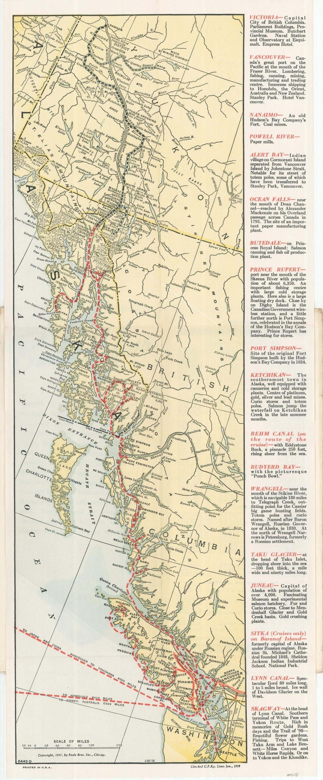
Pocket map showing the steamship lines of the Canadian Pacific Railway, issued shortly before the outbreak of WWII.
1 in stock
Description
This charming little brochure highlights the steamship routes in operation by Canadian Pacific Railways, ‘The World’s Greatest Travel System’, shortly before the outbreak of World War II in Europe.
Hashed red lines denote the traveler’s path along the coast, departing from Vancouver and Seattle to Juneau, Sitka, and Kagway – the connection with the White Pass & Yukon Route. Descriptive text on the right side of the sheet provides additional information on the various destinations accessible by the steamship lines.
Created by the Poole Brothers in Chicago, originally in 1936 according to the date code at the bottom of the sheet. This example has been updated and approved as of January 1939.
Map Details
Publication Date: 1939
Author: Canadian Pacific Railway
Sheet Width (in): 7.75
Sheet Height (in): 19.5
Condition: A-
Condition Description: Map folded into 6 panels and affixed to original illustrated stiff paper wraps. Creased along fold lines and minor wear to the front covers, but overall in very good to near fine condition.
$65.00
1 in stock