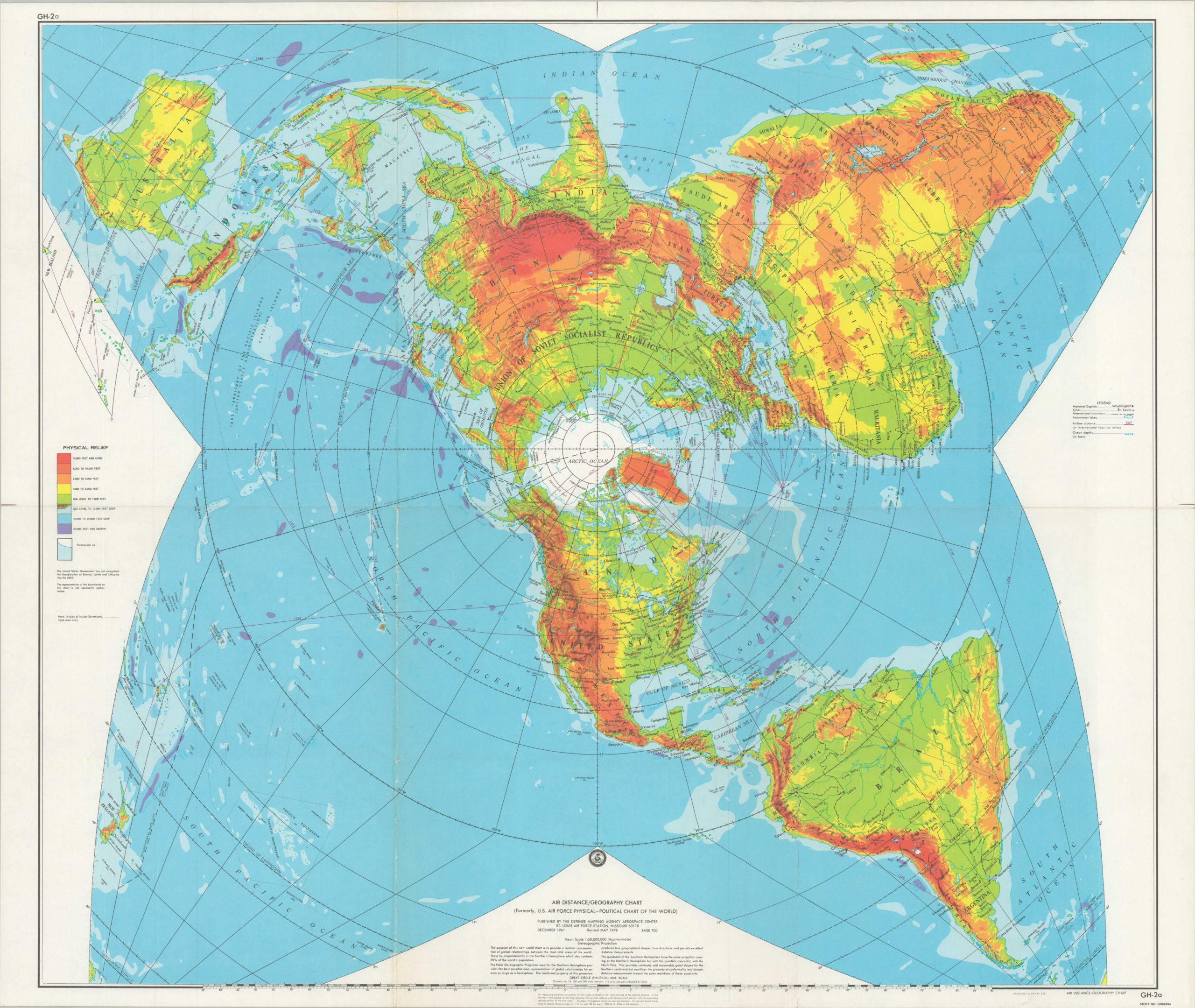
Air Distance/Geography Chart
Relief map of the world showcasing global aviation routes.
Out of stock
Description
The introduction of jet-powered aircraft, ICBMs, and space exploration in the second half of the 20th century rapidly revolutionized most of humanity’s concept of global transportation. This stereographic projection is designed to highlight the ‘new world’ made accessible by aviation. Points between distance locations are plotted as straight lines, allowing for a comparison of distances between vital strategic areas.
Published in St. Louis by the Defense Mapping Agency Aerospace Center in 1978
Map Details
Publication Date: 1978
Author: Defense Mapping Agency
Sheet Width (in): 24.6
Sheet Height (in): 20.6
Condition: A-
Condition Description: Creasing and moderate wear along old fold lines, including some separation along the outer edges (repaired on verso). Very good overall.
Out of stock