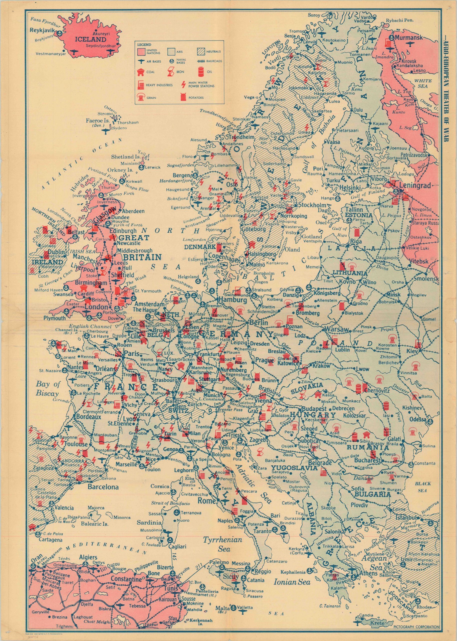
Afro-European Theater of War
$75.00
A persuasive map of Europe showing the Allies poised to strike back at Nazi Germany’s early gains.

Description
One of dozens, if not hundreds of maps, issued to the public during the 1940’s showing the current situation in the European theater of war. This issue, based on maps by C.S. Hammond, was published and distributed by the Pictograph Corporation and reflects the Allied victory in North Africa shortly after the surrender of the German and Italian forces in May 1943. Although Axis territory extends from Vichy France to the borders of Leningrad, the tides of war were changing. The German advance into Russia had been abruptly halted in the winter of 1942, and the industrial capacity of the United States was quickly blooming into a deciding factor on both fronts.
On the verso are six maps showing possible invasion routes into Germany, including attacks through Northern France, Sicily and Italy, the Lowland Countries, Scandinavia, the Adriatic, and Greece. Of interest on the map of France is a note labeling the channel crossing as “possible diversionary attacks” with the “main attack” coming from the south through Toulon. Possibly part of the clever campaign to deceive the Germans about the true intention of the military buildup around Normandy, which would host the largest amphibious operation in the history of the world just a few months after publication. A comparison chart, also on the verso, graphs the range, payload capacity, and speed of the belligerent’s air forces, showing the United States at a decided advantage.
Map Details
Publication Date: c. 1943
Author: Pictograph Company
Sheet Width (in): 23.00
Sheet Height (in): 32
Condition: B+
Condition Description: The map is in great shape, given it's likely prior use. Pinholes in the corners, plus fold lines, exhibit some wear. Issued on newsprint paper.
$75.00