Africa Mit Seinen Besondern Lanendern, Thieren und Wunderbarlichen Dingen
$275.00
“Africa with its special countries, animals, and wonderful things” [title]
1 in stock
Description
This fascinating woodcut map shows the continent of Africa about a century after the Portuguese first rounded the southern tip during their search for access to lucrative markets in the Far East. Surprisingly, coastal details are relatively limited, though the European presence during the 16th was largely limited to forts and factories accessible by sea.
The interior of the continent reflects the geography of the ancient Greek scholar Claudius Ptolemy, including the adoption of the Mountains of the Moon (Lunes Montes) – supposedly the source of the Nile River. Various kingdoms and regions are labeled, the latter reflecting Roman political organization in the north. Only two cities are identified – Alexandria (Ptolemy’s home) and Tagaza on the Senegal River, an important source of salt.
The image, one of the earliest to show the entire African continent, was first issued in the 1544 edition of Sebastian Munster’s Cosmographia published in Basel, though this is likely a later version due to slight variations in the woodcut. The Cosmographia, first published in 1544, was one of the most important texts of the 16th century and influenced geographic thought for generations of scholars and mapmakers. According to Magdalena Peszko of the British Library;
“The Cosmographia is a compendium of historical and geographical knowledge compiled from information gathered as part of Münster’s personal research, international collaborations and editions of the classical authors. The work was based on up-to-date knowledge and provided the geographical and historical overview of the world, natural history, topographical features, boundaries and administrative division of the described lands, their inhabitants, flora and fauna.”
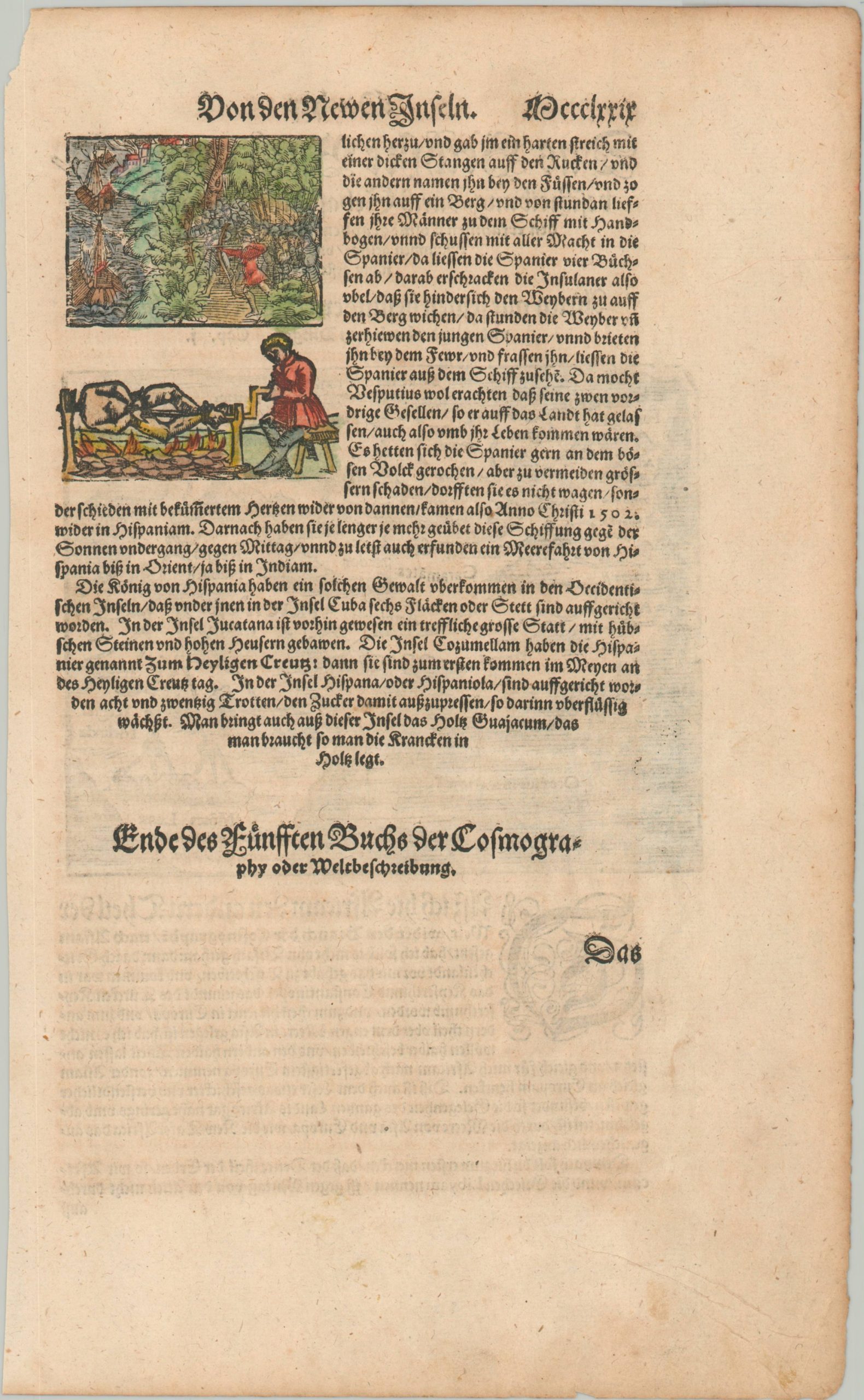
The verso presents two interesting vignettes. One shows a Spanish sailing ship under attack, possibly by Native Americans (though they are shown in European-style armor), while the second depicts a man being roasted on a spit over a fire. Fears of cannibalism in the New World were introduced by Columbus and would persist in the collective imagination, and on maps, for centuries.
Sources: British Library Blog; Columbia University; Hyperallergic;
Map Details
Publication Date: c. 1588
Author: Sebastian Munster
Sheet Width (in): 8.2
Sheet Height (in): 13.3
Condition: A-
Condition Description: Small map, approximately 6.1" x 4.9", on a single sheet from Munster's Cosmographia. Faint soiling near the top of the image and a bit of wear and spotting visible in the margins. Very good, with attractive modern hand color.
$275.00
1 in stock


