Aevi Veteris, Typus Geographicus
$700.00
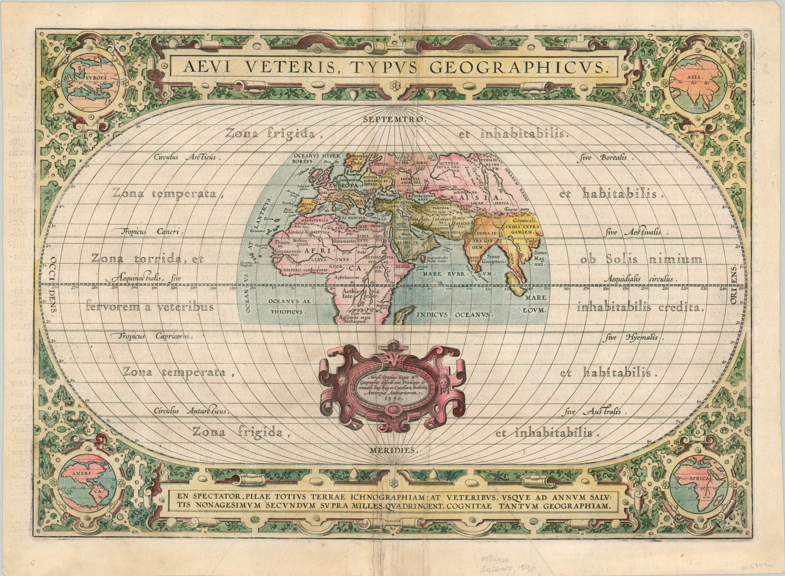
Late 16th century overview of classical geography by the creator of the first modern atlas.
1 in stock
Description
This stunning copperplate engraved map was published in Antwerp in 1590 by Abraham Ortelius. Best known for his publication of the Theatrum Orbis Terrarum, considered by most to be the first ‘modern’ atlas, Ortelius was an antiquarian scholar in addition to geographer and cartographer. He issued this map based on extensive studies of sources ranging from the ancient Egyptians to world maps from the Middle Ages (the verso lists upwards of fifteen such sources used in the compilation, notably Ptolemy).
The central image is presented in a partial oval, indicating that it was merely a portion of the larger world, which is alluded to in the borders. Here one can also see the various climatic zones that allegedly corresponded to levels of habitation and race across the globe. The map is an interesting synthesis of the old and the new, with notable cartographic myths juxtaposed with more modern geographic discoveries. Several major cities and rivers are labeled, with a number of the former showing their Roman place names (e.g. Lutetia for Paris).
The map is surrounded by a heavily embellished border; anchored in each corner with a more contemporary depiction of each continent. These images correspond nicely to the proclamation at the bottom of the sheet, which encourages the audience to wonder at the impact of Columbus’s discoveries on our knowledge of the world.
Map Details
Publication Date: 1590
Author: Abraham Ortelius
Sheet Width (in): 18.75
Sheet Height (in): 13.75
Condition: A-
Condition Description: Soft wear and a bit of extraneous creasing along the vertical centerfold. Faint scattered soiling in the margins, but remains in very good condition overall. Nice hand color.
$700.00
1 in stock