Aerial View of Lower Manhattan
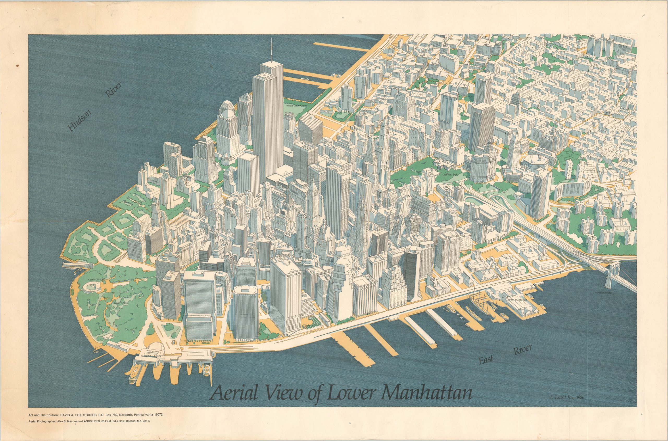
Pre-9/11 view of downtown New York City.
Out of stock
Description
This isometric aerial view of Lower Manhattan presents a starkly illustrated depiction of the New York skyline in the mid-1980s. The rich architectural diversity of the heart of the Big Apple is on full display. Iconic monuments like the Brooklyn Bridge, the World Trade Center, and Battery Park are labeled, though scores of buildings are accurately depicted and unnamed.
Designed and distributed by David A. Fox in 1986 using aerial photography provided by Alex S. MacLean.
Map Details
Publication Date: 1986
Author: David A. Fox
Sheet Width (in): 37.25
Sheet Height (in): 24.5
Condition: B+
Condition Description: Moderate wear and scattered spotting visible in the margins. A bit of creasing throughout the image from where previously rolled. Good to very good overall.
Out of stock