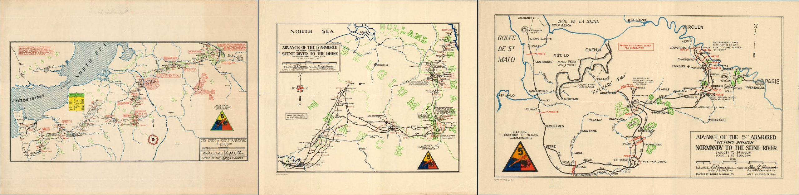
[Advance of the 5th Armored “Victory Division”]
Three maps showing the trek of the “Victory Division” across Europe in World War II.
Out of stock


Description
This series of maps was published in 1945 while the Fifth Armored Division marched across France and through Germany. Three separate sheets provide a detailed narrative of the unit’s advance; including movements by individual combat command groups, dates and notes on engagements, and lines of enemy defense. See here for the article I’ve previously written on these maps.
“Advance of the 5th Armored Victory Division Normandy to the Seine River.” Sheet size: 20″ x 12″ This map shows the path of the division from landing at Utah Beach in July of 1944 to its arrival at the outskirts of Paris at the end of August, including action at the Falaise Gap. Printed in March 1945 by the 669th Engineer Topographic Company.
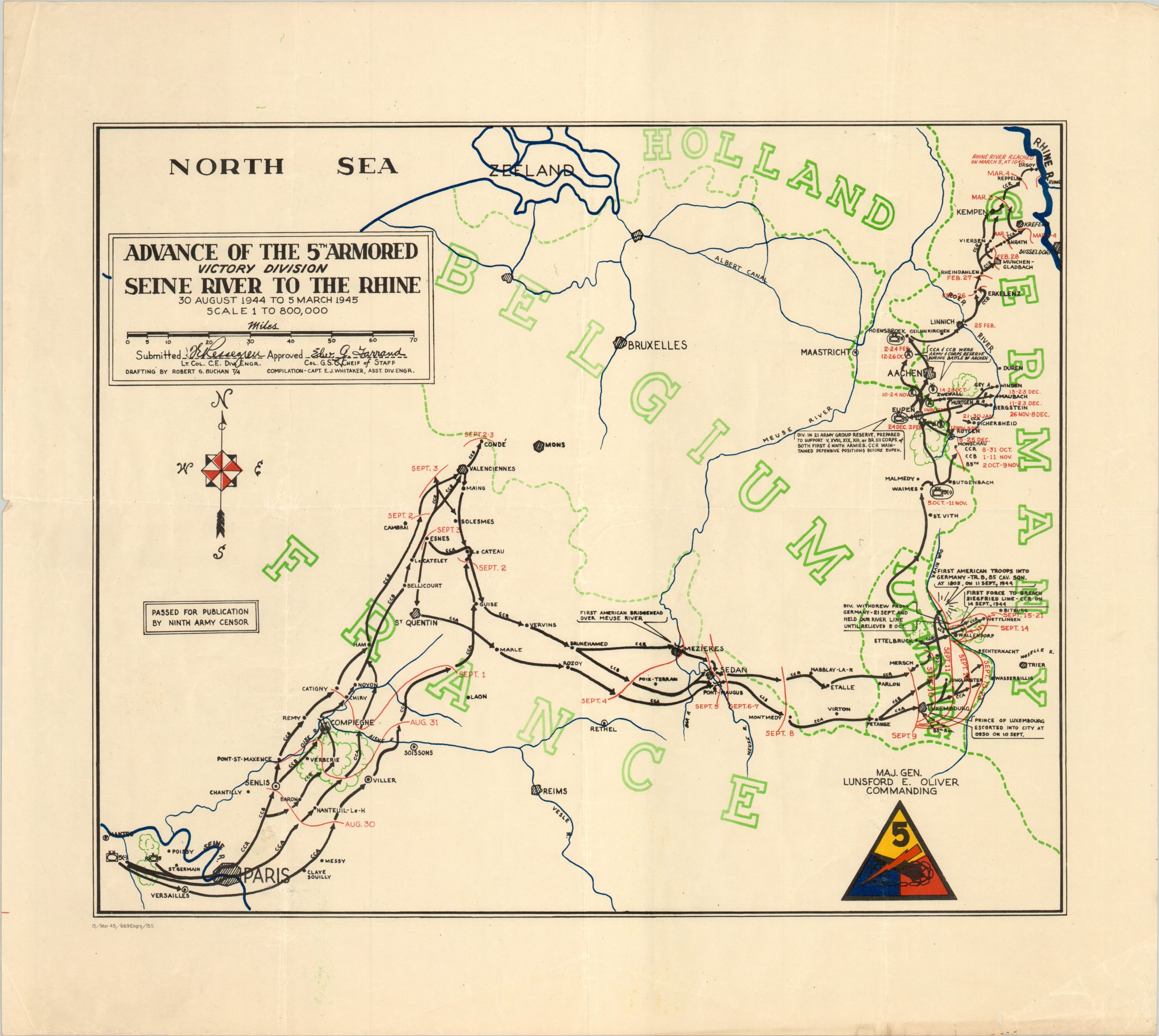
“Advance of the 5th Armored Victory Division Seine River to the Rhine.” Sheet size: 22.5″ x 20″ This map continues the route from the previous sheet; from Paris and across Germany to the banks of the Rhine River between August 1944 and early March 1945. Notes identify the locations of the first forces to breach the Siegfried Line, the first American troops to cross into Germany, and the triumphant return of the Prince of Luxembourg. Printed in March 1945 by the 669th Engineer Topographic Company.
“The Trek of the 5th Armored.” Sheet size: 28.9″ x 21.9″ The final map produced in the series, this sheet shows the entire campaign of the division in the European Theater. Training in England through V-E Day in Germany is depicted; providing the same level of detail as those previously issued. Notes in red ink call out specific engagements for which the division brass was particularly proud, such as being the nearest American division to Hitler’s Berlin after reaching the Elbe. A shield shows the corps and armies to which the division was assigned. Printed by the Office of the Division Engineer in June of 1945.
Map Details
Publication Date: 1945
Author: Robert Buchan
Sheet Width (in):
Sheet Height (in):
Condition: A-
Condition Description: Overall the three maps are in very good to excellent condition. Moderate creasing and faint discoloration along fold lines, and a few tears in the outer margins that do not enter the image.
Out of stock