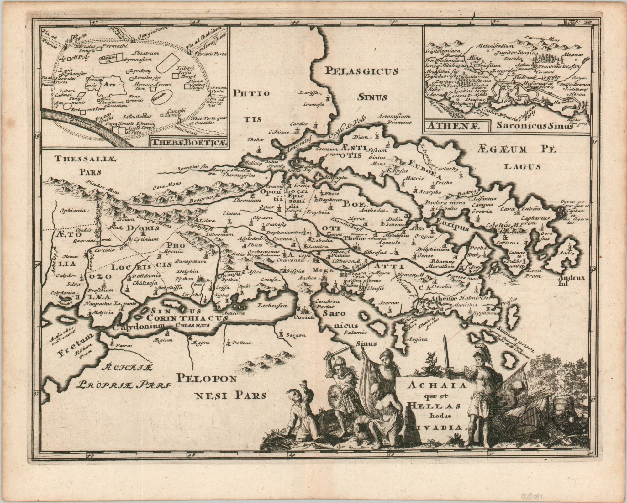
Achaia quae et Hellas hodie Livadia
$75.00
Part of ancient Greece from an early Enlightenment-era geography text.
1 in stock
Description
This attractive map of central Greece was issued as part of Philipp Cluver’s Introductio in Universam Geographicam around 1720. The massive six-volume work was first published in 1624 (without maps, introduced in 1641) and remained popular across numerous editions for over a century.
The image presents southern continental Greece as known to the ancients, with settlements, political features, and geographic features labeled. Inset plans of Thebes and the walled city of Athens are in the upper corners, while a decorative title cartouche can be seen in the lower right.
Though ostensibly meant to express the martial prowess of Greek infantry, the slaughter of unarmed combatants and taking of prisoners is a harsh representation to modern eyes.
Map Details
Publication Date: c. 1720
Author: Philipp Cluver
Sheet Width (in): 11.1
Sheet Height (in): 8.8
Condition: A-
Condition Description: Bold, crisp impression with slight discoloration along the outer edges of the sheet. One spot in the upper left remains confined to the margin, while a tiny speck can be seen in the upper middle, near the centerfold.
$75.00
1 in stock