A Trawler’s Chart of the North Atlantic Fishing Grounds
$50.00
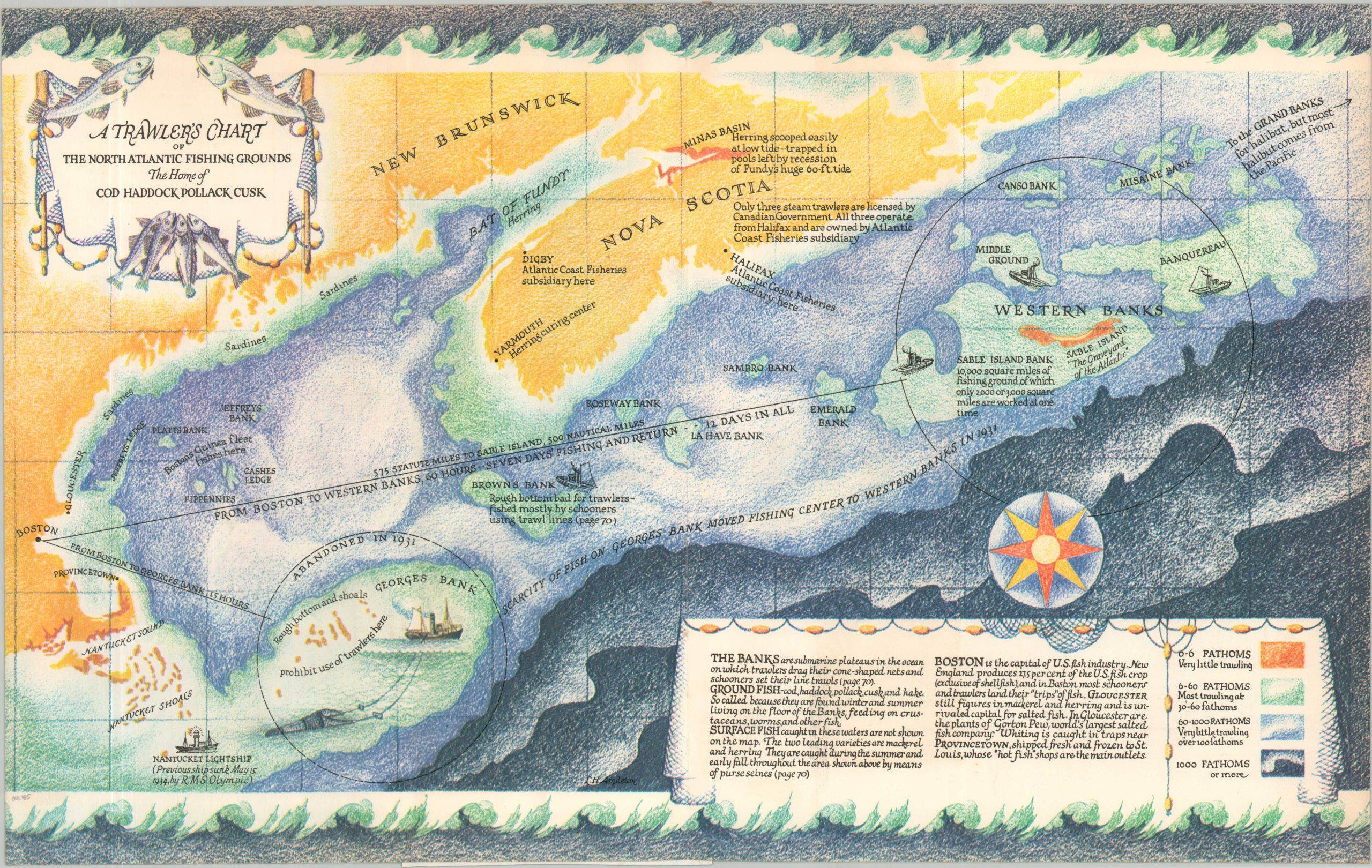
A colorful map of the important Grand Banks of Newfoundland.
1 in stock
Description
The Grand Banks of Newfoundland are a series of high underwater plateaus in the North Atlantic Ocean, off the coast of Nova Scotia. They are home to some of the most abundant fishing grounds on the planet; large schools of cod, pollack and swordfish provide a rich commercial bounty dating back to as early as the 15th century, when Basque fishermen plied the coast for cod to pack in salt.
This map shows the area stylistically and notes several important locations in the fishing industry. Color is used to show depth, and accompanying text provides additional information on the availability of certain species. The scarcity of fish is also referenced, as overfishing throughout the 20th century caused numerous fish populations to plummet. Sable Island is labeled as “The Graveyard of the Atlantic” as there are estimated to be over 350 shipwrecks around the small, sandy islet.
The map was illustrated by L.H. Appleton and published in the September 1935 edition of Fortune Magazine.
Map Details
Publication Date: 1935
Author: L.H. Appleton
Sheet Width (in): 22.25
Sheet Height (in): 13.8
Condition: B+
Condition Description: Creased along fold lines, as issued, and formerly mounted to a scrapbook page; a portion of which remains adhered to the verso but does not affect the image. Light toning along the outer edges of the sheet.
$50.00
1 in stock