
A Texan’s Map of U.S.A.
$200.00
Postwar souvenir map emphasizing all things Texas.
1 in stock
Description
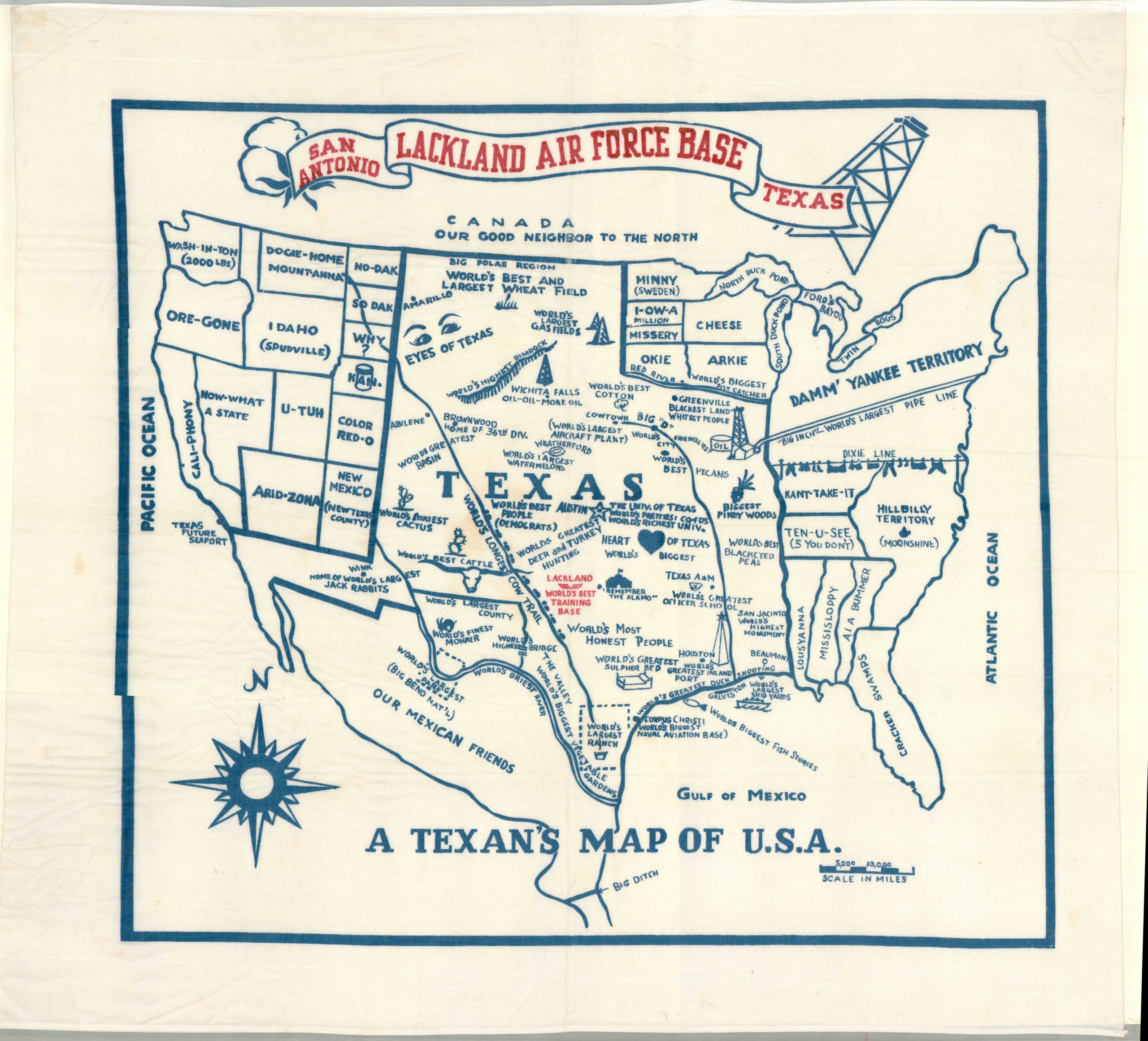
Everything is bigger in Texas! On this map, at least. The borders of the state stretch from the Gulf Coast to Canada and the Pacific on this amusing souvenir textile – possibly issued as a tablecloth. Many of the world’s biggest ‘things’ can be found within, especially as they relate to the industries of the recently concluded WWII. One unfortunate caption identifies Greenville as having the ‘blackest land’ and ‘whitest people.’ Surrounding states are relegated to regional stereotypes, humorous puns, and laughable geographic misconceptions.
Likely sold as a souvenir on Lackland Air Force Base in San Antonio, Texas around 1948. The same map, created anonymously, has been found in other similar formats, with a different base name stamped at the top. The U.S. Catalog of Copyright Entries attributes the original design to either Max Berger or James Harlan Withers.
Map Details
Publication Date: c. 1948
Author: Anonymous
Sheet Width (in): 35.5
Sheet Height (in): 33.5
Condition: A
Condition Description: Two-color printed map on white linen with hemmed edges. Lightly creased and wrinkled, with one or two tiny scattered spots. Very good to near fine condition overall
$200.00
1 in stock