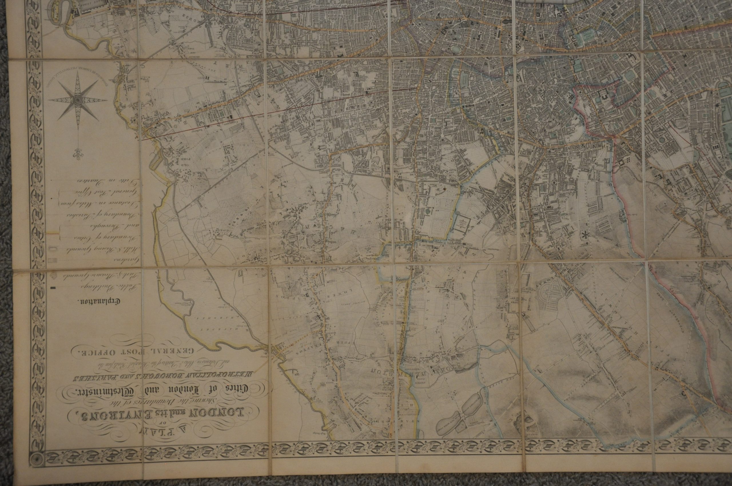
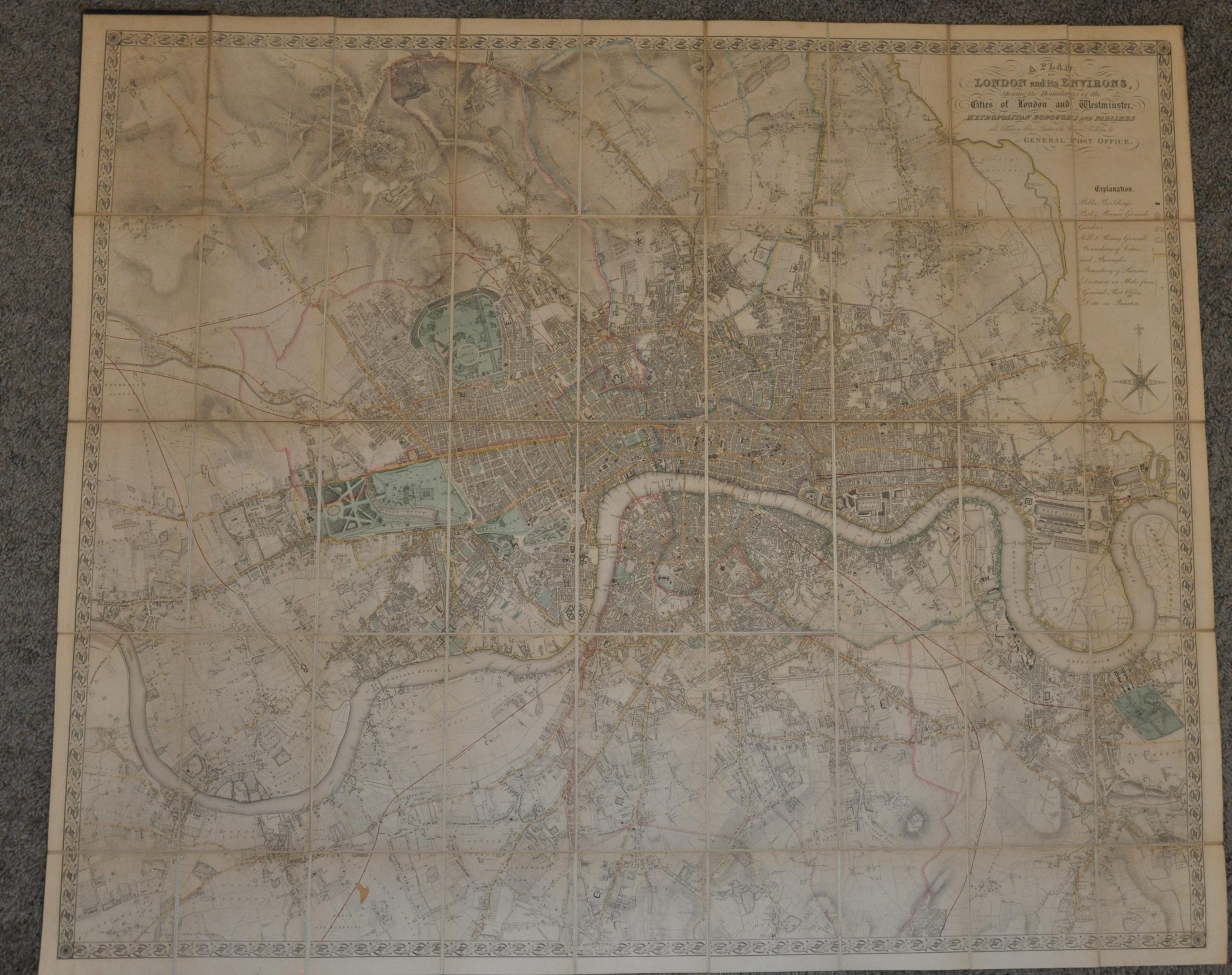
A Plan of London and its Environs, Showing the Boundaries of the Cities of London and Westminster…
An uncommon edition of John Dower’s detailed map of Victorian London.
Out of stock

Description
The spectacular map of London and the surrounding area presents the metropolis between the massive dockyard facilities on the Isle of Dogs and the eastern suburb of Hammersmith. The image contextualizes the intimate relationship that London (then rapidly expanding) had with the adjacent countryside, where the farms grew necessary foodstuffs for the growing population. The large scale allows for the presentation of a fascinating variety of features – important buildings, public squares, landmarks, and local industries can be seen throughout. Locations like the Infant Poor House contrast sharply with lavish buildings like the Royal Exchange, highlighting the class distinctions that would come to define the Victorian Era.
Topography and the physical landscape are also effectively presented through skillfully engraved hachures and pictorial elements. The Thames River, one of the city’s most important avenues of transportation, bisects the image through the middle of the sheet. Only a handful of bridges cross the critical waterway, though the Thames Tunnel (about to open for public use) is also labeled. Railway fever had also gripped Britain by this time, and several operational lines are shown in bright red.
The map has been previously, and apparently erroneously, identified as the second state of a map originally published around 1840 by Samuel Lewis. However, the lack of the publisher information below the title and the absence of features like Victoria Park (referenced in Howgego as an indicator) lead me to believe this is a different state, engraved and published by John Dower around 1842, based on the presence of Pentonville Prison (completed that year).
Source: National Library of Australia;
Map Details
Publication Date: c. 1840
Author: John Dower
Sheet Width (in): 42.25
Sheet Height (in): 38
Condition: A-
Condition Description: Finely engraved sheet dissected into 45 segments, mounted onto linen, and affixed to original stiff black boards (heavily worn). The front cover has separated, but is present, while the back cover remains affixed to the map in the upper left corner. Original hand color. Moderate toning visible along the seams and light scattered surface soiling. Very good condition overall.
Out of stock