
A Pictorial Map of Palo Alto and the San Francisco Peninsula
$545.00
“Palo Alto – Ultra Modern City with Romantic Spanish Heritage.”
1 in stock
Description
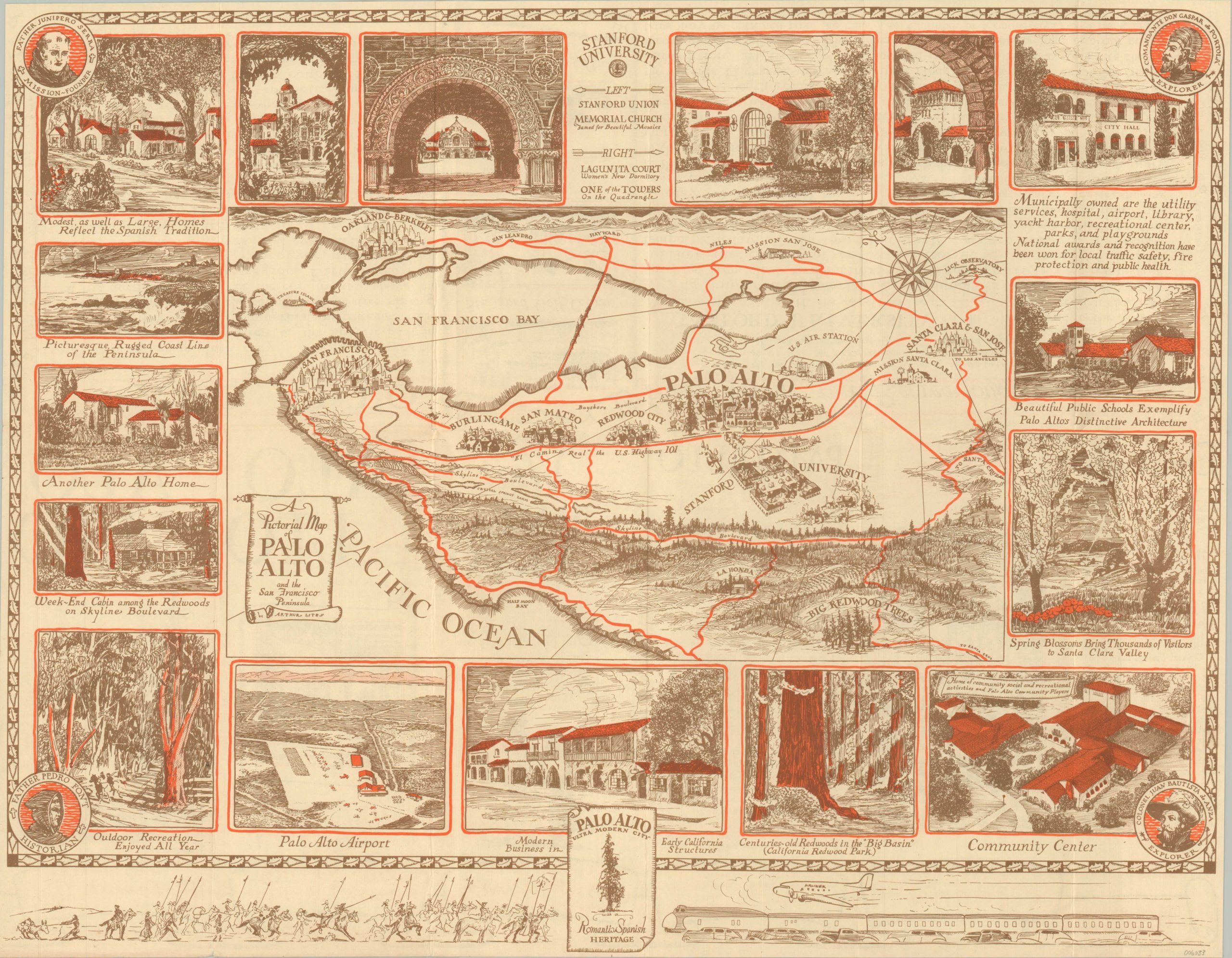
This beautiful compilation showcasing Palo Alto, California and the surrounding area was authored by Arthur Lites and published by the local Chamber of Commerce in 1939. That same year, nearby San Francisco hosted a World’s Fair on Treasure Island, and it’s likely the promotional brochure was issued in conjunction with the event to draw attention to the suburb.
A central pictorial map presents the San Francisco Peninsula, with bright red automobile routes connecting the (relatively) small towns of the region. Idyllic illustrated scenes in the border highlight local amenities, outdoor beauty, and several buildings from Stanford University.
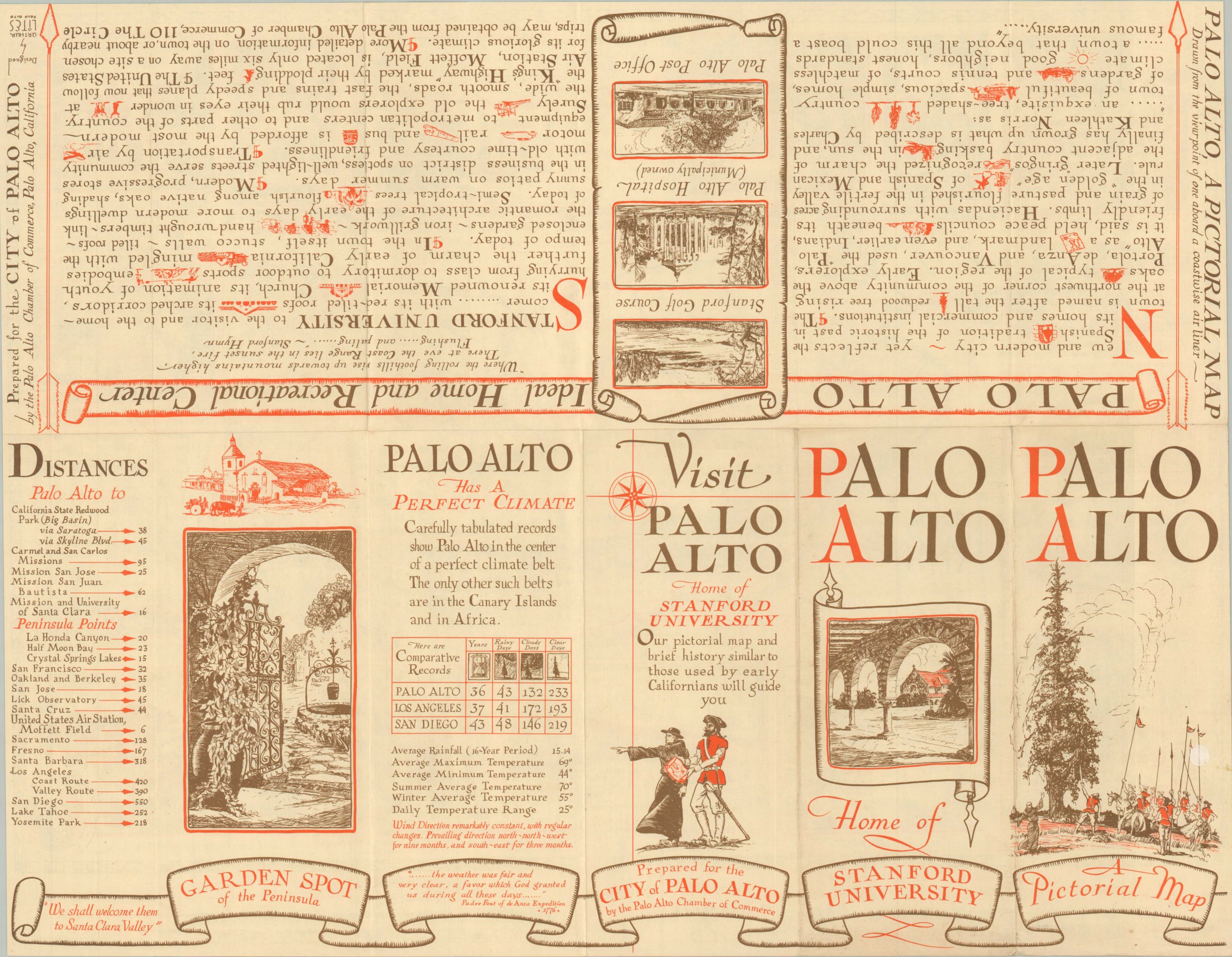
The motif of ‘old and new’ is shown throughout, with a parade of conquistadors facing off against sleek modern transport at the bottom of the page. The theme is continued on the verso, which offers a descriptive history and facts and figures for the ‘Garden Spot of the Peninsula.’
Map Details
Publication Date: 1939
Author: Arthur Lites
Sheet Width (in): 22
Sheet Height (in): 17
Condition: A-
Condition Description: Creasing and light wear along former fold lines and along the bottom edge of the sheet. A few tiny tears and wrinkles in the lower left corner. Very good condition overall.
$545.00
1 in stock