A Pictorial Map of Manhattan
$75.00
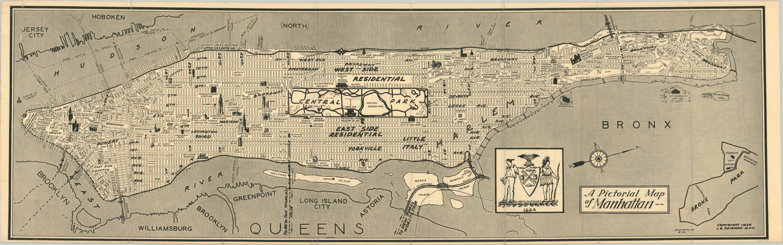
Pictorial map of New York City published for the 1939 World’s Fair.
1 in stock
Description
This stylized map of New York City focuses on the island of Manhattan, with a simple street grid base map overlaid with charming text and small illustrated vignettes. Major attractions, primary transportation routes, and neighborhoods are labeled individually within the image, which also includes an assortment of locations of interest from the adjacent boroughs.
The verso of the sheet shows three small scale maps of the city, each highlighting a different method of transportation. The BMT Lines, Interborough Rapid Transit Company, and Independent City Owned Rapid Transit Railroad are all depicted, each offering a different way to access the grounds of the 1939 World’s Fair, which was held in Queens.
Designed by A. Linn and copyright by I.S. Seidman. Likely originally published in a contemporary guidebook to the fair.
Map Details
Publication Date: 1939
Author: I.S. Seidman
Sheet Width (in): 29.75
Sheet Height (in): 9.25
Condition: A-
Condition Description: Moderate creasing along numerous vertical fold lines and a bit of wear in the margins. One small tear in the upper right corner has been repaired on the verso with archival tape.
$75.00
1 in stock