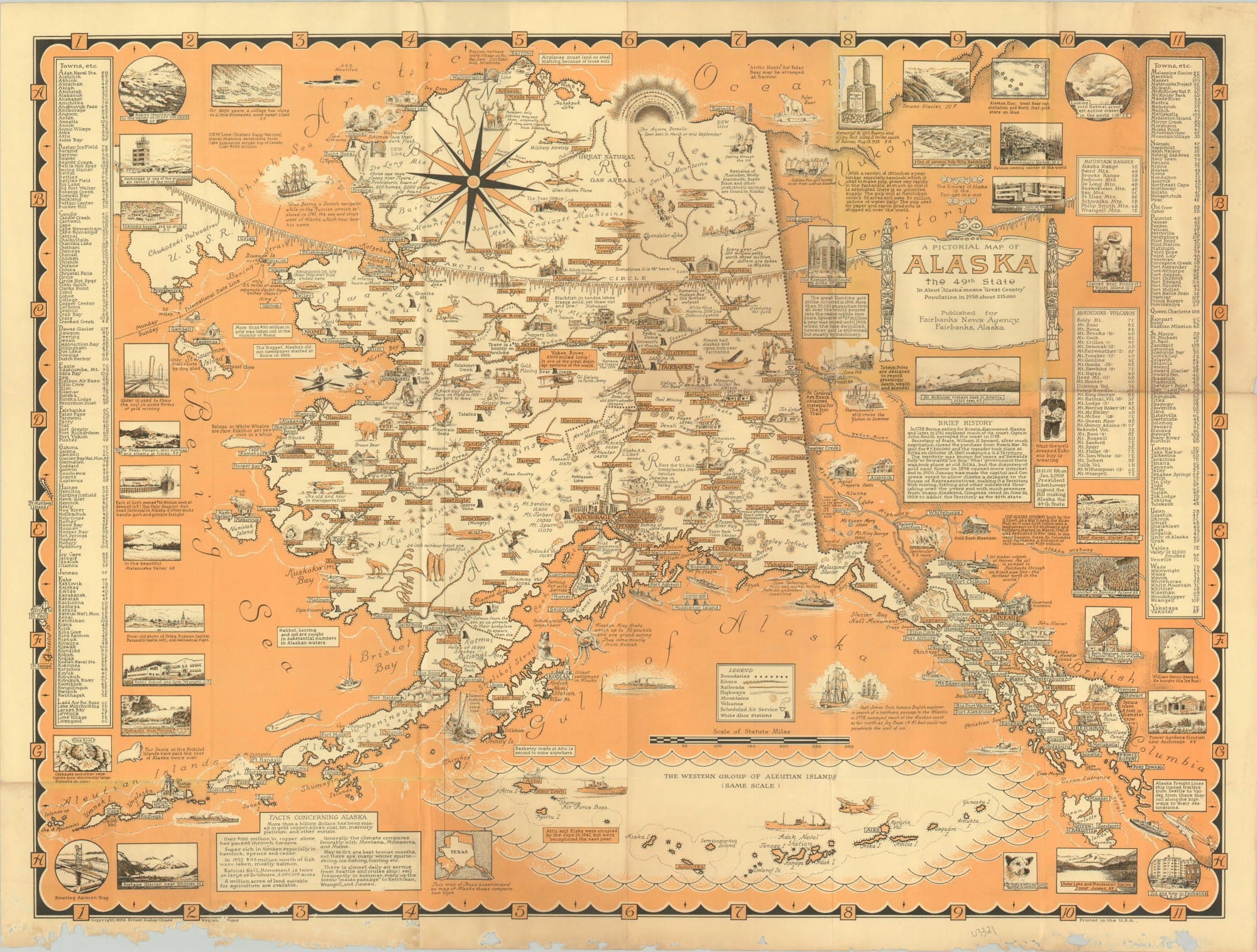
A Pictorial Map of Alaska the 49th State
$275.00
Pictorial celebration of “The Last Frontier.”
1 in stock
Description
This lively pictorial map of Alaska was originally designed, drawn, and published by Ernest Dudley Chase in 1959 to celebrate its admission as the 49th state of the Union. It was issued on behalf of the Fairbanks News Agency in Fairbanks, Alaska, and is the first of two editions (the second was issued in 1965).
The image remains the same as the earlier version (with the exception of adding a third color, red) and presents a vibrant overview of Alaska’s history, industry, geography, and indigenous culture. Vignettes dotted throughout the map highlight wildlife, recreation, and locations of interest while surrounding illustrations highlight much of the same. Transportation routes, volcanoes, and mountains are noted according to the legend directly above the inset map of the Aleutian Islands.
An engaging map by one of America’s foremost mid-20th century pictorial cartographers.
Map Details
Publication Date: 1959
Author: Ernest Dudley Chase
Sheet Width (in): 28.60
Sheet Height (in): 21.8
Condition: B
Condition Description: Heavy worming across the bottom of the sheet has resulted in significant paper loss in the lower margin. Several other areas are affected across the image, most evident along fold lines and in the center left. A bit of light discoloration is also present along the former creases and in the upper right corner.
$275.00
1 in stock

