
A Pic-Tour Map of Sequoia National Park and Kings Canyon National Park
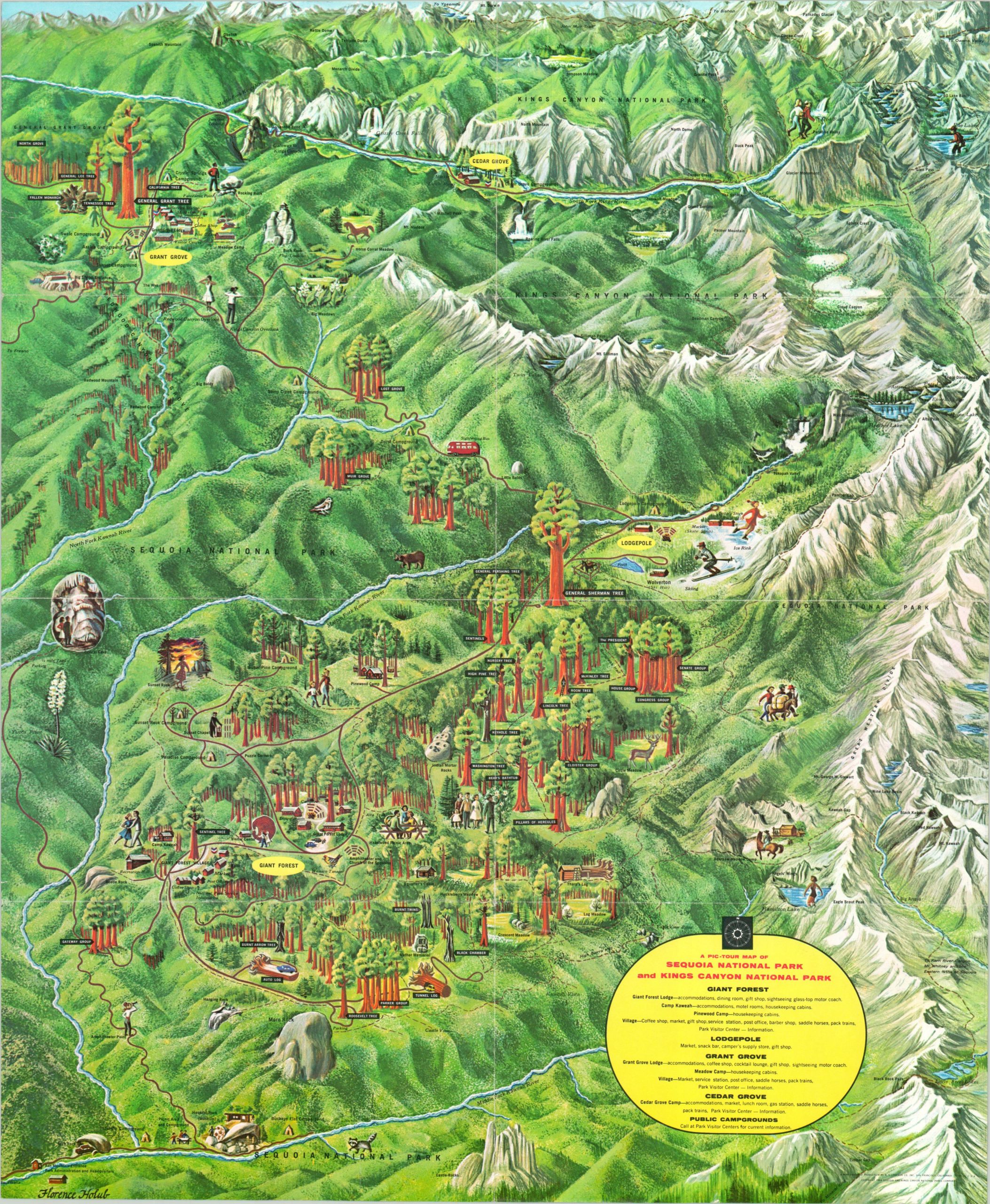
Rare pictorial map of Sequoia and Kings Canyon National Parks.
Out of stock
Description
This eye-catching pictorial map captures the beauty and awe of Sequoia and Kings Canyon National Parks in northern California. Technically two parks that have been jointly administered since 1943, Kings Canyon and Sequoia are located adjacent to the Sierra Nevada Mountain Range and are known for their towering redwood trees, diverse wildlife, and stunning vistas. Various locations of interest are illustrated and labeled throughout the image, including the General Sherman Tree, Tunnel Log, and Moro Rock.
The map was illustrated by Florence Holub and published in San Francisco in 1964 by H.S. Crocker Co. Inc on behalf of the Sequoia and Kings Canyon National Park Company. One of several vibrant Pic-Tour maps issued by the Crocker Company, this is one of two that was designed by the talented Mrs. Holub, the other covering Grand Teton National Park in Wyoming. Both are scarce, with the latter recording only one entry in WorldCat at the Colorado School of Mines. There are no entries for the King’s Canyon/Sequoia map, and I’ve only been able to find one other example for sale previously.
Map Details
Publication Date: 1964
Author: Florence Holub
Sheet Width (in): 17.10
Sheet Height (in): 21.40
Condition: A-
Condition Description: Creasing and moderate wear along former fold lines, including about an inch of separation that's been repaired on the left side with archival tape. Small pinholes at fold intersections and a few small spots of wear along the outer edges. Remains in very good condition despite the few minor flaws.
Out of stock