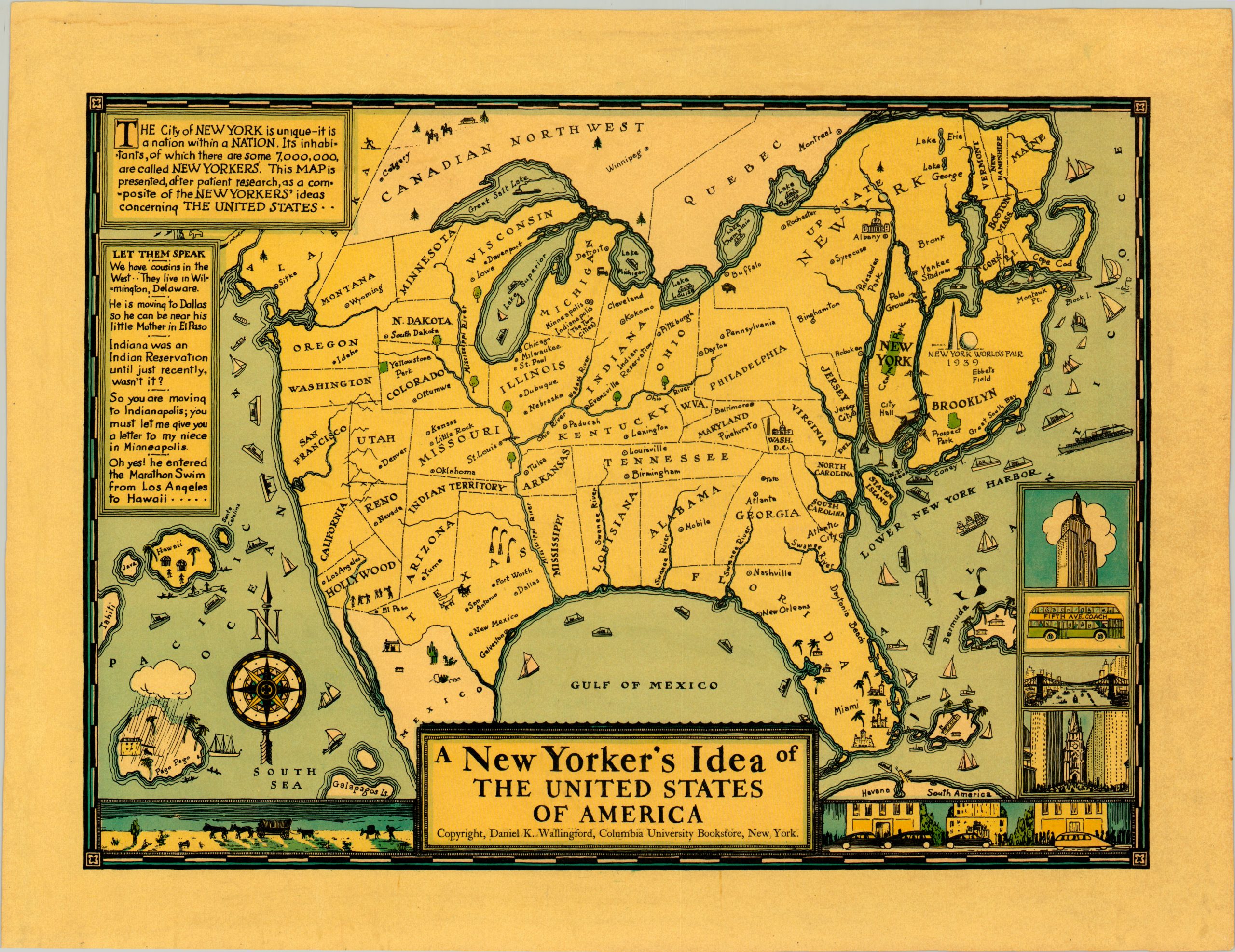
A New Yorker’s Idea of the United States of America
The 1939 World’s Fair edition of Wallingford’s satirical map of the United States.
Out of stock
Description
Showing the perspective of an eponymous New Yorker, this map pokes fun at regional stereotypes throughout the United States. “Patiently researched,” this map allegedly represents “a composite of the New Yorkers’ ideas concerning the United States.” If nothing else, the map is a comedic reflection on the city’s abysmal collective geographic knowledge!
As “a nation within a nation,” New York City gets its just dues on this image, where it’s pictured taking up a significant percentage of New England’s landmass, equitable in size to Texas! Other humorous aspects satirizing the superiority of New Yorkers can also be seen – including technological juxtaposition between urban and rural environments on the bottom and indifference to geological realities in fictional conversation on the left.
Daniel K. Wallingford drew and self-published this map, along with a similar image showing the Bostonian’s Idea of the United States, in several versions during the 1930’s. This particular example was issued in 1939 to coincide with the New York World’s Fair that took place that year.
Map Details
Publication Date: 1939
Author: Daniel Wallingford
Sheet Width (in): 18.5
Sheet Height (in): 14.1
Condition: A
Condition Description: Slightly uneven margins that show scattered discoloration from old adhesive residue on the verso (professionally cleaned). Very good to near fine condition overall.
Out of stock

