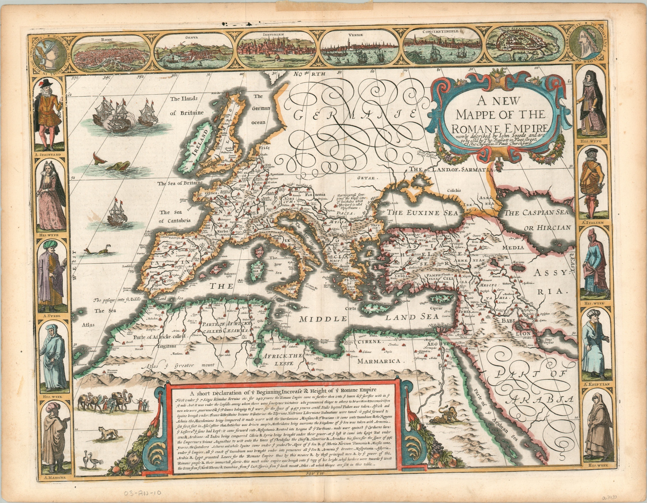
A New Mappe of the Romane Empire
$1,950.00
Stunning example of Speed’s map of the Roman Empire during the Pax Romana.
1 in stock
Description
This jaw-dropping map of the Mediterranean Sea and surrounding coastline is a visual celebration of the former glory of the Roman Empire. The boundaries of the ancient civilization are shown at the height of its territorial expansion under Emperor Trajan, during the period of unprecedented stability and prosperity known as the Pax Romana. Roman legions were in operation from the British Isles to the Arabian Peninsula, and nearly everywhere in-between. A large block of text near the bottom of the page provides a brief summary of the numerous acquisitions.
The image focuses on the territorial extent of the empire and shows the various provinces under Roman authority. The physiography and toponyms also reflect ancient geography and highlight the extent of Roman settlement across the vast region. Locations of interest include Babylon, Carthage, Londinium, Lutetia (Paris), and Byzantium. Rome, naturally, is depicted as the largest metropolis and its population would have been close to one million in the early second century CE.
Surrounding the map are numerous profiles and city views, constituting a cartographic design style known as cartes-a-figures. Male and female (men and their wives) profiles from various regional groups; Turks, Egyptians, Moroccans, Italians, and Spaniards, are shown on either side of the page. Along the top of the sheet are a group of city views highlighting six prominent cities from across Roman territory; Rome, Geneva, Jerusalem, Venice, Constantinople, and Alexandria. The inclusion of Geneva and Venice reflect their contemporary roles as maritime and mercantile powers, as their importance to the ancient empire was relatively limited.
Further pictorial and decorative elements can be seen across the image. Sea monsters, sailing ships, a merchant caravan, and strapwork cartouches complete the highly aesthetic map, published in London by John Speed in 1676. The map is from the former collection of longtime book and map dealer Harry Stern. The original frame (see photo) is also available.
Map Details
Publication Date: 1676
Author: John Speed
Sheet Width (in): 22.00
Sheet Height (in): 16.75
Condition: A-
Condition Description: A bit of light discoloration and a few small tears can be seen in the outer margin. One piece of archival tape remains affixed to the top of the sheet, where previously matted. A handful of light spots can be seen within the image (see center right), but overall the map remains in very good condition. Attractive hand color on thick watermarked paper with English text on the verso.
$1,950.00
1 in stock


