
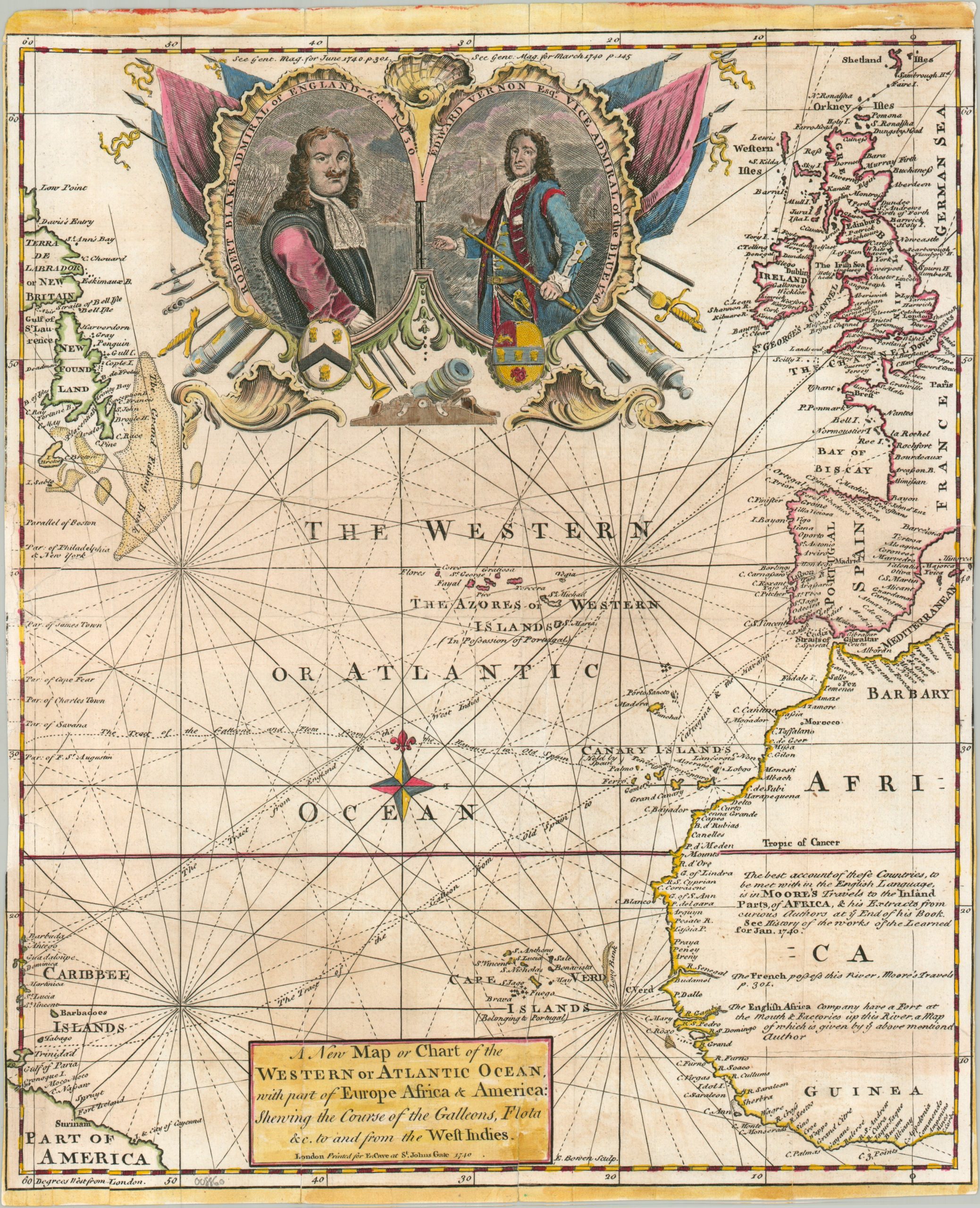
A New Map or Chart of the Western or Atlantic Ocean with part of Europe, Africa & America
$250.00
The Atlantic Ocean during the War of Jenkin’s Ear.
1 in stock
Description
This historically significant chart of the Atlantic basin was engraved by Emanuel Bowen and published in London as a supplement for the June 1740 issue of the Gentleman’s Magazine. The map captures a critical geopolitical moment: the outbreak of the War of Jenkins’ Ear (1739–1748). Sparked by a volatile mix of illicit trade, imperial tension, and the severed ear of a British merchant captain, the conflict shattered the fragile peace between Great Britain and Spain. Bowen’s map served as a practical guide for a British public eager to track naval skirmishes and colonial actions across the Atlantic theater (though much of the action took place in the West Indies, which are omitted).
The map clearly illustrates the maritime lifelines that dictated the flow of wealth, troops, and resources between Europe and the Americas. Bowen outlines the prevailing trade winds and currents, most notably the Gulf Stream, which forced Spanish treasure fleets and British merchantmen into predictable, highly vulnerable shipping lanes. By emphasizing major naval strongholds and privateer hubs from the Caribbean to the European coast, the chart underscores how control over these oceanic highways was vital for imperial power. Portraits near the top depict Admirals Robert Blank and Edward Vernon, both of whom won critical naval victories over the Spanish.
Beyond its immediate military implications, the chart shows the intense colonial competition that defined the mid-18th century. The coastlines of the Atlantic are packed with contested territories, where the overlapping claims of the British, French, Spanish, and Portuguese empires frequently led to frontier conflicts. Bowen’s crisp engraving style epitomizes the golden age of English magazine cartography, a genre that brought reliable geopolitical and hydrographic data directly into the hands of the reading public.
Map Details
Publication Date: 1740
Author: Emanuel Bowen
Sheet Width (in): 11.60
Sheet Height (in): 14.20
Condition: B
Condition Description: Copperplate engraved map extracted from a volume of Gentleman's Magazine. Trimmed margins and moderate toning throughout the sheet, visible in scan. Soft creasing along old folds, with a former split along the center repairs on the verso with archival materials. Heightened with attractive modern hand color. About good condition overall.
$250.00
1 in stock