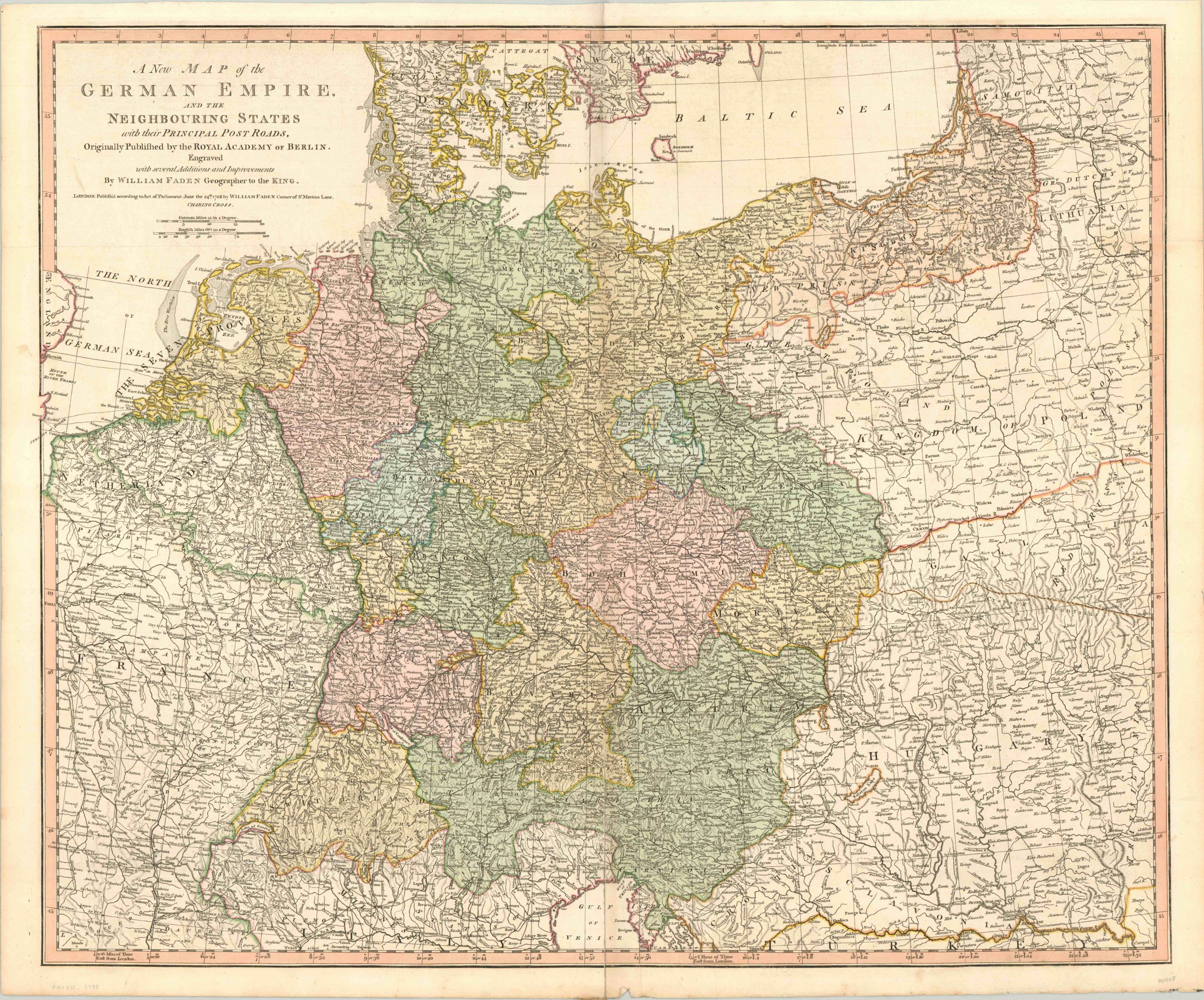
A New Map of the German Empire
$200.00
Late 18th century map of the German Empire, issued about 90 years before unification.
1 in stock
Description
This is an extremely detailed map of central Europe, from the eastern border of France to Poland and the northern reaches of Turkey. It’s focused on the loosely organized states of the German Empire, currently in its ascendancy and led by the powerful military of Prussia.
Each state and its border is hand colored, and the pale orange of the Kingdom of Prussia can be seen expanding in the northeast at the expense of Poland. (Shortly after publication, a second partition would take place and even more territory would be annexed.) The map also identifies the main post roads that serve the region, critical for the transportation of goods, troops, and information. Topography is depicted pictorially, and many natural features are individually labeled.
Published in London by William Faden, Geographer to the King George III, in 1788.
Map Details
Publication Date: 1788
Author: William Faden
Sheet Width (in): 31.5
Sheet Height (in): 26
Condition: B+
Condition Description: Creasing and some separation along centerfold, which has been repaired on the verso. Apart from some minor discoloration in the margins, the map is in excellent shape, with lovely original hand color.
$200.00
1 in stock

