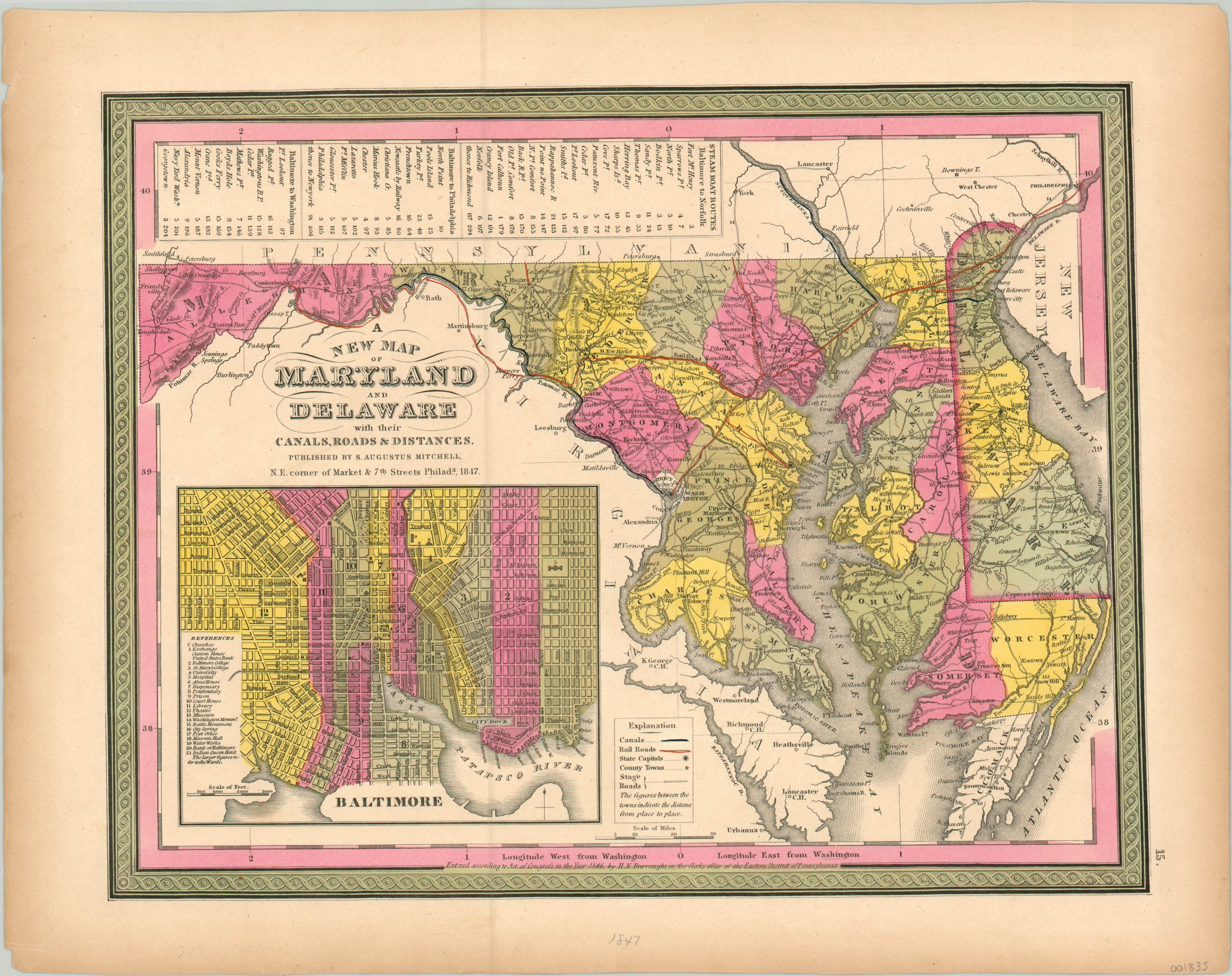
A New Map of Maryland and Delaware
Brightly colored transportation map of Delaware and Maryland from the mid-19th century.
Out of stock
Description
This detailed map of Maryland and Delaware highlights transportation innovations resulting from the Industrial Revolution. Railroads and canals, two primary thoroughfares for goods and people, are highlighted in orange and blue, respectively.
Stage roads are also shown, with distances between various points noted in many instances. A table at the top of the sheet lists three steamboat route itineraries from Baltimore to Norfolk, Philadelphia, and Washington.
An inset plan of the capital city is shown in the lower left, with churches and twenty-one buildings of interest located therein. The map was published in Philadelphia by Samuel Augustus Mitchell in 1847.
Map Details
Publication Date: 1847
Author: Samuel Augustus Mitchell
Sheet Width (in): 17.00
Sheet Height (in): 13.50
Condition: A
Condition Description: The outer margins are slightly toned, consistent with age, but otherwise the map is in fine condition with original hand color.
Out of stock

