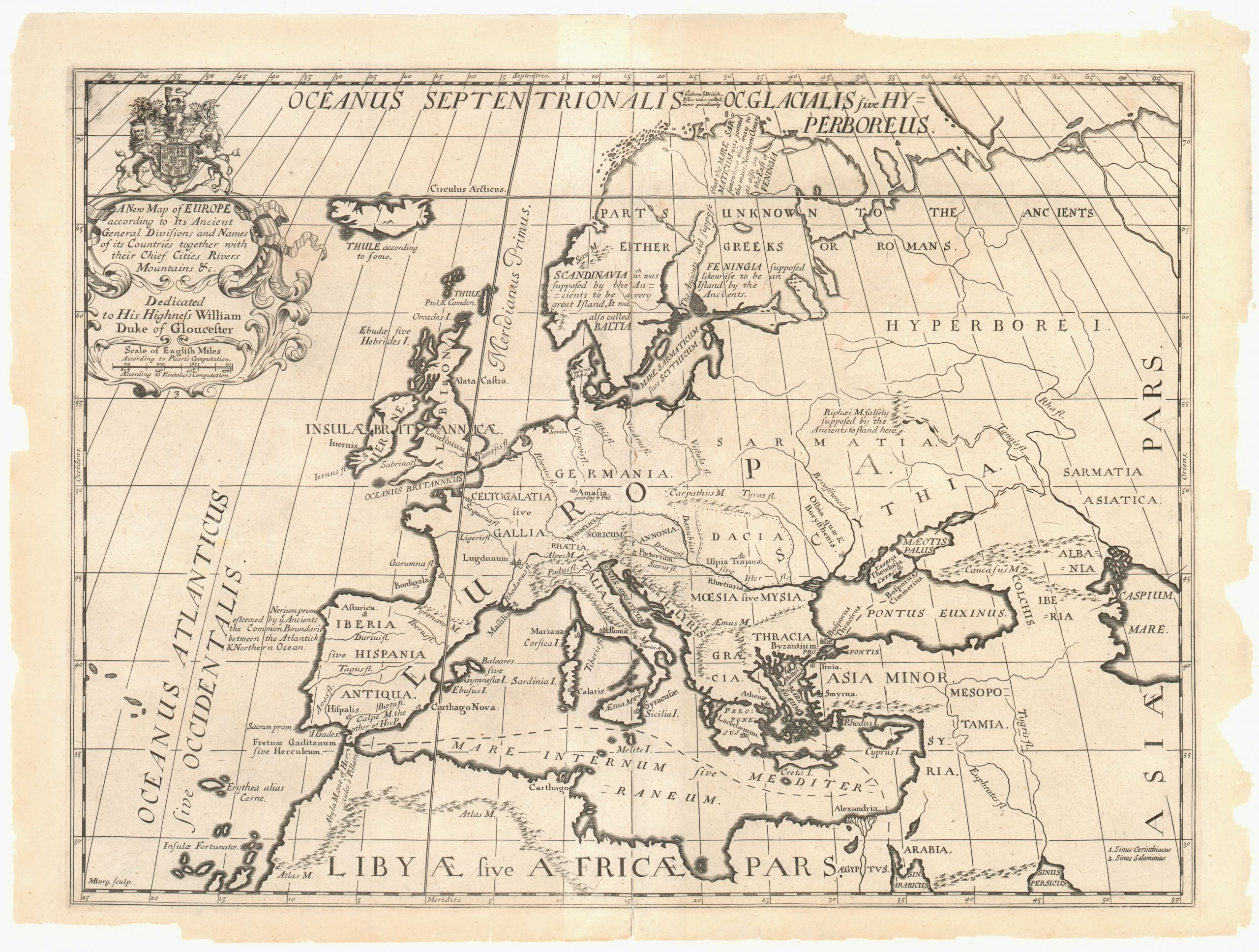
A New Map of Europe According to its Ancient General Divisions and Names
A map of Europe as known to the ancients, issued in the early 18th century.
Out of stock
Description
This map of Europe shows a roughly modern continental outline with the geographic place names and contextual annotations related to ancient kingdoms. Mt. Vesuvius, Carthage, and the mythical Roman island of Thule all make an appearance alongside numerous other historic regions, tribes, and cities. Interestingly, the Prime Meridian is still given as traveling through London (Londinium), though most ancient geographers used the Fortunate (Cape Verde) islands. Features a highly embellished rococo cartouche with the coat of arms of the Duke of Gloucester.
The map was issued by Edward Wells in A new sett of maps both of antient and present geography. This atlas contained 41 double page maps, most of which were issued in two forms to compare the ancient and present geography of various regions across the globe. The atlas was dedicated to William, Duke of Gloucester, a former pupil of Well’s at Oxford who died in 1700 at the age of eleven.
Map Details
Publication Date: c. 1710
Author: Edward Wells
Sheet Width (in): 21.50
Sheet Height (in): 16.00
Condition: A-
Condition Description: Moderate wear to the outer margins, including several areas where the sheet is missing or chipped, but this does not affect the image or border. One area where the ink has smudged in the upper right corner, otherwise the sheet is clean with a bold impression. Professionally washed and mounted on linen.
Out of stock