A New Color Map of the Western Front Showing the Famous Maginot and Siegfried Lines
$95.00
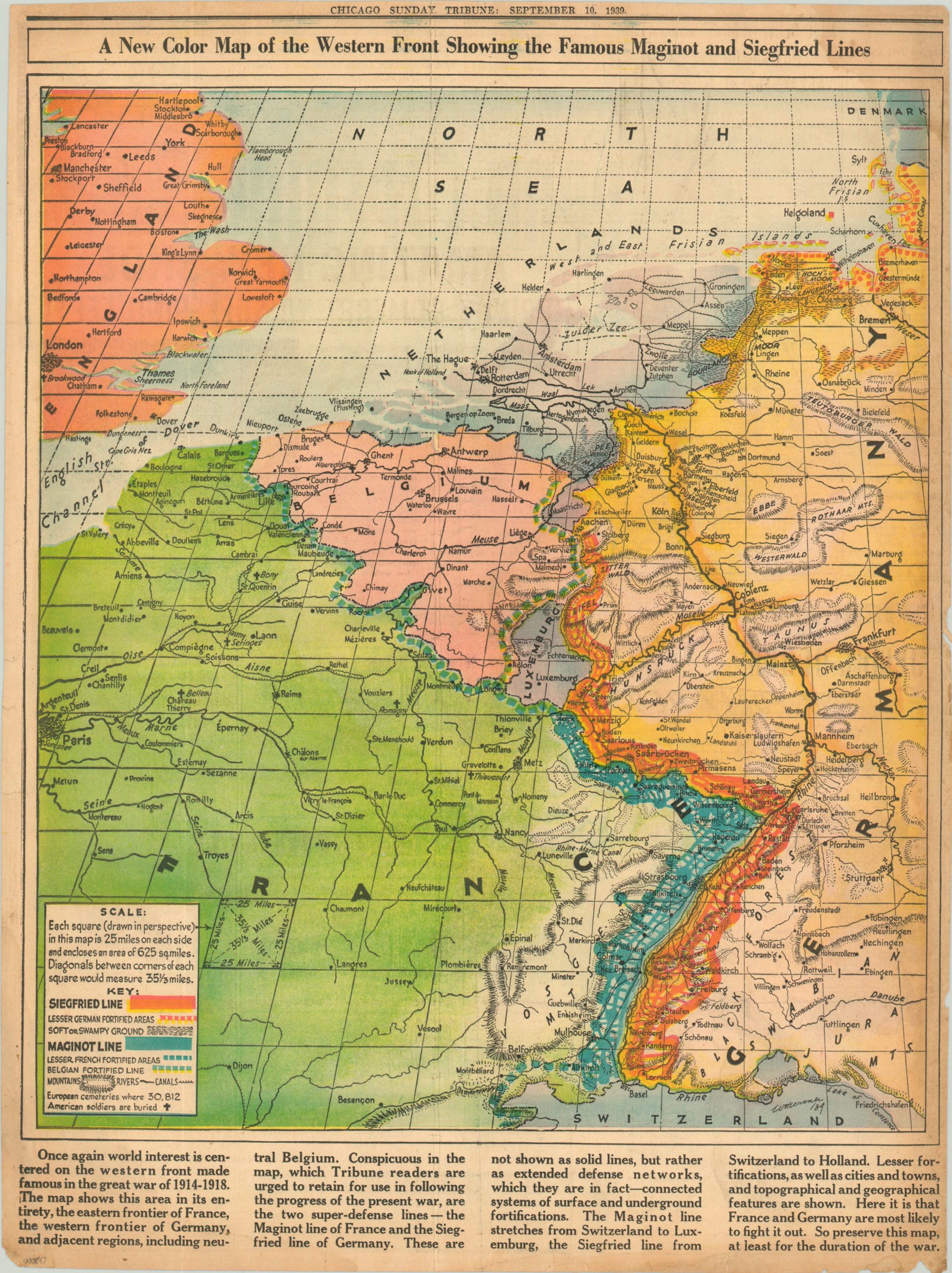
A map of the Western Front published less than two weeks after Germany invaded Poland.
Description
When war officially broke out on September 1, 1939, many in the United States still hoped it would be a largely regional affair. This perhaps explains the somewhat indifferent tone in the text accompanying this map of the Western Front, issued in the September 10th edition of the Chicago Sunday Tribune.
The map attempts to explain the complex system of massive fortifications along the border between Germany and France. The Maginot Line, running through French territory from Switzerland to Luxembourg, is shown in blue; while the German network known as the Siegfried Line is depicted in orange. While the map accurately portrays the immensity of these defensive emplacements, the notion that “here it is that France and Germany are most likely to fight it out” somewhat missed the mark. The Germans, aware of the incredible advantage enjoyed by French defenders, would circumvent the Maginot Line entirely in their invasion plans.
The legend also identifies, quite specifically, “European cemeteries where 30,812 American soldiers are buried.” The awareness of similarities with the Great War was not lost on contemporary audiences in the United States, and fear of being involved in “another war in Europe” pushed many to oppose any form of U.S. intervention.
Map Details
Publication Date: 1939
Author: W Huersner?
Sheet Width (in): 16.70
Sheet Height (in): 22.50
Condition: B
Condition Description: Moderate discoloration along the outer edges, along with some small tears and chips. A faint damp stain in the upper right corner, but still good to very good overall.
$95.00