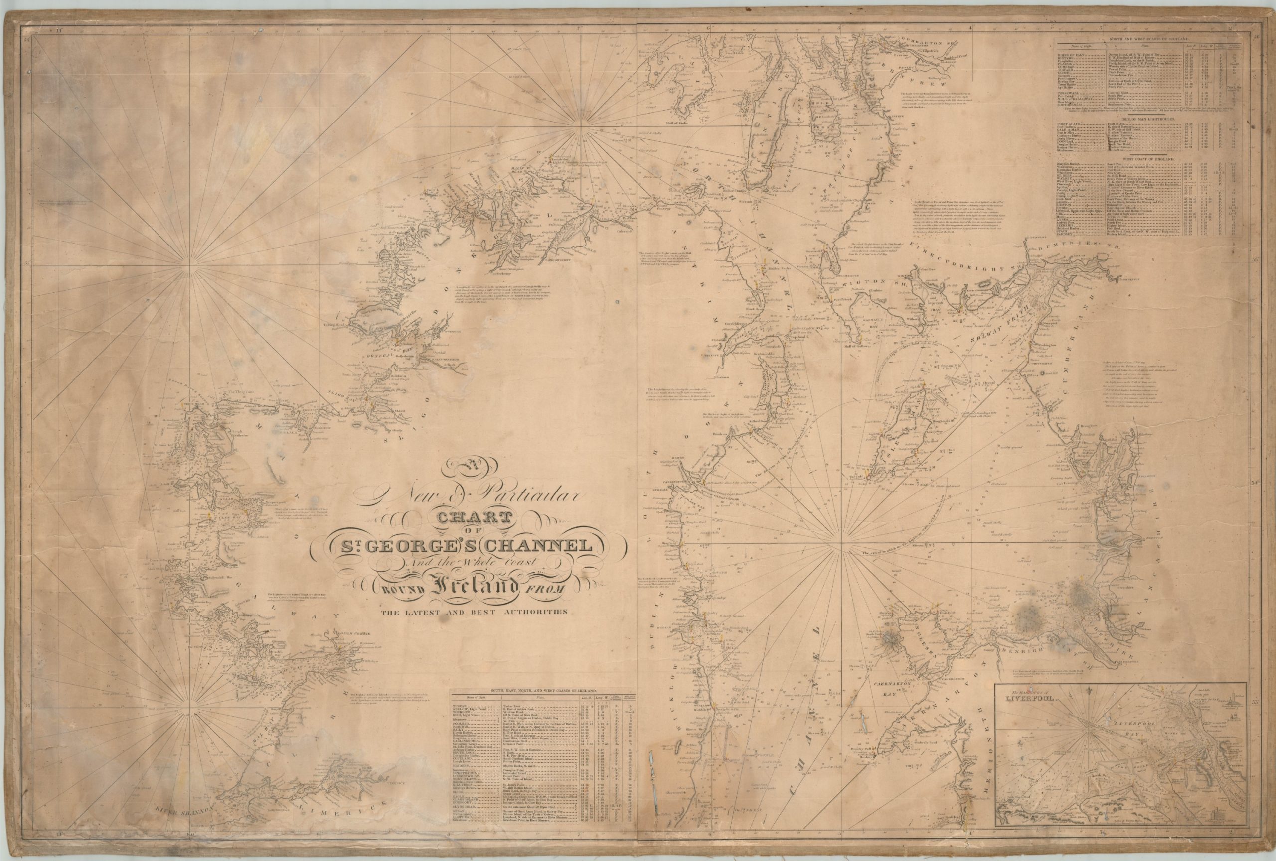
A New and Particular Chart of St. George’s Channel and the Whole Coast Round Ireland…
$750.00
Rare, possibly unrecorded, blueback chart of St. George’s Channel between Ireland and Britain.
1 in stock
Description
One can almost hear the breakers and smell the spray when looking at this blueback chart of St. George’s Channel, or the northern portion of the Irish Sea between Ireland and the United Kingdom. Called as such because of the blue paper used to reinforce the sheet, bluebacks were commercially published nautical charts that became popular for navigation in the early 19th century, primarily in England. Notable publishers include James Imray, Robert Blachford, John Norie, and eventually the British Hydrographic Office, though this example is undated and uncredited.
With a seafaring audience in mind, the map presents a wealth of information necessary for maritime travel. Depth soundings, floor composition, navigational hazards, coastal features, currents, settlements, geographic features, and other details are presented throughout the image. Rhumb lines, used as navigational aids when taking compass bearings, crisscross the Channel and North Atlantic while an inset plan in the lower right presents the harbors of Liverpool – an important shipping center.
Perhaps no information was as vital as the location of the various lighthouses, lightships, and guide buoys posted along the coast. They are brightly highlighted in orange and yellow, while accompanying tables list their names, locations, type, and effective distance. These tables have been cut out and pasted down onto the sheet, indicating they replaced older, outdated data and provide some of the most useful indicators on approximate age (apart from the handful of dated annotations within the image). The Arklow Bank lightship was first launched in 1825, offering the latest date I can independently confirm.
Source: Lightships off the Irish Coast.
Map Details
Publication Date: c. 1825
Author: Robert Blachford?
Sheet Width (in): 50.5
Sheet Height (in): 35
Condition: B
Condition Description: Well-used blueback chart mounted on original backing and bordered with a linen strip. Moderate to heavy wear throughout, including soiling, several small holes and tears, creasing and wrinkling, and edge wear. Some minor touch-ups have been applied professionally, making for a sheet that displays well and remains in fair to good condition overall.
$750.00
1 in stock

