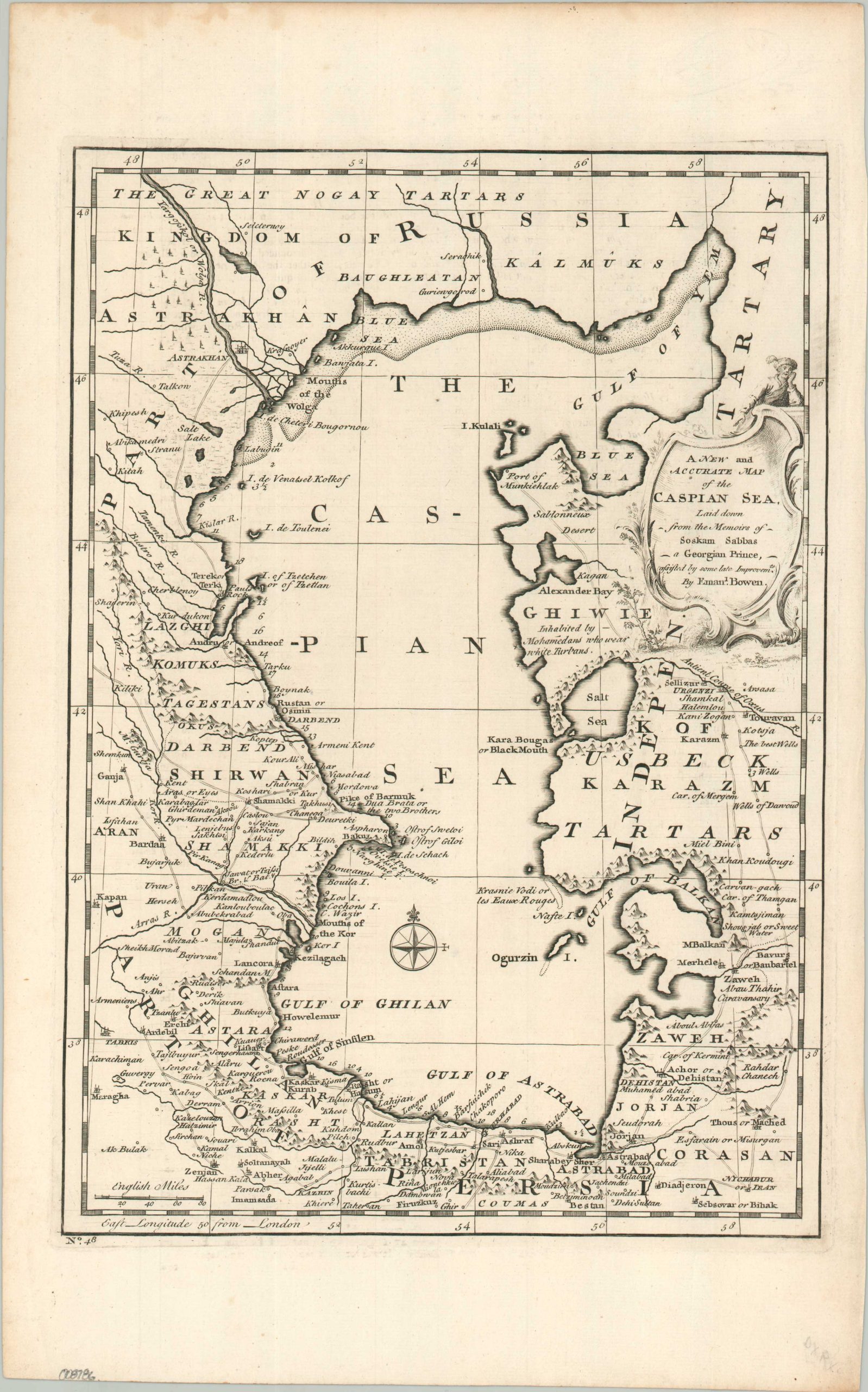
A New and Accurate Map of the Caspian Sea
$200.00
Laid down from the Memoirs of Soskam Sabbas, a Georgian Prince…
1 in stock
Description
This attractive copperplate-engraved map of the Caspian Sea highlights the disparity and contrast between imperial and tribal control during the mid-18th century. Along the western shores, Russian, Ottoman, and Persian authority have led to a well-mapped network of roads and numerous towns, with those settlements along the coast even noting the distances between each. This contrasts sharply with the rugged highlands and sparsely populated eastern coastline, under the contested control of the Turkmen, Uzbeks, Kazakhs, and Kalmuks. Toponyms identify a fascinating variety of commercial entrepots, military outposts, historic sites, and geographic features. Of particular interest are the vital Silk Road hub of Astrakhan, Nader Shah’s naval base at Baku, and the ‘ghost’ city of Urghenzi along the ‘Antient Course of the Oxus.’
The map was originally published in London around 1752 as part of Emanuel Bowen’s A Complete Atlas, or Distinct View of the Known World. Bowen credits Georgian Prince Soskam Sabbas (Sulkhan-Saba Orbeliani) as the primary source in the decorative title cartouche, which reflects the mercantile nature of the region. Sabbas was a high-ranking diplomat of a prestigious family and author of the first comprehensive Georgian dictionary.
Map Details
Publication Date: 1752
Author: Emanuel Bowen
Sheet Width (in): 10.10
Sheet Height (in): 16.10
Condition: A-
Condition Description: A nice dark impression on a sturdy sheet of laid paper. Slightly irregular margins show faint wear and a few small tears, but ovall in very good condition.
$200.00
1 in stock