A New and Accurate Map of Muscovy or Russia in Europe
$185.00
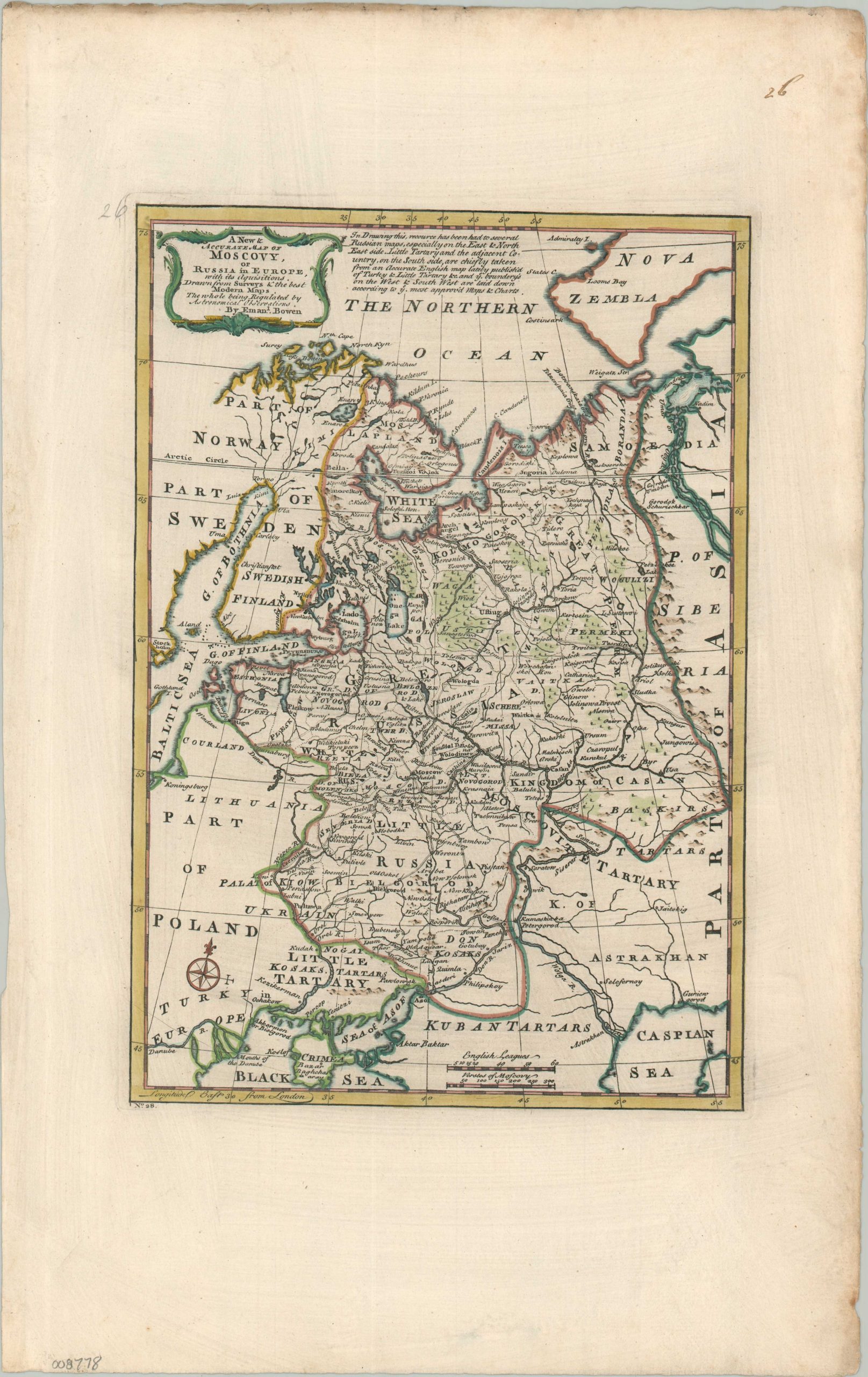
The Russian Empire in Europe during the mid-18th century.
1 in stock
Description
This crisply engraved map of eastern Europe provides a succinct overview of Russia’s territorial gains from the first half of the 18th century. Outlined in red, the empire stretches from the frigid island of Nova Zembla and the Kola Peninsula through the Baltic and down to the coastline of the Sea of Azov. Though it appears just outside the Tsar’s realm, Russia held a demilitarized Azov due to its victory over the Ottoman Empire in 1739.
Gains in Swedish Finland led up to the Kymen (Kymi) River, according to the provisions of the Treaty of Abo that ended the Russo-Swedish War of 1741–1743. The Urals, depicted pictorially, present a formidable physical barrier to the rest of Russia’s empire in Asia. Also of interest is the city of Kiow (Kyiv), opposite the Dnieper River and a Russian possession since the 1686 Treaty of Perpetual Peace with Poland-Lithuania.
The map was published in London by Emanuel Bowen in 1747. It was issued as plate No. 28 in his work, A Complete System of Geography.
Map Details
Publication Date: 1747
Author: Emanuel Bowen
Sheet Width (in): 11.90
Sheet Height (in): 18.90
Condition: A
Condition Description: Crisp copperplate engraving on sturdy laid paper with nice outline color. Some minor marginal wear, including faint toning, a printer's mark in the lower right, and two handwritten page numbers. Very good condition overall.
$185.00
1 in stock