
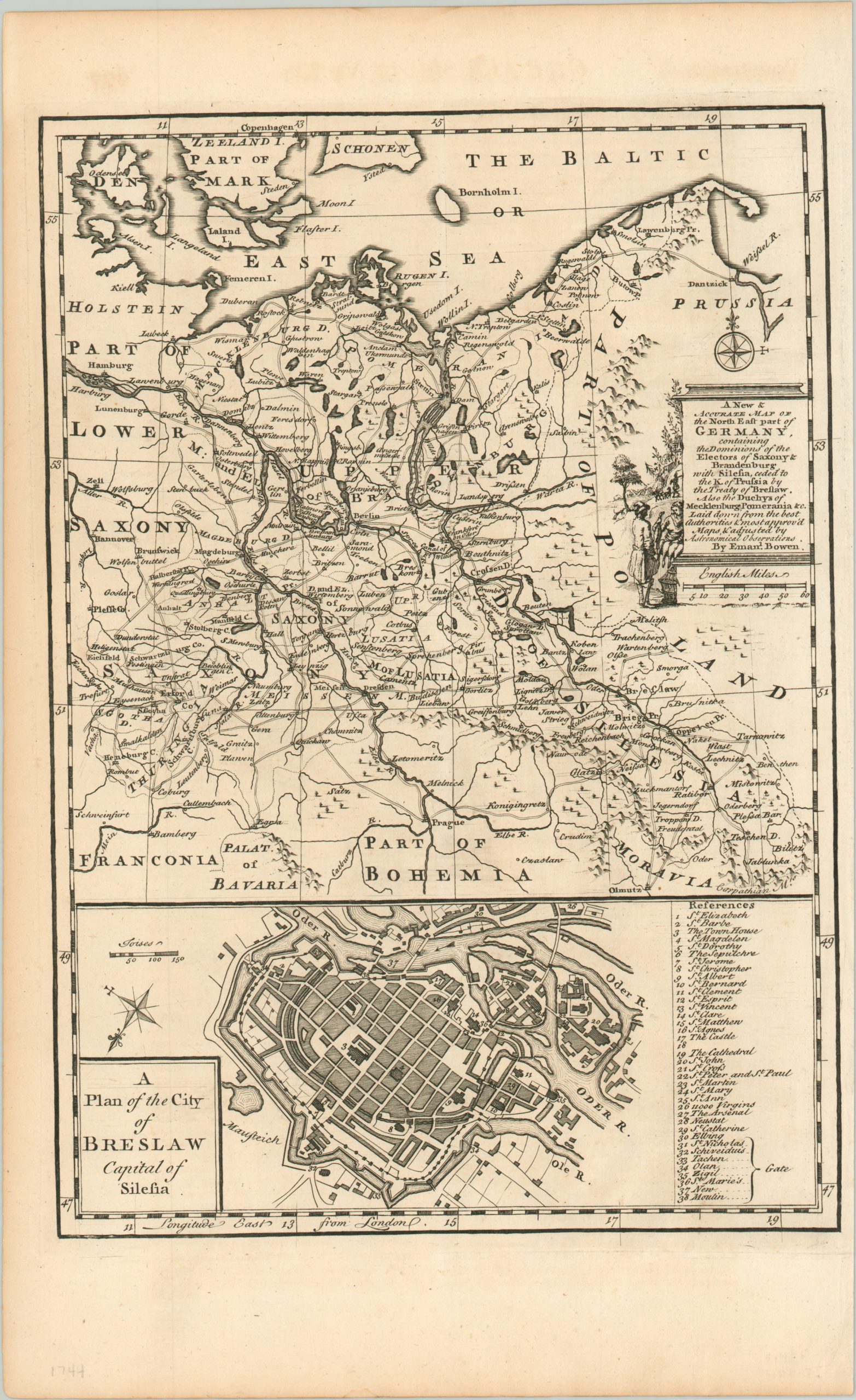
A New & Accurate Map of the North East Part of Germany
$125.00
The theater of conflict in the Second Silesian War.
1 in stock
Description
This detailed copperplate engraved map of a large region in central Europe was engraved by Emanuel Bowen and published in a 1744 edition of London’s Gentleman’s Magazine. It shows the theater of conflict for the Second Silesian War, which erupted between Prussia and Austria shortly before the map was issued.
The image shows the German territories of the Holy Roman Empire between Saxony and Poland, with the contested region of Silesia labeled in the lower right. The area’s abundant natural resources and navigable rivers, two reasons for the series of mid-18th century wars, are emphasized throughout the image.
Immediately below is a plan of Breslaw (Breslau), in modern day Poland. It was here that Empress Maria Theresa of Austria relinquished the territory of Silesia to Frederick the Great two years prior (in 1742), at the end of the First Silesian War.
Map Details
Publication Date: 1744
Author: Emanuel Bowen
Sheet Width (in): 9.5
Sheet Height (in): 15.5
Condition: A
Condition Description: Slightly toned around the outer edges, consistent with age, but otherwise in near fine condition.
$125.00
1 in stock