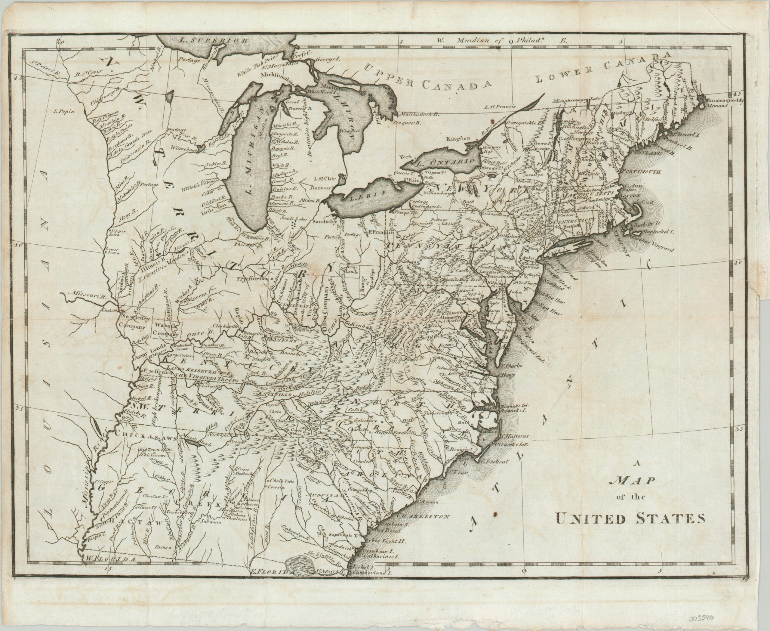
A Map of the United States
An early map of America published in Philadelphia.
Out of stock
Description
Published less than two decades after the signing of the Declaration of Independence, this map captures the gradual development of the United States from a British territory into a fledgling nation. Colonial-era claims of Georgia are shown extending to the Mississippi River. North Carolina, on the other hand, has seceded the western lands that would eventually become Tennessee, labeled here as the Southwest Territory and home to one of the earliest mentions of Nashville on a map printed in America.
Land companies and grants reserved for veterans of the Revolutionary War are outlined across the Northwest Territory and parts of Kentucky. Frontier fortifications, Native American villages, and geographic features are also labeled throughout. A fascinating overview of the U.S. from the late 18th century.
Designed by Joseph Scott and published in Philadelphia by F. & R. Bailey in 1795 as part of The United States Gazetteer: Containing an Authentic Description of the Several States.
Source, Phillips pg. 871
Map Details
Publication Date: 1795
Author: Joseph Scott
Sheet Width (in): 15.10
Sheet Height (in): 12.20
Condition: A-
Condition Description: Two edge tears and a small hole in the center of Ohio have been professionally repaired on the verso. A bit of light discoloration along former fold lines and wear visible in the margins. Very good overall.
Out of stock

