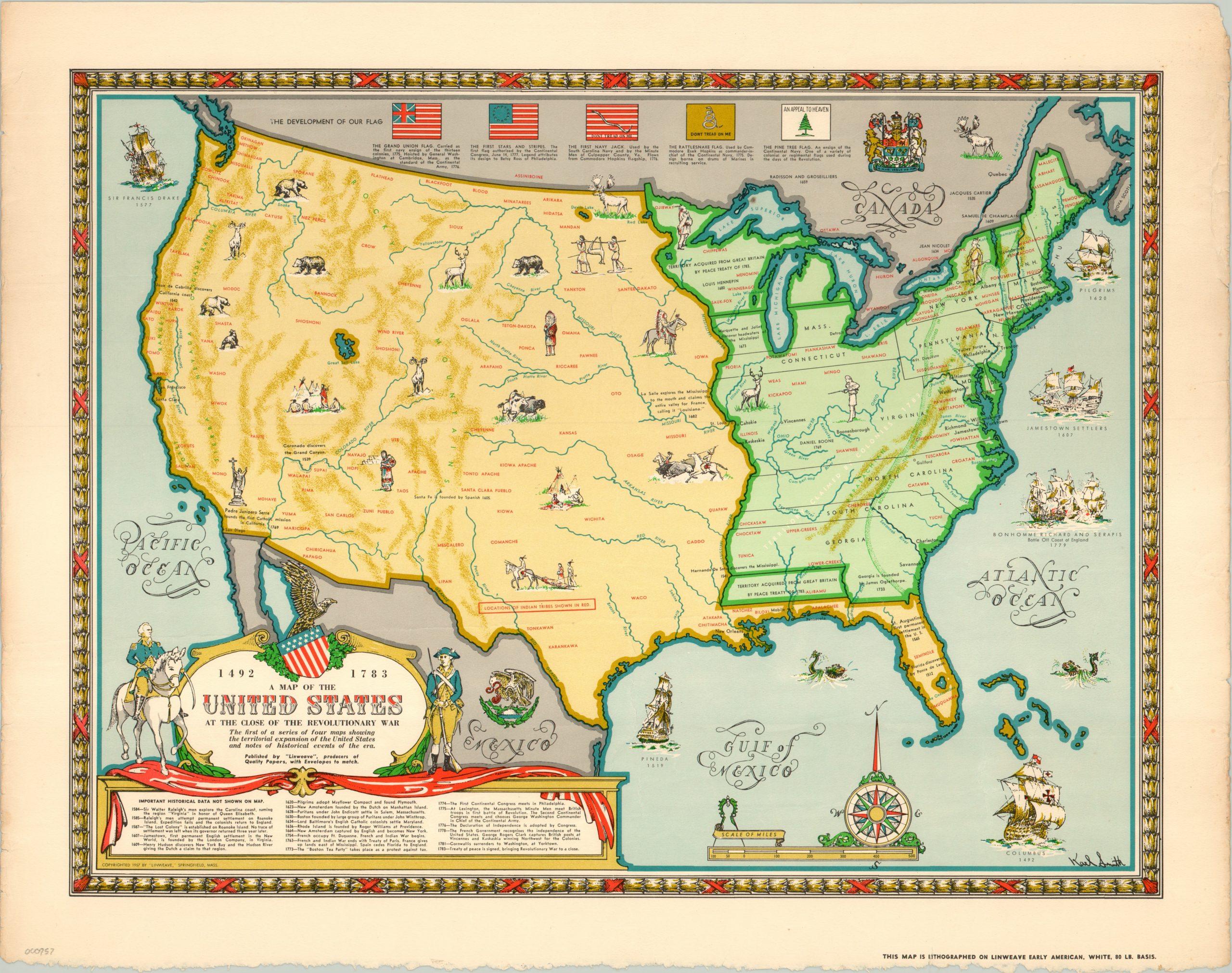
A Map of the United States At the Close of the Revolutionary War
$150.00
The first in a series of four historical pictorial maps by Karl Smith for Linweave.
Description
This colorful map of the United States shows the organization of the country after the Treaty of Paris was signed in 1783 (though it keeps the outline consistent with modern international borders). Small illustrations within the map reflect events and features from the late 18th century, and lean heavily towards the untamed frontier and heavy Native American presence throughout the country. Several naval battles can be seen in the Atlantic and Gulf of Mexico.
Accompanying text list numerous tribes and gives brief historical background on certain areas. Below the decorative title cartouche is a list of important historical data in the development of the United States, from Raleigh’s 1584 exploration of Carolina to Cornwallis surrendering at Yorktown in 1781. A decorative compass rose and scale complete the image.
The map was drawn by Karl Smith and published by Linweave as promotional material for its paper products. Further advertising can be seen in the lower right, which indicates “this map is lithographed on Linweave Early American, White, 80 lb. Basis.” Other maps in the series are printed on slightly different shades or weights, allowing for a physical comparison of the product along with a decorative piece.
Map Details
Publication Date: 1957
Author: Karl Smith
Sheet Width (in): 22.20
Sheet Height (in): 17.50
Condition: A-
Condition Description: Wear and discoloration along the outer edges, including a ragged bottom. A few small crinkles where the map was previously folded. Otherwise the image is crisp and bright on strong paper.
$150.00