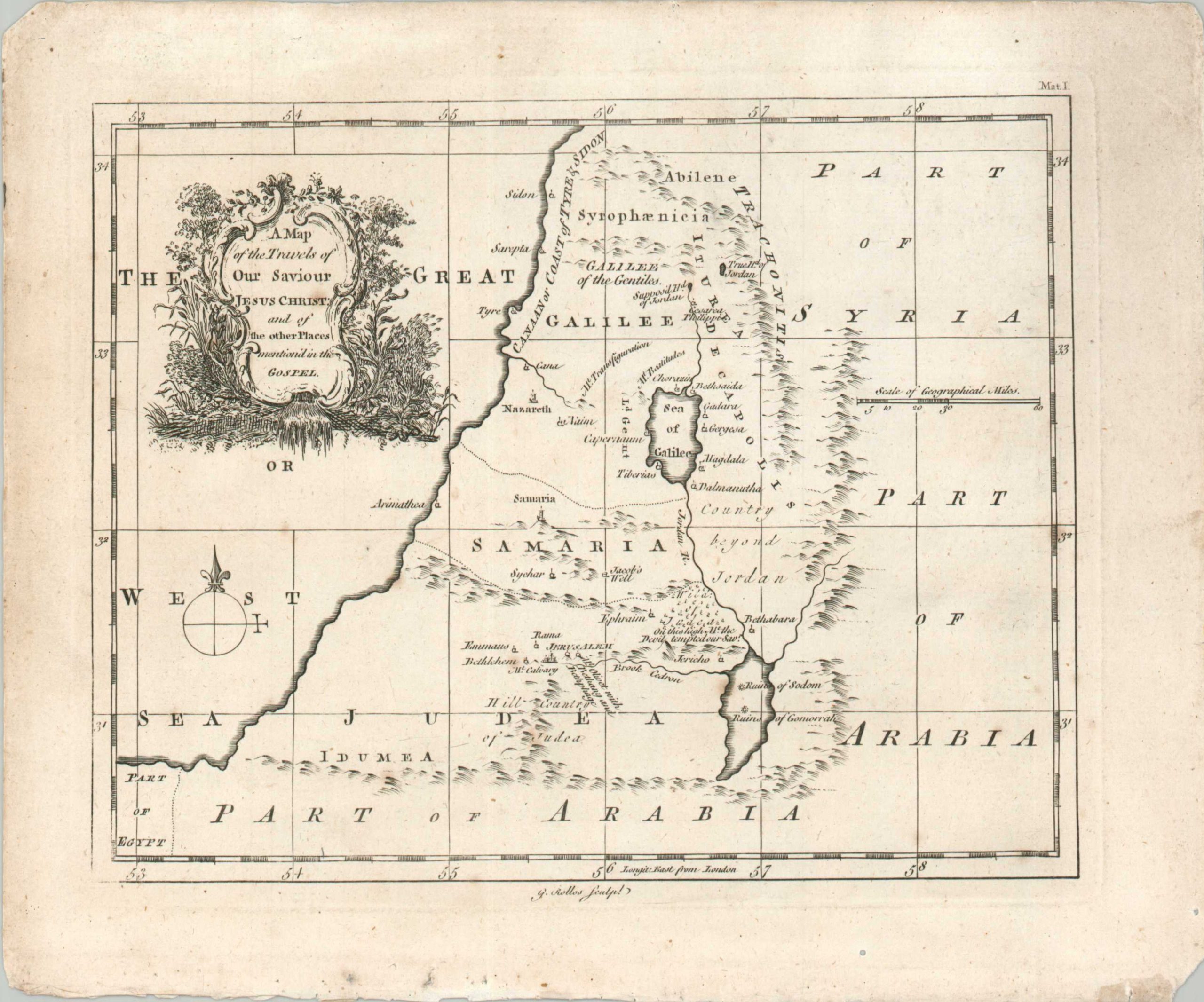
A Map of the Travels of Our Saviour Jesus Christ and of the Places Mentioned in the Gospel
$50.00
A handy Biblical reference map from the late 18th century.
1 in stock
Description
This convenient guide to the Holy Land was engraved by George Rollos and published around 1780 inclusion in a Bible (note the reference to the Book of Matthew, upper right). The simple geography and legible topography make for a useful, if unsophisticated, accompaniment to the religious text. Notable locations include Bethlehem, Jerusalem, Nazareth, Jacob’s Well, the Wilds of Judea, and the ruins of Sodom and Gomorrah.
Map Details
Publication Date: c. 1780
Author: George Rollos
Sheet Width (in): 11.25
Sheet Height (in): 9.25
Condition: B
Condition Description: Copperplate engraved map on a single sided sheet, washed with a ragged lower binding edge. Light scattered foxing, a few tiny holes from worming, and chipped corners. Good condition overall.
$50.00
1 in stock