A Map of the Owasippe Scout Camps and Surrounding Points of Interest
Souvenir map of the oldest Scout Camp in the United States.
Out of stock
Description
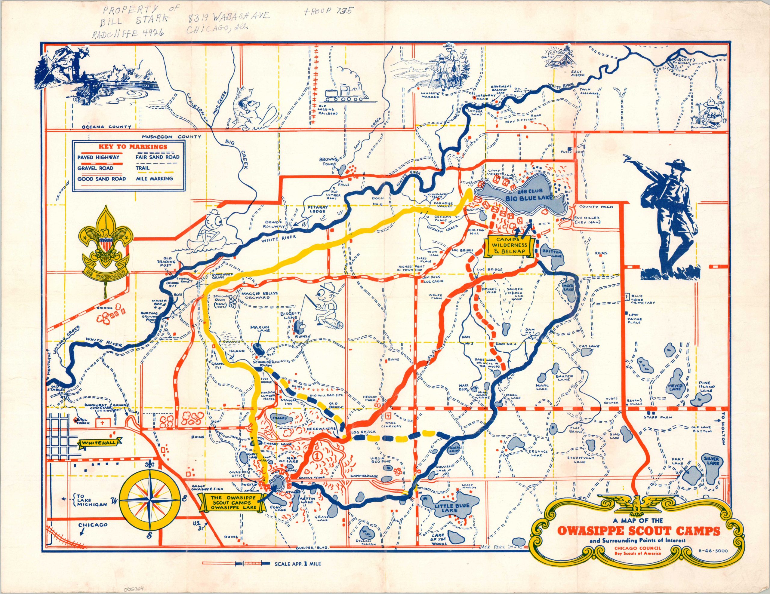
This charming map of the Owasippe Scout Reservation was illustrated by camp veteran Jack Perz and published in 1946 by the Chicago Council of the Boy Scouts of America. Established in 1911, Owasippe is the nation’s oldest continually operating Scout Camp, eventually growing to nearly 11,000 acres (today, it is about 5,000 acres) about 20 minutes north of Muskegon, Michigan.
The image notes the network of roads and trails that crisscross the expansive grounds. Various features (both geographic and manmade) and recreational areas are labeled, including the three subcamps – Belnap, Wilderness, and Owasippe Lake. Illustrated vignettes showcase just a few of the numerous activities available. The nearby town of Whitehall, Michigan is visible in the lower left, along with the rail connection to Chicago.
Example at White Lake Historical Society.
Map Details
Publication Date: 1946
Author: Jack Perz
Sheet Width (in): 21.75
Sheet Height (in): 17
Condition: B+
Condition Description: Three-color printed map on a single-sided sheet of glossy paper. Moderate wear along old fold lines and an old owners inscription (black ink) in the upper margin. Light wear along the outer edges of the sheet. Good condition overall.
Out of stock