A Map of the Empire of Germany
$50.00
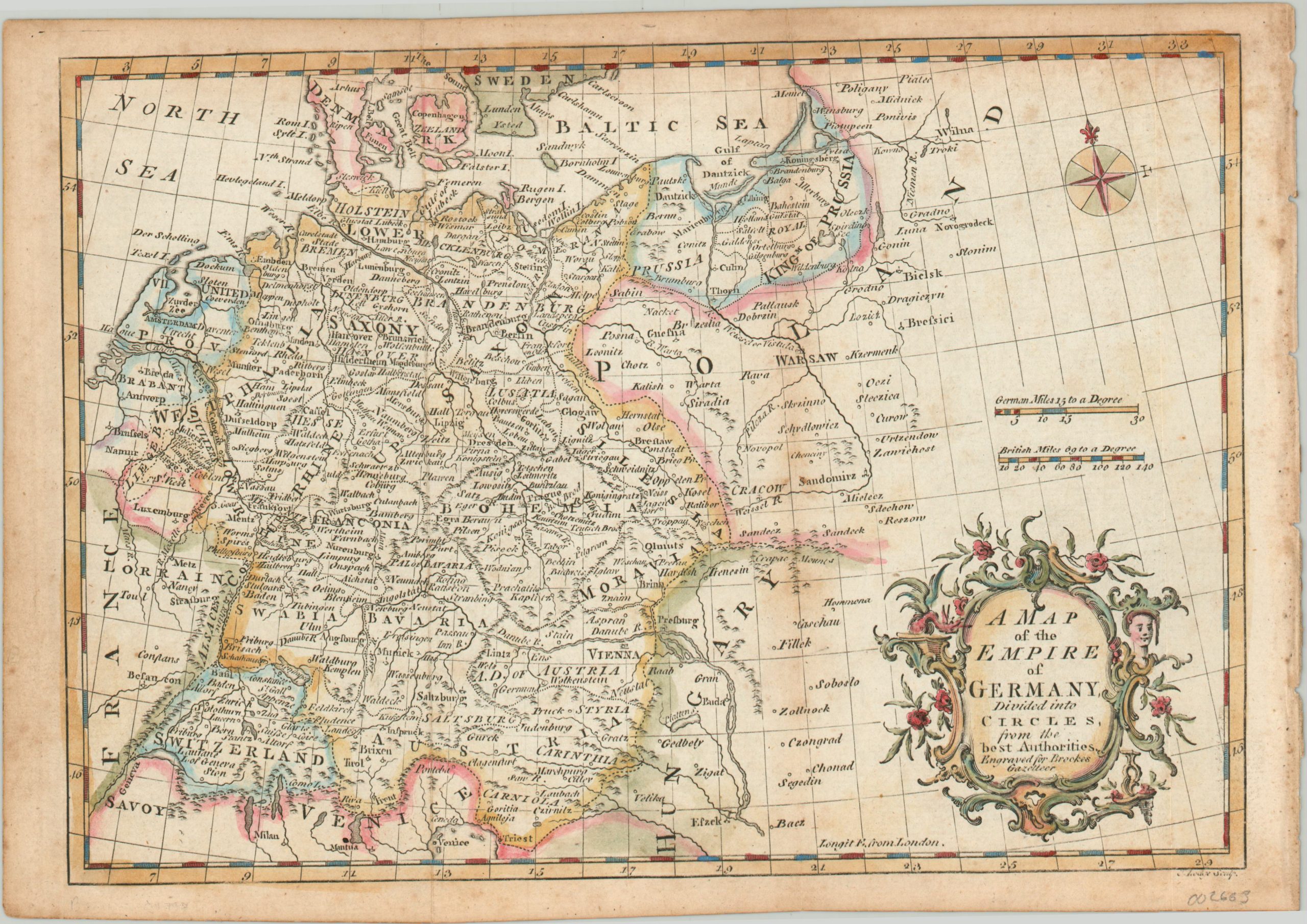
A late 18th century map of Germany that predates the modern concept of the nation.
1 in stock
Description
Though the concept of a unified German state didn’t begin to develop in force until the Napoleonic Wars, the germ (get it?) of a ‘German Empire’ can be traced back to the much older Holy Roman Empire. But as the 18th century drew to a close, the rivalry between Austria and Prussia – two integral components of the HRE – would become irreconcilable and ultimately contribute to its dissolution.
This map was engraved by John Lodge and published in Richard Brookes’ The General Gazetteer in London around 1790. It shows the various states of the German Empire and includes a decorative title cartouche and compass rose.
Map Details
Publication Date: c. 1790
Author: John Lodge
Sheet Width (in): 12
Sheet Height (in): 8.4
Condition: B
Condition Description: Moderate discoloration along the vertical centerfold, near the center of the image, and scattered soiling around the outer edges and margin. Light creasing along fold lines. Remains in decent condition and features attractive hand color.
$50.00
1 in stock