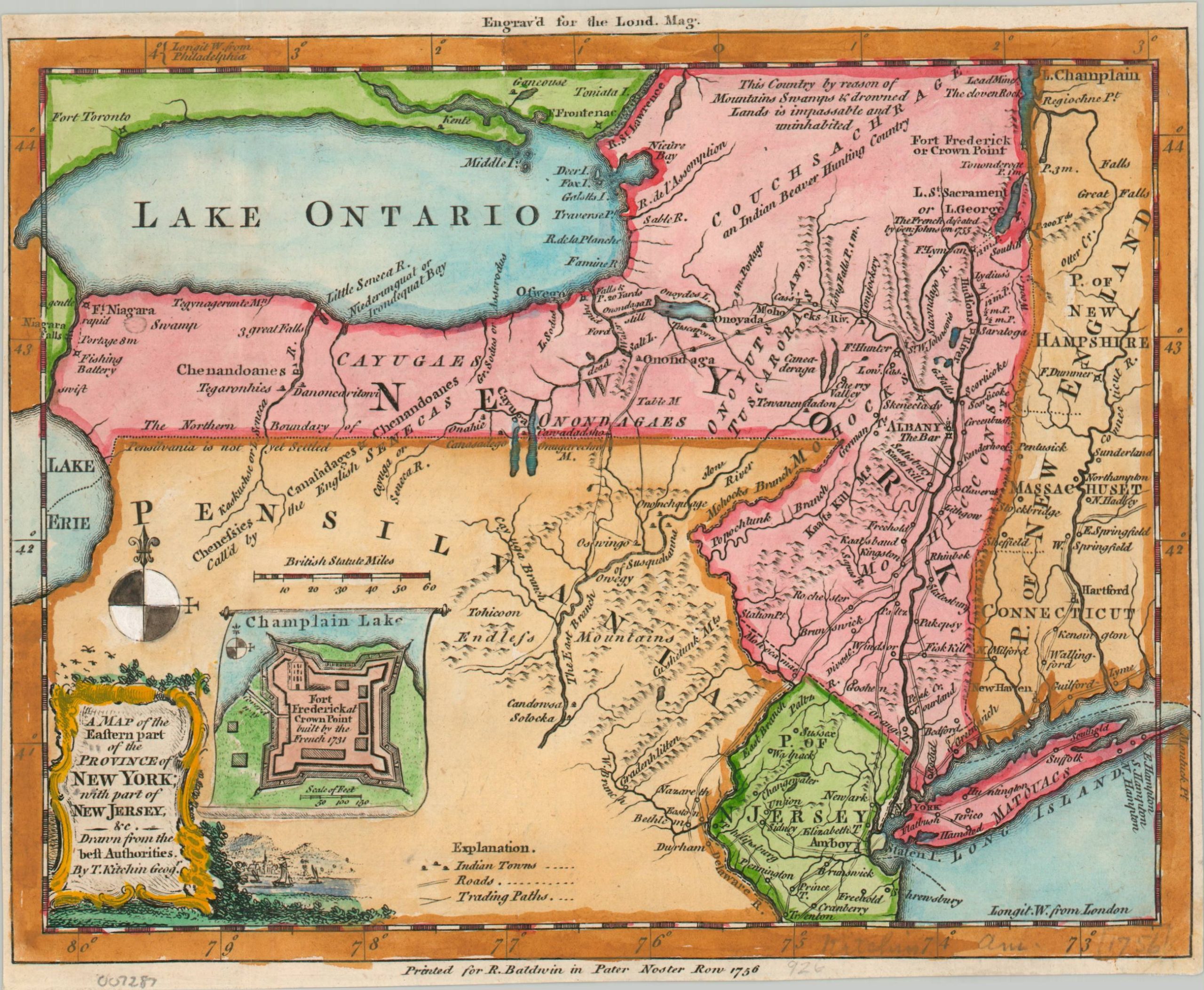
A Map of the Eastern Part of the Province of New York; with part of New Jersey &c.
Mapping the outbreak of the Seven Years’ War.
Out of stock
Description
This fascinating map of colonial New York and Pennsylvania was published in 1756 to inform a British audience about the ongoing French and Indian War (the North American theater of the broader Seven Years’ War). The Hudson River Valley was an important theater of the conflict, as it included parts of the disputed region between France and Britain.
Features of special military relevance are emphasized, including topography, Native American villages, frontier fortifications, and navigable waterways. An inset in the lower left shows French Fort Frederick (Fort Saint-Frédéric) on Lake Champlain.
The map was designed by Thomas Kitchin and printed by Robert Baldwin. Originally issued in the September 1756 edition of the London Magazine, England’s first literary periodical, as part of a series covering various theaters over the course of the war.
Source: Metropolitan Museum of Art
Map Details
Publication Date: 1756
Author: Thomas Kitchin
Sheet Width (in): 8.5
Sheet Height (in): 6.9
Condition: A-
Condition Description: Copperplate engraved map with trimmed margins and bright (modern) hand color. Good to very good condition overall.
Out of stock