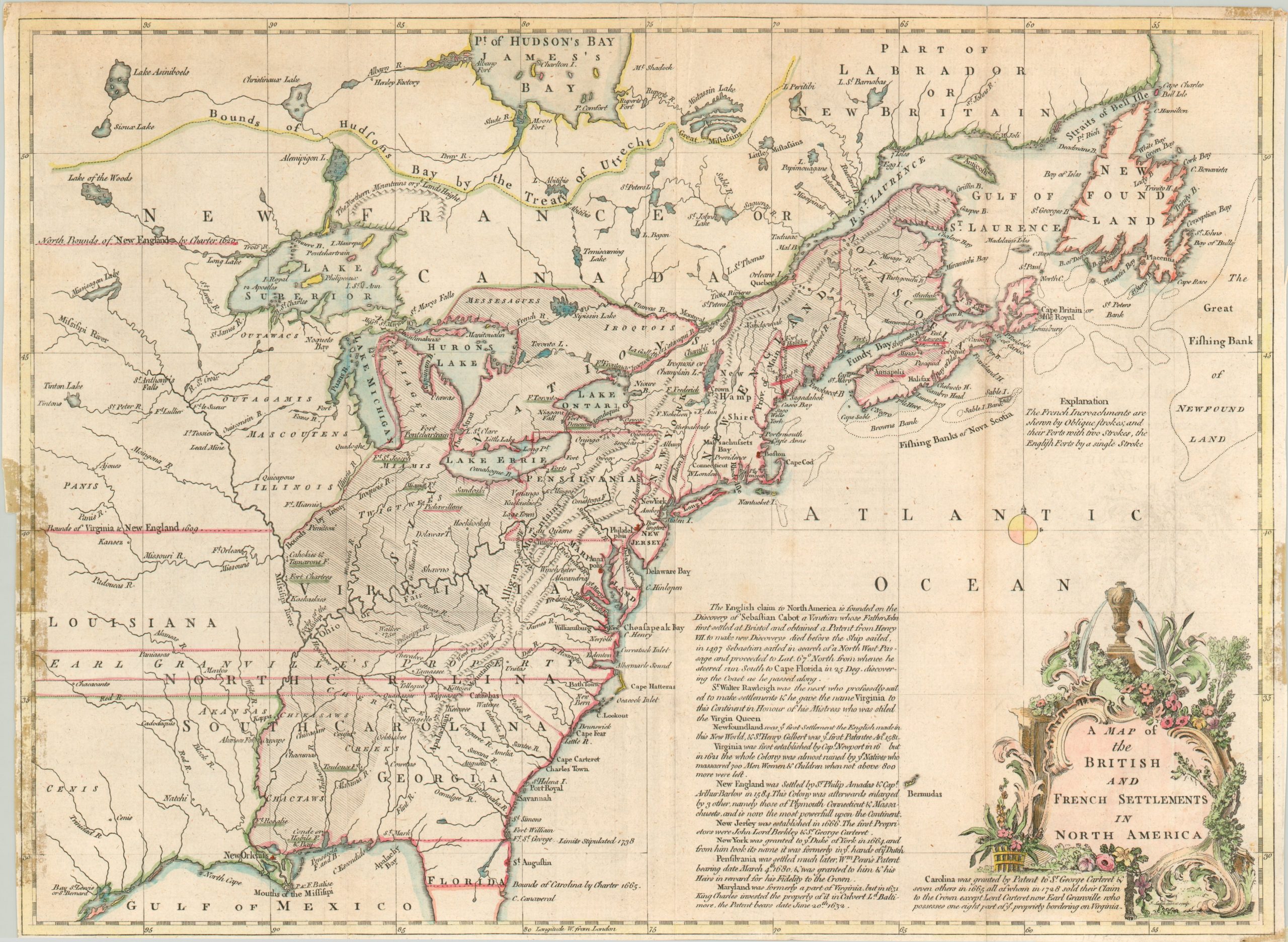
A Map of the British and French Settlements in North America
Political overview of colonial America at the outset of the French and Indian War.
Out of stock
Description
Published in the July 1755 edition of London’s Gentlemen’s Magazine, this is one of the earliest maps that show the theater of war in a localized conflict that would soon erupt on a global scale. French and British colonial aspirations in the interior of the continent had long been at odds, and small scale fighting had occurred throughout the 1740’s and early 1750’s. But larger scale battles began in earnest in 1754, prompted by the building of forts, complex alliances with Native American tribes, and ongoing territorial disputes.
This map presents many of those conflicting claims, obviously giving precedence to the historical validity of Britain’s title to the lands on the East Coast and within the Great Lakes region. The hashed area highlights French encroachments into English territory, and forts are underlined according to their ownership (single line for English, double line for French). Extensive annotations and boundary lines provide further information on the historical claims.
Less than a year after this map was published, Britain formally declared war on France, sparking the broader worldwide conflict known as the Seven Years’ War. It would end in 1763 with the Treaty of Paris, which would see France relinquish the majority of its colonial claims in North America to the British victors.
Map Details
Publication Date: 1755
Author: John Lodge
Sheet Width (in): 15.50
Sheet Height (in): 11.20
Condition: B
Condition Description: Narrowed margins on all sides and there is some discoloration in several spots around the edges from old tape used in framing. Creasing and a few splits along fold lines, but the map remains in good condition, with nice hand color.
Out of stock

