A Map of Texas
$350.00
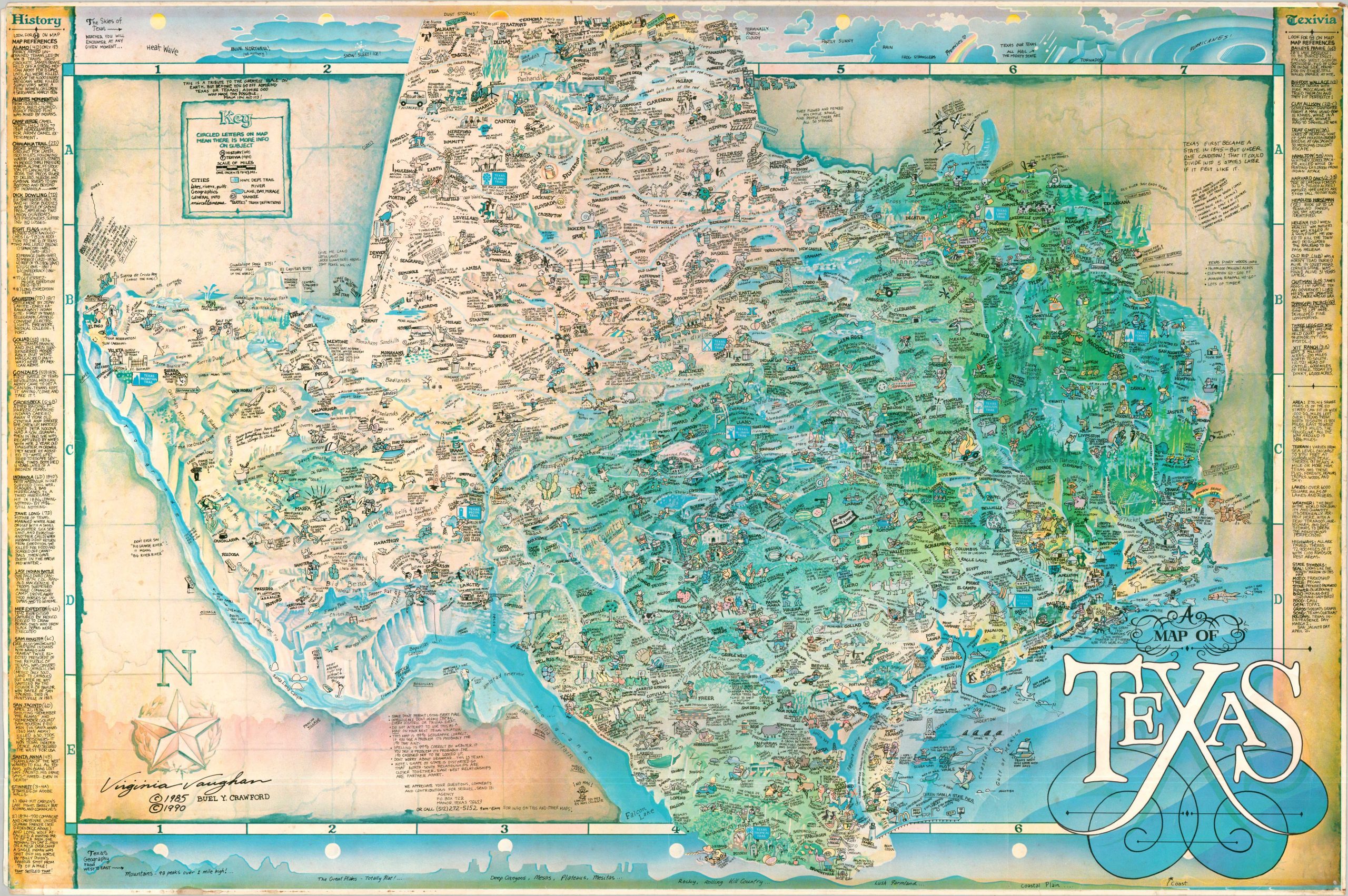
This is a tribute to the greatest place on Earth. – Text, upper left.
1 in stock
Description
This fun-filled pictorial map of Texas does much to distill the bombastic personality, history, and culture of the Lone Star State into one static image. A heavily distorted outline contains dozens of brightly illustrated vignettes representing important people, events, and places. Other icons celebrate local industries, wildlife, and the geographic diversity that can be found across the 268,000+ square miles that make up the state. Profile views of the sky (top) and land (bottom) showcase further the natural extremes.
The cultural and ethnic composition of Texas is also highlighted; with the inclusion of sportsmen, Mexicans, Native Americans, cowboys, road trippers, farmers, oil barons, and more. Apart from labeling various attractions, the accompanying text provides translations for Texan Definitions (in quotes), factual tidbits, and the occasional dig at Yankees. The critical humor also applies to locals (note the ‘disclaimers’ in the lower center). Columns on the left and right present Texas History and Trivia, represented on the map with H’s and T’s, respectively.
The map was illustrated by the talented Virginia Vaughn and copy written in 1985 by Buel Y. Crawford. The first edition was published to commemorate the Texas Sesquicentennial in 1986 – this is the second edition, issued in 1990 by (presumably) Crawford’s advertising agency in Manor, Texas.
Map Details
Publication Date: 1990
Author: Virginia Vaughan and Buel Crawford
Sheet Width (in): 36.25
Sheet Height (in): 24.25
Condition: B+
Condition Description: Color printed map on a single-sided sheet. Moderate wear along the outer edges - notably the chipped and soiled corners and some faint dampstaining. Lightly wrinkled from where previously rolled. Good condition overall.
$350.00
1 in stock