
A Map of Russia
$2,200.00
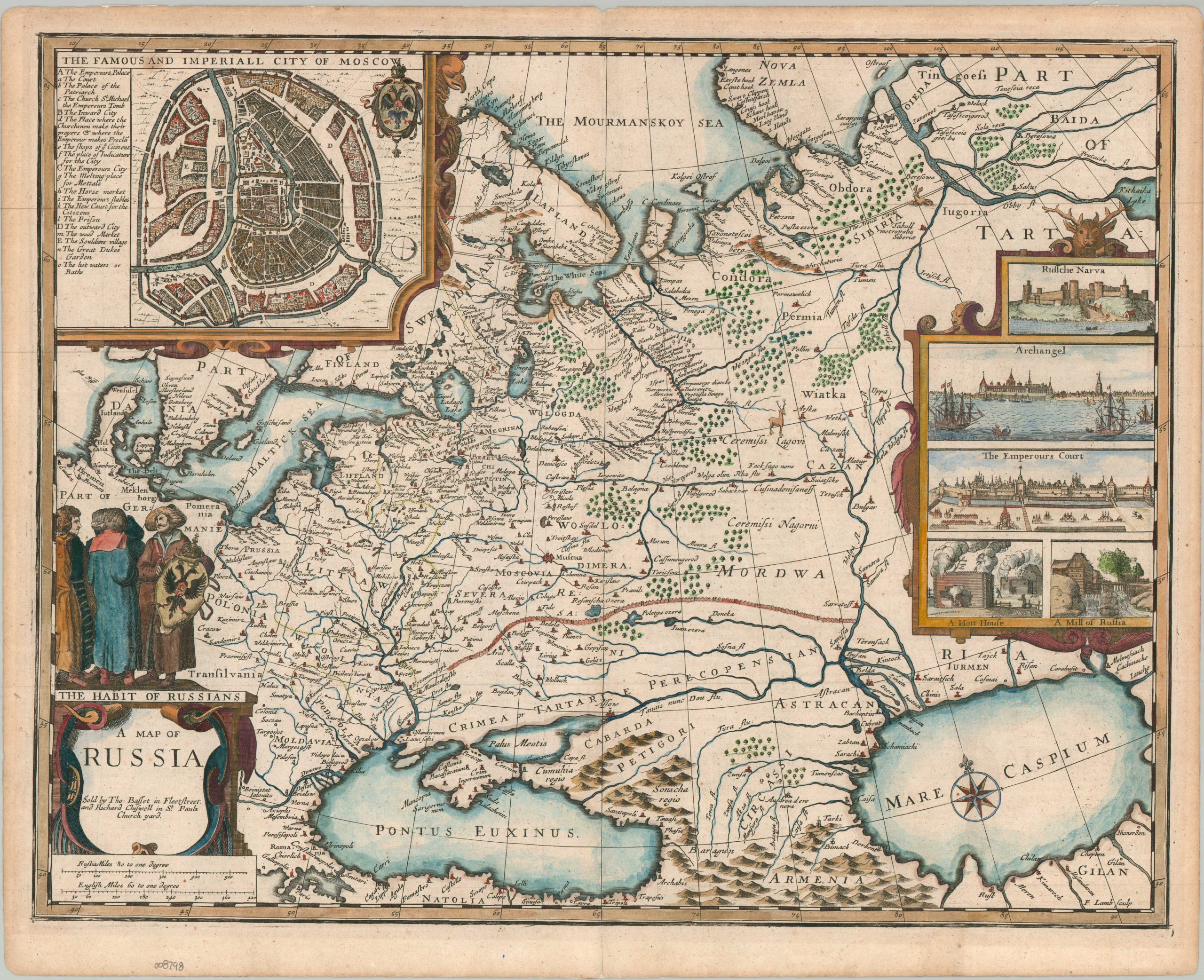
John Speed’s magnificent 1676 map of Russia.
1 in stock
Description
This spectacular map of Russia offers one of the most visually arresting views of the country available to the European public of the 17th century. In the west, territorial boundaries with adjacent nations are shown with thin dotted lines. These borders, determined officially by treaty, contrast sharply with the ambiguous frontiers of the south and east.
Of particular interest is the depiction of a large system of fortifications designed to protect Russian territory from invasions by Crimean Tatars. While several settlements are labeled beyond this critical defensive line, they were either ruins (such as the short-lived fortress of Borissa) or subject to constant raids. Geographic features (forests, mountains, rivers) are shown with an exaggerated pictorial style. Oddly, the Ural Mountains are omitted, but the rugged highlands of the Caucasus and Armenia are emphasized.
The majority of settlements are concentrated along navigable rivers, notably the economically vital Northern Dvina as it approaches Arkhangelsk, Russia’s only deepwater port. Rivers were not only good for maritime transportation; in the winters, their frozen surfaces provided extremely efficient highways for sleds.
Numerous decorative elements add visual complexity and contemporary information for the audience. In the upper left is an inset plan of the Imperial City of Moscow that identifies over a dozen different locations across the different districts of the capital. In the center right are delicate views of Ivangorod Fortress (Russian Narva), the harbor of Archangel, a ‘Hott House’ (a traditional Russian sauna, or banya), and a watermill. The elaborate title cartouche features the distinctive double-headed eagle of the Russian coat of arms, plus three figures wearing heavy furs in ‘The Habit of Russians.’
The map was designed by John Speed and published in London by Thomas Bassett and Richard Chiswell in 1676. This sheet comes from the landmark final edition of Speed’s work, which for the first time compiled his two most important atlases- The Theatre of the Empire of Great Britaine and A Prospect of the Most Famous Parts of the World – into a single volume. While not as rare as the earlier standalone volumes, this 1676 publication included nine highly desirable new maps, including this present example covering Russia under the Romanovs.
Map Details
Publication Date: 1676
Author: John Speed
Sheet Width (in): 21.00
Sheet Height (in): 17.10
Condition: A-
Condition Description: Copperplate engraved map on sturdy watermarked paper with old full hand color. Small splits along the top and bottom of the centerfold expertly repaired on verso. Light toning in the margin and a single spot of foxing visible in the upper left inset. English text on verso. Very good overall.
$2,200.00
1 in stock