
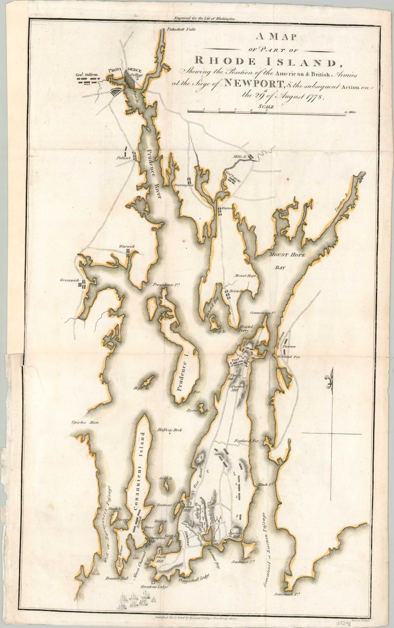
A Map of Part of Rhode Island Shewing the Position of the American & British Armies at the Siege of Newport
Early 19th century plan of the Battle of Rhode Island.
Out of stock
Description
This striking copperplate engraved map of Rhode Island covers the area along Narragansett Bay between Providence and Newport. Little interior detail is provided apart from a few scattered roads and towns (though Brown University is shown) and topography is depicted in hachure.
The image shows the military situation at the outset of the Battle of Rhode Island, an important engagement during the Revolutionary War that was the first real effort to coordinate French and American military forces in a unified encounter against the enemy. Its outcome was inconclusive but was notable also for the participation of an integrated unit, the 1st Rhode Island Regiment, led by Colonel Christopher Greene.
The map was published in London in 1806 by Richard Phillips as part of The Life of Washington.
Map Details
Publication Date: 1806
Author: Richard Phillips
Sheet Width (in): 10.75
Sheet Height (in): 17.3
Condition: B+
Condition Description: Moderate wear along fold lines and along the outer edges of the sheet. The margins show some discoloration and wear, consistent with age, and there's a bit of further abrasion in the lower left. Marginal repairs with linen tape on the left side of the page. Remains in good condition overall, with original outline color.
Out of stock