A Map of Oberlin College and Towne Showing Its Life and Traditions
$350.00
Pictorial representation of Oberlin’s historic identity.
1 in stock
Description
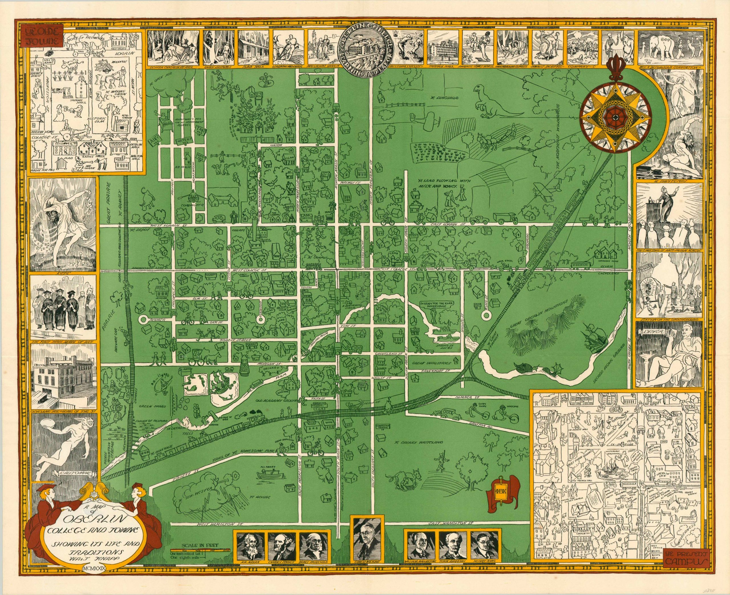
This elaborate view of Oberlin, Ohio was drawn by Walt Knapp and originally published in an issue of the 1930 yearbook. The main image is a map of the town, drawn in a cartoonish style and filled with whimsical and comedic references. Frustrated golfers, stranded motorists and even dinosaurs shared the self described “land flowing with milk and honey.”
Classical cartographic elements are also shown in the form of sailing ships, sea monsters (in Plum Creek, no less) and a decorative compass rose. The sketch-style look is continued with inset maps of Oberlin College campus and the historic downtown area. The detailed border is filled with more serious subject matter and form.
Portraits of university dignitaries, the college seal and vignettes of scenes in the area are drawn in a more realistic style. Illustrations of important moments are also rife – Oberlin’s contribution during WWI, the temperance movement, and early female graduates.
Of particular note are the multiple references to the Underground Railroad. The town, near the border of Lake Erie, was a critical junction along the route used by escaped slaves making their way to Canada.
Map Details
Publication Date: 1929
Author: Walt Knapp
Sheet Width (in): 32.90
Sheet Height (in): 26.90
Condition: A
Condition Description: Fold lines as issued and the paper is slightly thin from where adhesive was removed on the verso. Near fine overall.
$350.00
1 in stock