A Map of Newport and Middletown
$225.00
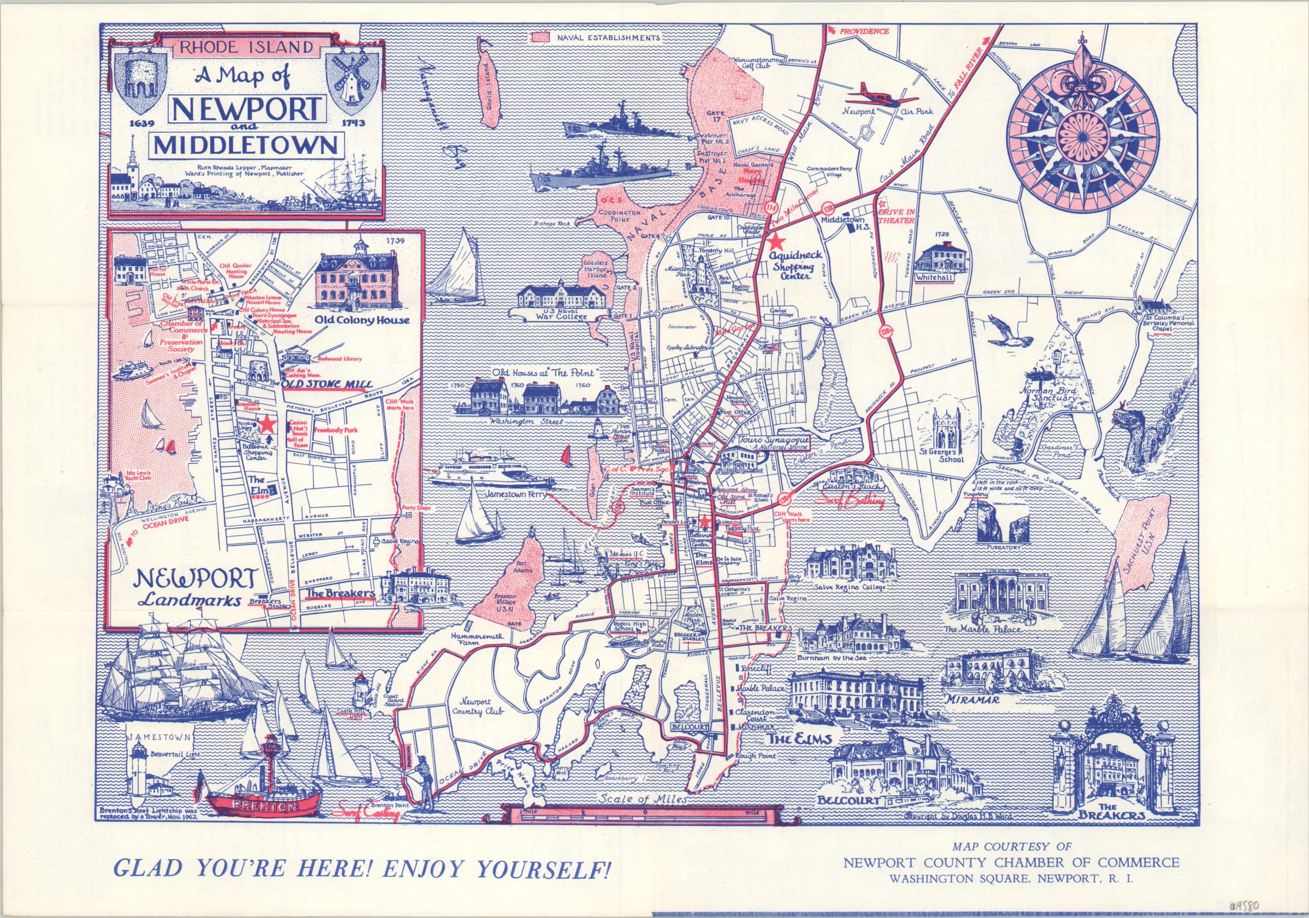
Promotional map of Newport, Rhode Island published in the early 1960s.
1 in stock
Description
This tri-color tourist map of Newport and Middletown, Rhode Island showcases the area’s historic architecture and prominent shipbuilding industry. Numerous vignettes draw from both categories, while red color highlights the preponderance of naval establishments. The image also identifies locations of interest, recreational opportunities, transportation options, and local businesses. An inset in the center left shows the landmarks in downtown Newport, while the verso describes several attractions in more detail.
The map was created by Ruth Rhoads Lepper, a graduate of the Rhode Island School of Design and Boston’s Museum of Fine Arts. She worked as a cartographer for the Navy during World War II and created several pictorial maps covering New England, primarily Maine. Published c. 1962 by Ward’s Printing of Newport. An earlier edition was issued in 1961, but this version has been updated to reflect the retirement of the Brenton’s Reef Lightship (lower left).
Map Details
Publication Date: c. 1962
Author: Ruth Rhoads Lepper
Sheet Width (in): 16.75
Sheet Height (in): 11.75
Condition: A
Condition Description: Creased along originally issued fold lines. Near fine overall.
$225.00
1 in stock