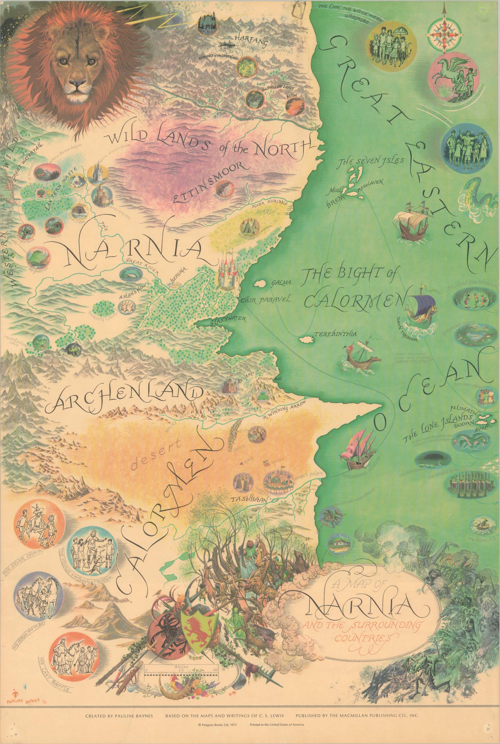
A Map of Narnia and the Surrounding Countries
A colorful map of C.S. Lewis’ world of Narnia, drawn by renowned illustrator Pauline Baynes.
Out of stock
Description
Travel through the wardrobe into the world of Narnia with this gorgeously illustrated map, designed by Pauline Baynes and published by the MacMillan Company in 1972. You’ll arrive near the Lamp Post in the upper left, not far from Mr. Tumnus’ house and the beaver’s dam. Numerous other locations that play prominent roles in the novels are also identified – Cair Paravel, the White Witches’ castle, and the Dawn Treader among them. A marvelous title cartouche is filled with a variety of characters, divided between light and darkness, or good vs. evil – a theme central to the series.
The seven books were originally written by C.S. Lewis between 1950 and 1956; their titles and accompanying illustrations can be seen in the upper right and lower left corners. Lewis chose Pauline Baynes to illustrate his novels after seeing her skilled work in some of his good friend J.R.R. Tolkien’s lesser-known publications (Tolkien actually wanted Baynes to illustrate the Lord of the Rings, but the project was too large in scope). More information on Pauline Baynes is available at her website here.
Map Details
Publication Date: 1972
Author: Pauline Baynes
Sheet Width (in): 20
Sheet Height (in): 30
Condition: B+
Condition Description: Pinholes in the corners and light wrinkling along the edges from where previously rolled. A 3" tear in the upper center has been unfortunately repaired with old cellophane tape, resulting in some soiling around the small spot on the front. A faint streak in the bottom left, near the publication information. Good condition overall.
Out of stock

