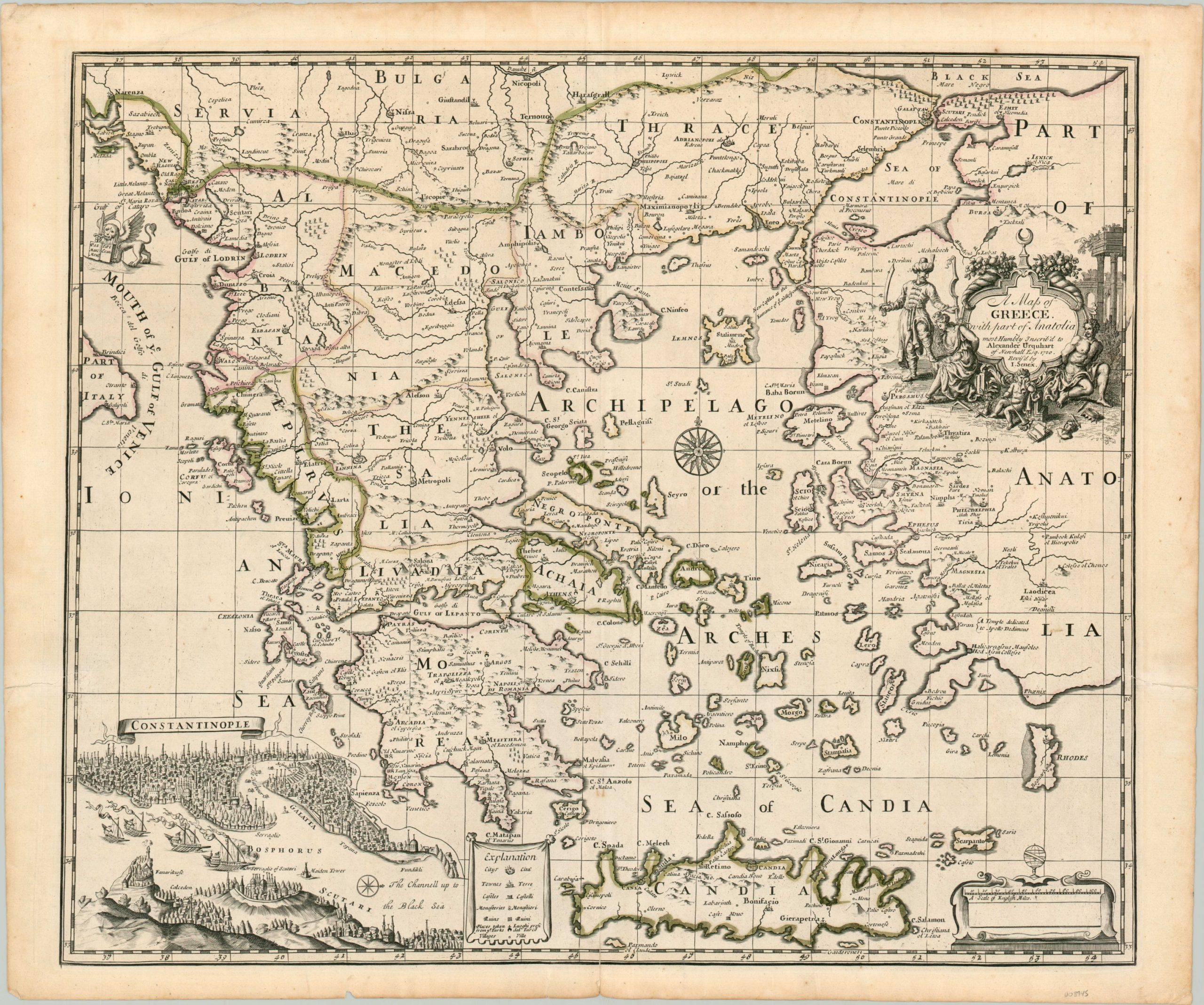
A Map of Greece with part of Anatolia
Greece under the Ottoman Empire, about a century prior to independence.
Out of stock
Description
This fascinating map of Greece covers a broad Mediterranean region between the Gulf of Venice and western Anatolia and between the island of Crete and the Black Sea. Most of the area depicted was successfully conquered by the Ottoman Empire from the early 14th to mid-16th century, though conflict with Christian powers (primarily Venice) persisted at the time of publication. Possession of cities is defined with a cross or crescent above the walls and a unique symbol combining the two identifies ‘places taken from the Turks’ (according to the key).
The latter shows significant victories across Central Greece and the Peloponnese, but several of these conquests had been previously returned to Ottoman rule under the terms of the 1699 Treaty of Karlowitz. The subjugation of the local people (at least from a Western perspective) is reflected in the title cartouche, which shows a Turkish soldier enslaving two figures, one is a woman, possibly Cybele or Tyche, wearing a mural crown, a symbol of cities. A putti weeps nearby as books, statuary, broken tools, and a crown lie scattered about. Above all sits the crescent – a candid criticism of Ottoman authority and the destruction of classical culture.
A wonderful view of Constantinople can be seen in the lower left, adjacent to the legend. Oriented with north to the right, the scene depicts an Ottoman fleet with pennants flying, sailing through the Bosphorus towards the Black Sea. Minarets, the harbor in the Golden Horn, domed mosques, and Topkapi Palace can all be seen. Final decorative elements include a cartouche with the distance scale in English miles and a depiction of the Lion of St. Mark. This iconic symbol was traditionally associated with Venice and is holding a book that reads Pax Marc Meus Tibi Evan – short for “Pax tibi Marce, evangelista meus. Hic requiescet corpus tuum.” (“Peace be with thee, O Mark, my evangelist. Here thy body will rest”). This refers to the words spoken by an angel to St. Mark as he stumbled his way through the Venetian lagoon. Using the legend as justification, a pair of Venetian merchants stole his corpse from the Church of Alexandria and re-interred it at St Mark’s Basilica in the early 9th century.
The map was engraved in 1720 by John Senex, who dedicated the work to Alexander Urquhart, Laird of Newhall. Urquhart was a Scotsman and retired British Army officer who speculated heavily in the Dairen Scheme and South Sea Bubble. After sitting in the House of Commons between 1715 and 1727, he died heavily in debt after the business ventures failed.
Sources: History of Parliament; Example at the University of Alabama
Map Details
Publication Date: 1721
Author: John Senex
Sheet Width (in): 24.75
Sheet Height (in): 20.5
Condition: A
Condition Description: Light soiling and one small chip in the outer margin. One small spot within the image in southern Anatolia. Otherwise in near fine condition, with original hand outline color on a bright watermarked sheet.
Out of stock

